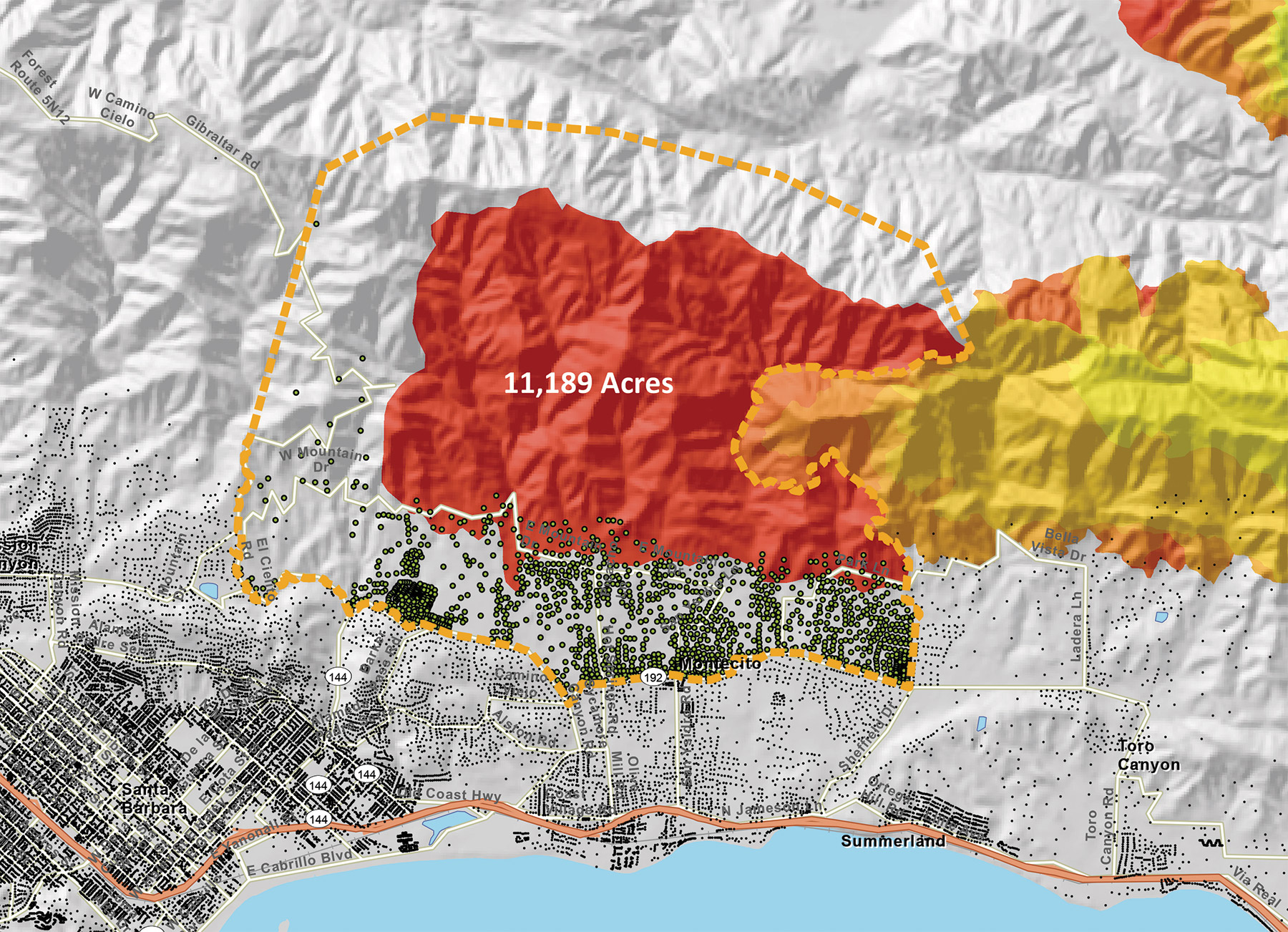
SATURDAY GROWTH: Hundreds of Montecito and Santa Barbara homes sat directly in the line of fire on Saturday when roaring winds pushed Thomas off the mountains and into the streets. Remarkably, only 20 structures were damaged or destroyed. To put these numbers in context, 210 homes were lost in the Tea Fire and more than 400 in the Painted Cave Fire. Not a single firefighter was injured holding the line in the front country separating neighborhoods from the steep, rocky, densely vegetated terrain sprawling behind them.
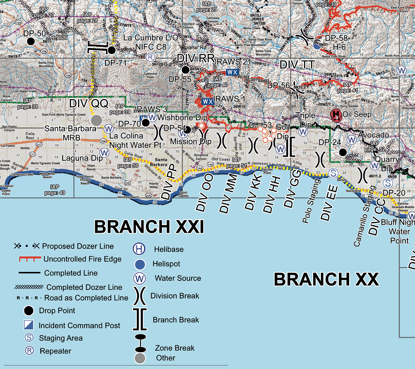
PLAN OF ATTACK: Maps like this help organize a firefighting army into phalanxes of offense and defense. This was Tuesday’s plan. A line of divisions separated by )( symbols — some with as few as 50 firefighters, others with as many as 200 — stood at the ready. Proposed and completed dozer lines are marked to the north and west of the fire’s edge. Water sources for helicopters are sprinkled throughout the region. An explanation of each symbol and line is included in the legend below.
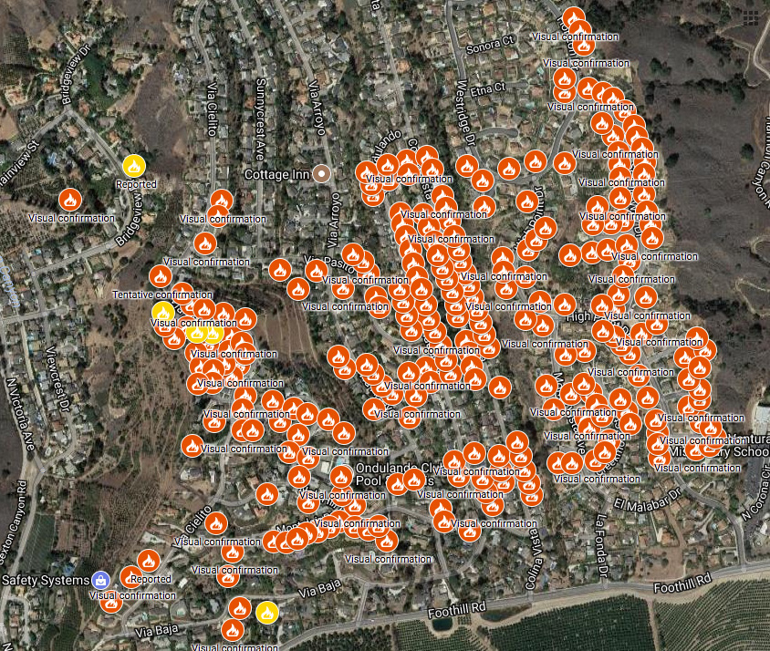
NOT SPARED: While Santa Barbara and Montecito have so far dodged a whole barrel of bullets, Ventura wasn’t as lucky in the early days of the fire. Ventura County Star reporters are plotting the location of each lost home in their area. This portion of their map shows the utter devastation of the Via Ondulando neighborhood.