

That time of year has come again: Wildfires are burning across the state. With each fire season comes a recurring conversation about what needs to be done differently to protect our communities.
With so much at stake, whatever actions we take as a community must be based on an accurate understanding of the natural ecology of wildfire in our region — which can be quite different than elsewhere in the state. With science as our guide, we can ensure that our limited resources are spent wisely, that homes and lives are saved, that firefighters aren’t placed at undue risk, and that we’re focusing on ways to truly make a difference in our ongoing relationship with wildfire.
A Brief History of Chaparral and Fire
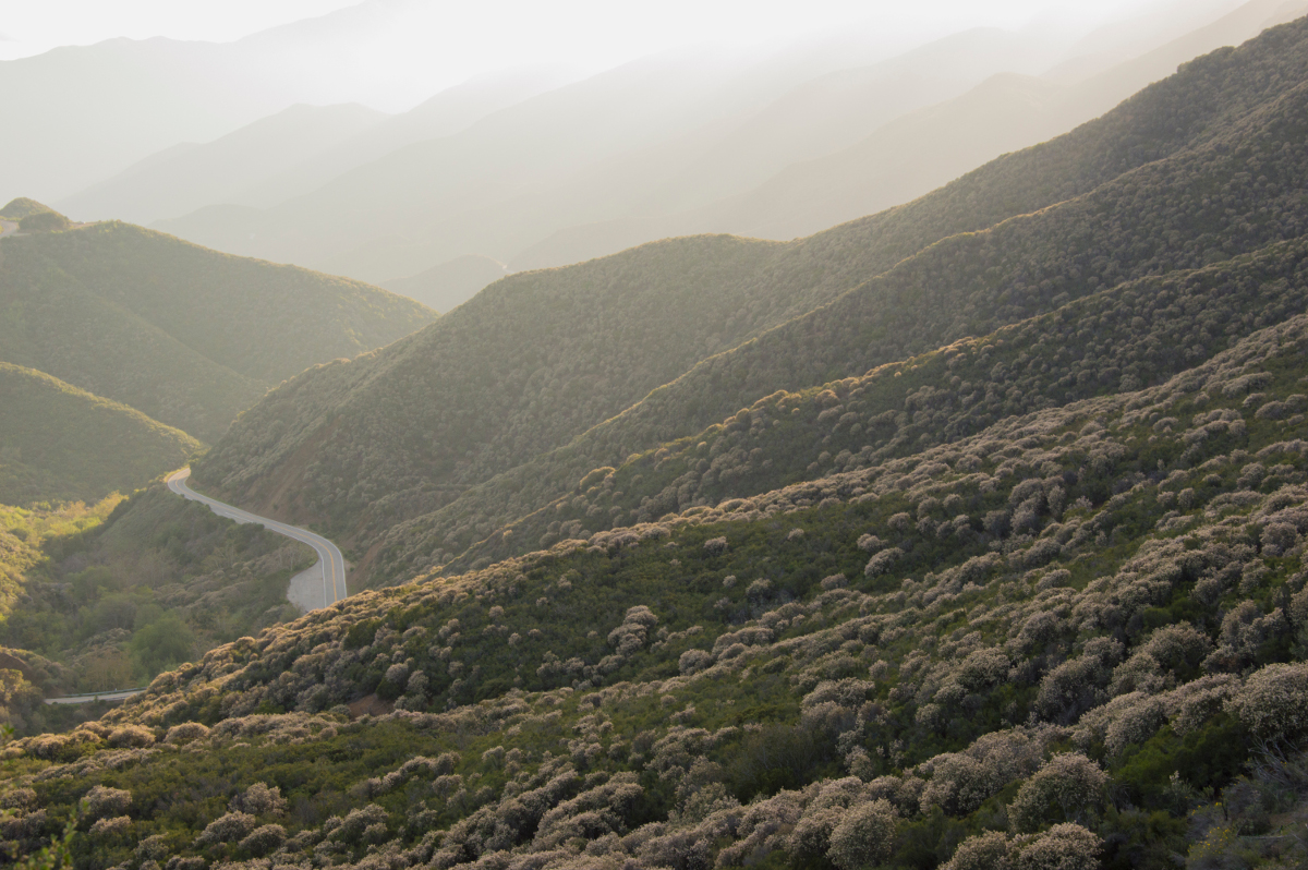
Chaparral is the shrubland ecosystem that manages to survive the harsh, dry mountains along the central and south coasts through several unique adaptations. It provides habitat for birds, mammals, pollinators, and other wildlife. It holds the steep slopes above our towns in place. And it provides an enchanting landscape to explore and appreciate. Yet, it’s been getting a bad rap for over a century.
There’s a fascinating book titled History of the Los Padres National Forest written in 1945 by William “Billy” Brown, who was an information specialist for the Forest Service. Brown recounts the locals’ thoughts about the chaparral in the early 1900s:
… there seemed to be an obsession on the part of the local public to demand the replacement of the native chaparral cover by coniferous forests. Forest rangers did their best to oblige in the matter of converting the brush hillsides into pine forests….[but] little vestige remains of the heavy field planting done during the first decade of the century.
A century later, there remains a clamor for the removal of chaparral, born of a misunderstanding about what it is, why it’s important, and why it’s not to blame when wildfires burn near our towns.
When humans settled the region, we began setting fire to the landscape intentionally and unintentionally. The Chumash burned small areas around their villages for reasons related to foraging and hunting (not to control wildfires). They understood that repeated burning of the same area would eventually cause the native shrubs to disappear — a process we now know as “type conversion.” This is because while many of the plants dominating the chaparral need fire to germinate their seeds, they afterward need ample time to produce enough seed to repopulate the area before the next fire.
When the Chumash purposely burned areas repeatedly, deer-favored native grasses and edible herbs grew in the chaparral’s place. As Europeans and Americans settled the area, they brought with them non-native plants from other parts of the world and expanded such burning operations, converting large swaths of chaparral-covered land to grasslands for livestock grazing. Now, chaparral that burns more often than every 30 years can become replaced by these invasive plants — referred to as “flashy fuels” — which dry out quicker and spread wildfire faster.
How Chaparral Wildfires Burn
Chaparral wildfires are naturally large and intense fires that burn all the vegetation in an area and leave the landscape bare. Nearly every chaparral-covered portion of Los Padres National Forest has burned within the last century, with most of the land having burned sometime within the past few decades. Unnatural amounts of fuel have therefore not accumulated in most of the chaparral, despite such a claim being continually repeated.
During the dry summer and autumn months, our region’s naturally dense shrubland vegetation will burn if it has an ignition, and these have been increasing in step with our area’s population. Before humans settled the region, wildfires could only ignite from lightning, meaning a single area naturally burned once every 30 – 150 years. Now, dozens of fires burn across the region each year, 98 percent of which are a result of human activity.
And when they ignite, they can be extremely difficult to fight depending on the weather conditions. This hasn’t necessarily changed over the years either. From the 220,000-acre Matilija Fire in 1932 to the 119,000-acre Wheeler Fire in 1985 to the recent 280,000-acre Thomas Fire — all of which burned roughly the same area in Ventura County — wildfires in our region have been large and unruly.
Where We Go From Here
So why do we keep focusing on chaparral as the problem? Science tells us that using prescribed fire on chaparral-covered lands already experiencing overly frequent fire results in type conversion to non-native plants that burn earlier in the year and spread wildfire faster.
Science also tells us that fuel breaks have a positive effect on wildfire suppression less than half of the time, create corridors for invasive plants to invade the surrounding chaparral, and fragment habitat for the wildlife. The Thomas Fire even burned across 70 miles of fuel breaks and three major highways between Santa Paula and Santa Barbara. Yet, some voices in the community are still calling for more prescribed burns and more fuel breaks across the landscape.
In 2014, a Berkeley fire ecologist was the lead author of a widely acclaimed scientific paper titled “Learning to Coexist with Wildfire.” Its central thesis? Those of us living on the edge of such fire-prone landscapes are the ones who need to adapt, not the landscapes around us. And we can do this in a few important ways according to researchers:
• We first must retrofit our existing homes with fire-safe materials such as noncombustible roofs, ember screens, and double-paned windows.
• We also need to establish and maintain smart defensible space within 60-100 feet from the home.
• We then must turn to developing new policies to prevent home construction in dangerous, flammable areas within what’s known as the wildland-urban interface.
On this last point, more than 60 new homes have been built in the area burned by the destructive Painted Cave Fire in 1990 — most of them within an area designated by Cal Fire as a “Very High Fire Hazard Severity Zone.” This places a heavy toll on our firefighters who are tasked with defending an ever-growing number of homes in inherently unsafe areas.
These steps — making our homes fire-safe, maintaining defensible space, and reexamining land use policies — will take an investment of time and money. But our investment will pay off dividends in the long run and ultimately, it will help us adapt to living in a region that experiences frequent wildfires. It will also relieve the pressure of fighting fires in dangerous wildland areas and focus more of our resources on preventing human-caused ignitions in the first place.
We have managed to pack 1.5 million more people into the areas surrounding the Los Padres since Billy Brown’s time. It’s not the forest that has changed over the years — it’s us. We have moved to paradise, built flammable homes in fire-prone canyons, and started countless fires along the way. The fix to such a problem starts not on the chaparral-covered mountain slopes but in and around our homes and communities. It starts with me, you, and our neighbors.
It’s time for us to adapt.
Bryant Baker is conservation director for Los Padres ForestWatch.


