Evacuation Order Issued for 8 p.m. Friday Night

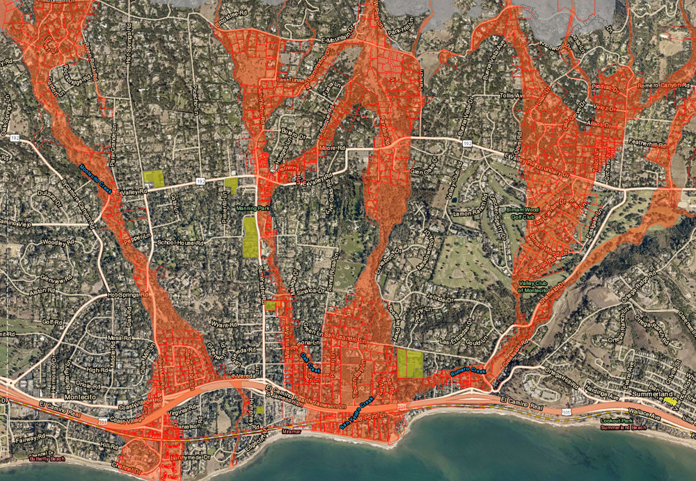
As a large storm front moves steadily closer to Santa Barbara and triggers fears of debris flows, county officials have issued an evacuation order for everyone living in the “red zones” below the Thomas, Whittier, and Sherpa burn scars. Residents are ordered to leave by 8 p.m. Friday night. A map of the evacuation areas can be found at readysbc.org as well as information on how to sign up for alerts. To determine your evacuation status, type your address into the rectangular space (query box) at the upper left of the interactive map.

County Flood Control has been working “around the clock following yesterday’s storm,” said deputy director Tom Fayram, to remove the mud and rock that rolled into the debris basins and creeks during Thursday’s heavy downpour. They plan to work until the coming rains make it impossible to continue, he said.
Weather forecasters have predicted up to seven inches of rain may fall on the Santa Barbara region between Friday evening and Tuesday. The “main event,” as they are calling it, is now shooting in along a powerful jet stream aimed at the Central Coast. Before departing Saturday night, it could produce thunderstorms and up to 75 mph wind gusts in the foothills. Flooded roads and downed trees are likely.
Special evacuee rates are on offer at area hotels, Visit Santa Barbara reports; the city’s tourism ambassadors have helped organize the list for each evacuation recently. Go here to view the options, and please note that availability can change.
A Red Cross Evacuation Center will open at 7 p.m. at the Goleta Valley Community Center at 5679 Hollister Avenue. For general questions, call the county’s Emergency Call Center at (833) 688-5551 or dial 2-1-1. For assistance evacuating animals, contact the Animal Hotline at (805) 681-4332.


