

An Open Letter to the Redistricting Commissioners:
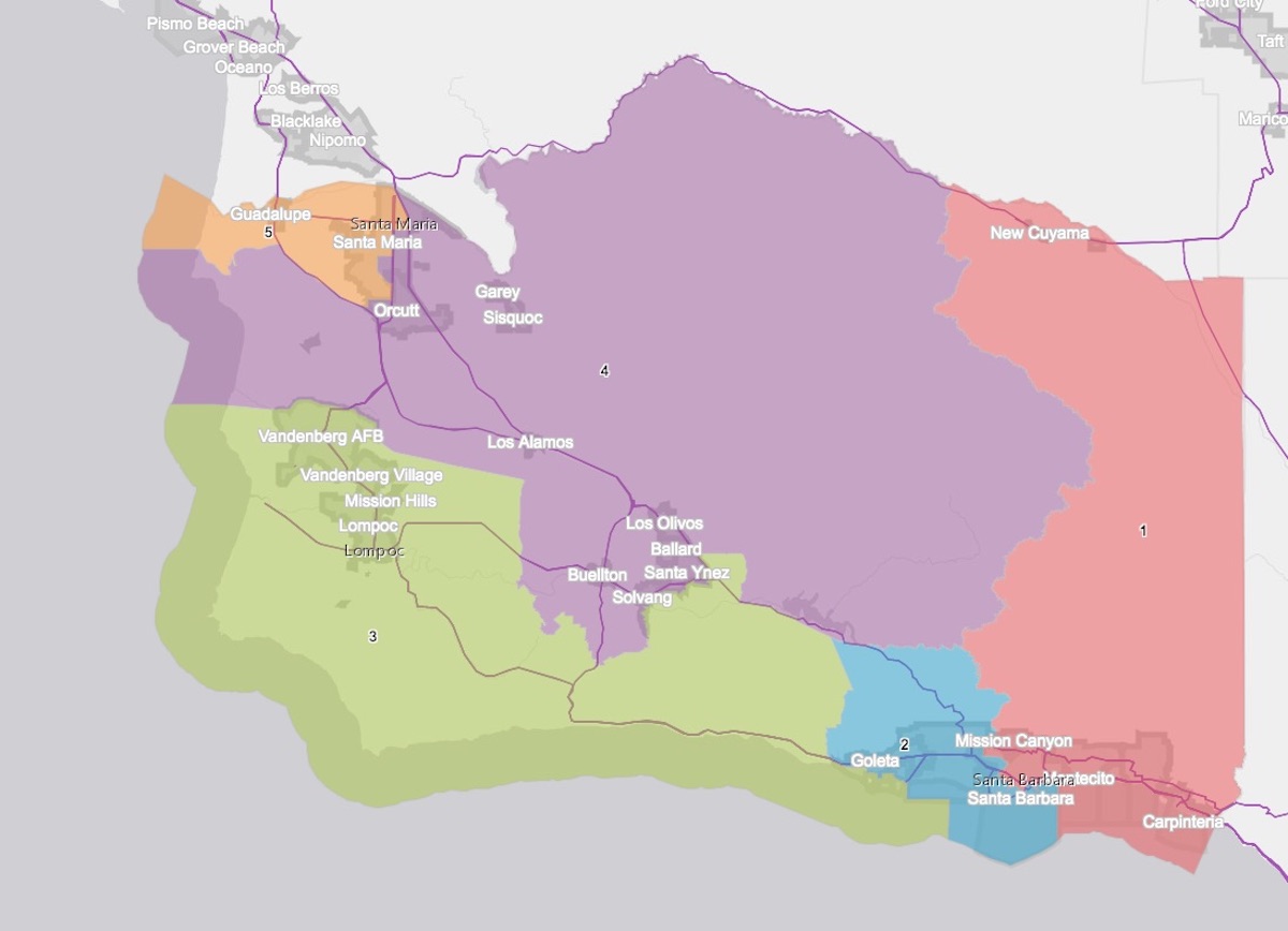
I am writing you at 4 in the morning because I am so aghast at what is proposed for the Santa Ynez Valley by Map 821C. As a former county planning commissioner who has represented the valley and a resident for 32 years, I strongly protest this proposal to dismember the valley in an attempt to solve a problem that would not exist except for Map 821C’s separation of the valley from the Gaviota Coast. As the former chair of the General Plan Advisory Committee that worked on the first draft of the Santa Ynez Valley Community Plan, I am flabbergasted that any agency such as the commission, that is supposedly working on the behalf of the public, would advocate such an ill-conceived threat to regional planning.
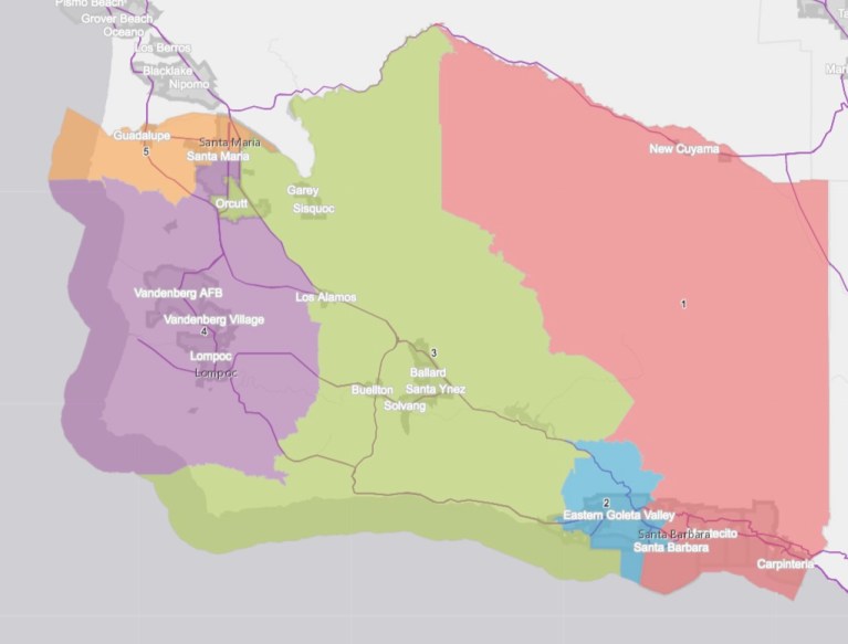
Map 821C advocates claim that this patch job is necessary to address the Santa Ynez Band of Chumash Indians’ request to maintain the connection between their reservation in the valley and important historic and spiritual sites on the South Coast. The Chumash solution to this issue was to simply maintain what has existed since 1880, a 3rd District that connects the Gaviota Coast to the valley, with as little change to the district as possible. They requested your support for Map 818 not Map 821C. They did not ask for the valley to be reassigned to the 4th District and then have their lands divided from their neighbors by a line that defiles the integrity of the valley and the Santa Ynez River Watershed upon which we all rely.
This last-minute proposal to amend Map 821 is not only ill-conceived, it contradicts one of the most basic principles guiding your work. The commission appears to have forgotten that the Santa Ynez Valley is unquestionably a Community of Interest, and you are clearly diminishing its ability to address shared social and economic issues by dividing it. The valley contains two cities and three unincorporated townships that greatly rely upon the representation of a single county supervisor to address regional issues such as water, transportation, energy, flood control, job creation, education, solid waste, toxic wastes, tourism, etc.
The Santa Ynez Valley Traffic Circulation and Safety Study of 2020 is just one example of a project that emphasized regional cooperation in order to address a problem that the separate jurisdictions could not address independently. The representation of a single supervisor from the valley when dealing with state and federal agencies to address regional problems such as this is essential.
The importance of the integrity of the Santa Ynez River watershed and Lake Cachuma reflects the need to consider our jurisdictions holistically. A chain is only as strong as its weakest link, and when you patch a chain together with different materials, you end up with a deficient tool that cannot be relied upon. We all know the story of Captain Haley’s surveying chain that resulted in the City of Santa Barbara’s errant street grid.
One only has to look at the different districts shown on Map 821C that the Santa Ynez River runs through on its course from the mountains to the sea to understand the map is flawed. Like many of the other maps, the uppermost reaches of the river are shown in the 1st District, reflecting the location of Gibraltar and Jameson reservoirs, but then it passes into the 2nd District. Lake Cachuma itself is in the 4th District. Then the river passes into the 3rd, and then the 4th, and finally the Third before it reaches the ocean.
Map 821C dismembers the Santa Ynez Valley the same way it dismembers the Santa Ynez River, our most precious resource. That your commission would even consider such a poor model for the delineation of our all-important supervisorial districts shows an amazing lack of concern for the Community of Interest the Santa Ynez Valley and Santa Barbara County embodies.
Clarification: This version updates the map designations, which are “C” to reflect changes made during the December 1 meeting.


You must be logged in to post a comment.