

“What is the purpose of your visit?” the passport control officer asks as I hand over my document, words I haven’t heard since the beginning of the pandemic. Like nearly everyone else on my flight, I tell her I’ve come to take a cruise. She stamps my passport and hands it back with a welcoming smile.
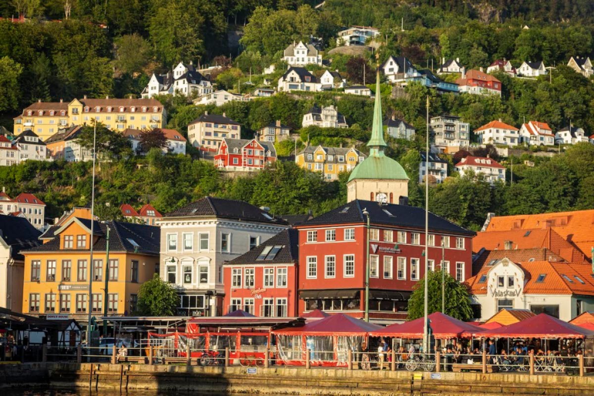
This year United Airlines inaugurated direct flights from Newark to Bergen, Norway, in the heart of the fjords, the biggest cruise port in Norway since the 19th century when people first wanted to see the fjords and the striking coastline. Because local infrastructure in Norway was so poor at the time with so few decent hotels or restaurants, a well-appointed floating hotel offering well-planned shore excursions, excellent dining, and comfortable suites prompted people to take a cruise.

Bergen feels like a small town, with cobblestone streets in its historic center, houses built among forested hills, and a picturesque harbor that is a UNESCO World Heritage site. But because the city is spread out, tucked in-between fjords, hills, and seven mountains, the layout conceals that Bergen is Norway’s second largest city — its university alone has 20,000 students. Walking around the town I’m struck by how many electric or hybrid cars are on the street, even taxis. Today nine out of ten cars sold in Norway are plug-ins as the government doesn’t charge sales tax on them. This huge incentive works — 25% of all cars in Norway are now plug-ins, the largest percentage per capita in the world.

Everyone tells me how lucky we are today enjoying blue skies. Bergen averages 239 rainy days a year. The summer sunshine entices everyone outside: to eat fresh seafood, to walk along the harbor, or even dance along the historic Hanseatic wharf at ten o’clock at night. For residents used to long dark winters and rainy days, a day of sun and blue skies stretching into the night is a gift. Everyone I meet is smiling. It is contagious. I join the dancers — members of The Cottontails, a dance club for American swing dances — who normally have to practice indoors, but tonight they are on the street dancing to a cassette on a boom box. A crowd gathers to watch and is invited to participate.
I’m here to explore the world of the seafaring Vikings — the Orkney and Shetland Islands of Scotland, the Faroes in the North Atlantic, and finish with a near circumnavigation of Iceland. Our Lindblad/National Geographic Expedition MV National Geographic Explorer is 367 feet long with an ice-strengthened hull, capable of handling sea ice or a wild crossing of the North Sea. The crew outnumbers the 115 passengers. I am part of the staff that includes naturalists, a geologist, an historian, an undersea specialist, a cultural specialist, and a National Geographic photographer.
Carol Knott is our onboard ship historian. Since 1988 she’s worked as an archaeologist in the Outer Hebrides of Scotland, living in a crofting village on the Isle of Lewis.

The maritime culture of the Norse people we now refer to as the Vikings had a tremendous impact on Europe and beyond as they were the first Europeans to open up the North Atlantic and reach Greenland and North America more than a thousand years ago.
“It was the practice for the Vikings,” Knott explains, “to go out in summer and sail wherever you could and beat up the people and bring back as much booty as you could — this was generally understood among them to be a good thing to do. At first it was local, around the Baltic. It was only at the end of the eighth century that they sailed westward.”
Knott, zipped up in outerwear against the elements, has the focused look of someone who studies her surroundings. She is also wearing a jaunty tweed hat from her home on the Isle of Lewis. “Many of the Vikings,” she continues, “are simply looking for rich locations they can raid when they can go out on a foray, hit it quickly, grab whatever they can get, then return home with their loot and have a nice winter at home on their farm. The Vikings were always farmers. As we’ll see everywhere we visit, their descendants are still farmers, minding their sheep. That’s their identity. That’s who they are. But they have their sleek ships as well, and they use them.”

The Vikings were scarcely known before 793 when they raided the prosperous Church of St Cuthbert on the tidal island of Lindisfarne on England’s northeast coast. It sent a shockwave throughout Europe, and for more than two centuries they were the most feared warriors on the continent and even beyond — the Volga Vikings, primarily trading furs, honey, and slaves, traveled east from Sweden and the Baltic to follow Russian rivers to the Black and Caspian Seas. They reached Byzantium and the Abbasid caliph in Baghdad, even traveling as far east as Mongolia. These Vikings were called the Rus. Russia and Belarus would derive their name from these Norse people.
History is usually written by the winners, but in the case of the Vikings, it was written by the losers, the literate monks whose priories, monasteries, and churches the Vikings often targeted. The monks might have exaggerated the butchery and depravity of the Vikings, but compared to what? Who else in medieval Europe was a paradigm of virtue and saintly conduct on or off the battlefield? In the monks’ defense, English words derived from Old Norse include berserk, ransack, and slaughter.
It wasn’t until centuries later the Vikings had any say, until they wrote their Sagas. “Reading them,” Knott says, “you learn the reason for expanding where they voyaged and pillaged was that the Norwegian royal authority increased their demands, expecting the Vikings to pay taxes. Many rebelled, preferring to venture into the unknown for new land and riches than stay at home subjected to rules they didn’t like. Also, because of increasing population, there was a period when there was a shortage of arable land in western Norway. It forced families to divide their property between their sons. So, many were looking for new land.”

At 3:30 a.m. I watched copper clouds fill a sky underlit by a rising sun. Our wake crossing the North Sea stretched straight and narrow to the horizon, unbroken by swells. We could have been on a lake as we sailed into the Orkney archipelago
Vikings reached the Orkneys early in the ninth century, controlling the islands until the fifteenth century when it became part of Scotland. King James III granted Kirkwall the status of a royal burgh in 1486, and it remains the largest town in Orkney, home of St. Magnus Cathedral, its steeple visible from the pier where we dock in a Scottish mist. Built of brilliant ochre and red sandstone, it is named after Magnus Erlendsson, Earl of Orkney, a Norse nobleman and the island’s first Christian martyr.
This is the Mainland, Orkney’s largest island, and home to two archaeological treasures we will visit. We bus along a narrow road bounded by fenced pastures dotted with Angus cattle or sheep freshly shorn of their wool, as well as fields of electric green barley or grass farmers are cutting for silage for the coming winter months, wrapping in black plastic the heavy rolls weighing hundreds of pounds, then stacking them next to their barns. In a good summer they’ll hope to get three cuttings.
Providentially the rain stops as we arrive at the Ring of Brodgar, a Neolithic henge and stone circle. We approach along a path through fields of wildflowers, bright with buttercups, yellow rattles, Yorkshire fog grass, meadowsweets, vetches, docks, cow parsnips, bog cottons, selfheal, purple orchids, bell heathers, and both red and white clovers. Sited on a narrow band of land between freshwater Loch of Harray and the sea waters of Loch of Stennes, we walk around the outside of the stone circle. The Neolithic builders excavated a ditch surrounding the standing stones from the bedrock — up to 13 feet deep and 32.5 feet wide. We enjoy glorious weather while ever-changing clouds fill the skies. Scotland is a cloud-watcher’s paradise.


The Neolithic stone circle named Ring of Brodgar in Orkney, Scotland | Credit: Macduff Everton
The Neolithic period was the last chapter of the Stone Age. Hunter-gatherers — who fished, hunted, and collected wild plants — settled in villages to farm and raise domesticated animals. This transition occurred over millennia, beginning about 10,000 B.C. in the Mediterranean Levant in the Near East at the end of the Ice Age. These changes didn’t reach Britain and Ireland until 4300 B.C., probably through immigrants from the continent who brought with them cattle, pigs, and sheep, as well as seeds for farming wheat, barley, and other vegetables. As they settled, they transformed the country. They became more sedentary by necessity, and for the first time, they produced pottery as well as finely made ax heads, arrowheads, and knives. They built large rectangular timber houses or halls. Showing a willingness and ability to work together, they embark on public projects. They create community works with a burgeoning need to make permanent marks on the landscape.
After the initial immigration across the English Channel, primarily from coastal areas of present-day Brittany, Normandy, Belgium, and the Netherlands, local distinctions appear throughout Britain and Ireland as people respond to their regional environments. Monuments to the dead arise between 4200 and 3800 B.C. as communities place their deceased in passage graves, long barrows, burial cairns, tombs, and chambers, often waiting a generation or much longer before sealing them. Many were collective burials assembled over time. They created an identity and a history by leaving a mark on their landscape.

They embark on enclosing spaces in causewayed enclosures, especially in southeastern Britain, by digging oval or circular ditches, building up the lip from what they excavated, and also creating monumental parallel ditches or trenches, which archaeologists call cursus. Again, these were marks on the landscape, declarations that someone had lived in this spot and created this monument for their progeny to see after they died.
The earliest henge monuments began here in Orkney, then spread throughout the isles–Stonehenge, Avebury, and Callanish being the most famous. What did they signify? We don’t know. A round shape seemed important, but to what end? A circle is easy to lay out. Anyone with a stake and a length of cord can do it. Does it suggest a sacred space? When communities erected these stones, what concepts and beliefs were they representing? What we see today at many sites are just the underpinnings, the barebones of what once stood proudly and ultra-modern thousands of years ago. While the original history and meaning might be lost through time, the monuments remain.
Who doesn’t appreciate an enigma? In the third millennium, henges and standing stones became so ubiquitous across the isles that archaeologist Barry Cunliffe suggests, “the entire landscape seemed to belong to the gods.”

Just along the road was Skara Brae, Europe’s finest example of a Neolithic village. Lining the pathway to the site were plaques reminding us of historical events. Beginning with the date of 1969 when men landed on the moon, we walk 5,000 years back in time, arriving at Skara Brae, dated 3100 B.C. Situated above a lovely white sand beach on the Bay of Skaill, the archaeological site includes eight interconnected drystone houses featuring flagstone furniture and central hearths. Sand dunes covered the village for millennia until a wild storm uncovered it in 1850. The settlement appears snug, comfortable, and inviting. It seems peaceful, hopefully much less stressful than our lives today. For Neolithic villagers, connectivity meant paying attention to their surroundings rather than searching for internet access.
Every evening before dinner there is an hour for drinks and a recap by the staff in the ship’s lounge. With digital photography we put together concise and informative visual presentations relating to the day’s events. It’s also when our expedition leader, a droll Irishman by the name of Peter Wilson, provides a brief of the following day. We have an overall schedule and itinerary, but if we find humpback whales that approach our ship to play with us, swimming back and forth, even rolling on their backs, as if responding directly to our collective oohs and aahs, we take the time. Why else are we here?
Jacob Edgar, our staff ethnomusicologist, is a world music tastemaker and global explorer. Since 1998 he’s headed the music research at Putumayo World Music, putting together superbly edited compilations of music from around the world, opening doorways to other cultures — more than 15 million of his compilations have sold. In 2006 he formed Cumbancha to bring attention to important international artists he feels need wider recognition and serves as a record label, booking agency and music publisher.

After dinner, Edgar introduces Saltfishforty, a local Orkney musical duo who come onboard. He reminds us that music is such an important language, redolent of regional dialects. “Listening to music is an excellent way to make a connection with people who are very different from yourself, and it can create a common ground that overcomes some of the barriers that separate people of different walks of life.”
Douglas Montgomery plays fiddle and guitar, Brian Cromarty guitar and mandola. Together they provide an aural introduction to traditional Orkney music, treating us to some of their own inspired compositions. Getting in the spirit, passengers sip wee drams of the local Highland Park whisky, the most northern whisky distillery in the United Kingdom. Michael Jackson, the godfather of whisky writers, considers it “the greatest all-rounder in the world of malt whisky. It is definitely an island style but combines all the elements of a classic single malt: smokiness (with its own heather-honey accent), maltiness, smoothness, roundness, fullness of flavor, and length of finish.”
It could describe the music of Saltfishforty.

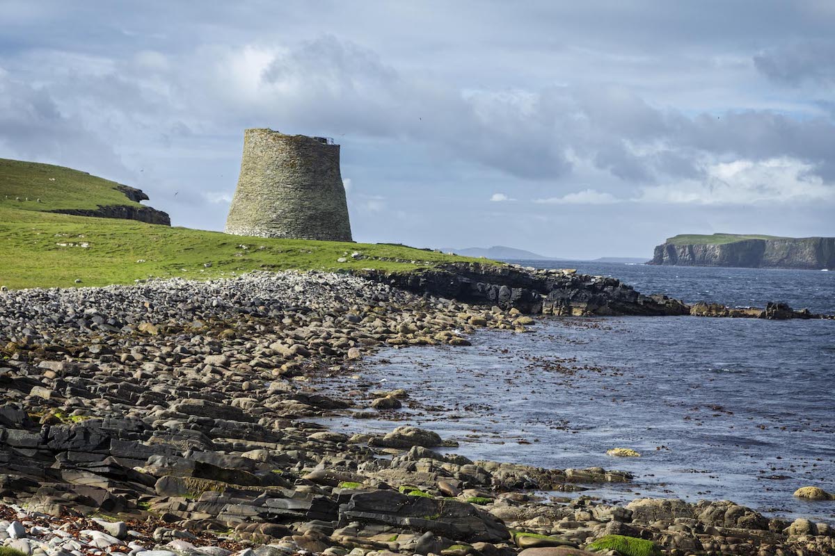
The following morning in the Shetlands we anchored off the island of Mousa (Mossy Island in Old Norse). We use Zodiacs to reach the pebbly beach, then walk along the coast passing nesting oyster catchers, drumming snipes, terns, and auks until we arrive at an archaeological treasure more recent than the neolithic sites of yesterday. The arrival of copper and gold metallurgy around 2500 B.C. and the onset of the Bronze Age around 2100 B.C. didn’t stop people from erecting their megalithic monuments. It was during the Iron Age that brochs appeared, distinctive circular dry-stone towers unique to Scotland. The Broch of Mousa, built around 300 B.C., was the tallest prehistoric building in Britain, standing 44 feet high (13.3m).
It is circular in plan with double-skinned windowless walls encircling a main room. Crouching to enter through an easily defended opening — the wall is 5 meters thick at the base — the dry stone interior was stark and cold, but in its time, it would have had fur rugs, wall coverings, timber floorings and a second floor, snug and secure against the elements. An interior stone staircase leads up to a parapet with a view of Mousa Sound.
In the 12th century, according to Viking sagas, the mother of Harald, Earl of Orkney, repaired to the broch with her lover. Harald, who didn’t approve of the match, laid siege, but the broch proved impregnable, so he left. On a blustery day the walls proved impregnable to the wind, although starlings and storm petrels found holes enough to nest in the outer wall. Shetland is famous for its birds—21 of the 24 seabirds common to Britain breed in Shetland.

The Faroes are roughly halfway between Norway and Iceland, a North Atlantic archipelago of 18 major islands, all but one inhabited, featuring a subpolar oceanic climate warmed by the Gulf Stream. Føroyar is the Faroese name for the archipelago, meaning sheep island in Old Norse, which is fitting as there are twice as many sheep than people. Many of the 54,000 inhabitants are descendants of Vikings. And for centuries it was part of Norway, but is now an independent territory of Denmark, self-governing since 1948. Schoolchildren learn Faroese and Danish early on, as well as German, French, English, and Spanish. Tórshavn is one of Europe’s smallest capitals with only 13,000 inhabitants, although the Vatican has only 800 inhabitants and San Marino 4,500.
Undersea tunnels connect many of the islands, even offering Wi-Fi connections, and the Faroes boast of the only undersea roundabout in the world. Most people, if they know of the Faroes at all, it is because they export sustainably raised Atlantic salmon famous for its superior quality and taste, or more infamously because the Faroese continue to harvest dolphins annually with drive hunts known as the Grindadrap, butchering the sea mammals close to shore. Islanders have eaten whale meat for more than a millennia dating back to the Vikings, an important food source for remote islanders who depend on self-sufficiency to live. But an international outcry over the slaughter is affecting tourism and businesses. Bakkafrost, Faroe’s largest salmon farmers, called the slaughter “totally unacceptable.” Communities often band together when outsiders tell them what they shouldn’t do, but today many Faroese agree they should stop the Grindadrap altogether.
Martin Eidesgaard, our guide on our first outing on the southern island of Su∂uroy, prepared us for how matter-of-fact the Faroese are. “The lambs are cute now in the fields,” he said as we pass a field of them gamboling gayly about, “but they are even cuter when they are on my plate later in the winter.” We would hear the same matter-of-fact depiction of an unforgiving life on a remote island. “He was a fisherman who went out in a storm and died. He was a young man who climbed to the top, but coming down he slipped and fell, and he died.”

That evening Jacob Edgar brought on board the Faroese ensemble vocal group Kata, five women with angelic voices. “They will entrance and beguile us,” he explains, “with their haunting arrangements of ancient songs collected through vintage field recordings and archival song books. Even the children’s songs are filled with tragedy and gruesome imagery of murder, death, and terrifying mystical creatures. It is a window into the difficult life the Faroese people led for centuries, where the risk of death from falling off a mountainside, drowning at sea, starvation, or disease was a fact of life. Luckily those days are gone while the people of the Faroes now enjoy a wonderful quality of life in a jaw-droppingly beautiful setting.”
The five young women proceed to sing jaw-droppingly beautiful songs.
There are so many options for excursions in the Faroes. We can hike in the mountains, visit a farm, the National Museum, or take another hike. I want to do them all. The islands are green, steep, and rocky—a volcanic geology 50-60 millions years old with a layer cake of successive lava flows—dramatic vistas fill the gorgeous landscapes. Cold winds buffet the islands where wind farms and water generate fifty percent of the electricity for the islands.

Tórshavn (Thor’s Harbor), the capital of the Faroes, is on the southeast coast of Streymoy, the largest of the islands. On a little rocky peninsula extending into the harbor is the historical district of Tinganes, filled with painted buildings, usually red, an excellent color choice to counterbalance rainy and dreary days, although some are painted black, but the window fenestration is white, and doors bright green or red. They all feature sod roofs bright with the green of the grasses, and many of the homes have lace curtains at the windows. It feels like a living-history museum except these are people’s homes and functioning, operating governmental offices that include the office of the prime minister. One can actually knock on the door although he was gone when we tried to meet.
When Google street view wouldn’t come to the Faroes, locals were pissed. One can argue the value of Google street view, but for the Faroese, when they realized they weren’t even on the map, it smacked of discrimination. Durita Dahl Andreassen, with the country’s tourism board, came up with an innovative and creative answer. They strapped cameras and flexible solar panels to five of her sheep and let them loose on the mountains. Google Sheep View went viral. It didn’t take long before Google pronounced the campaign “Shear brilliance,” prompting the company to visit the islands. “Where there’s a wool, there’s a way,” declared David Castro González de Vega, Google Maps Program Manager. “When Durita decided to document the country for Street View, sheep weren’t a baaad place to start.”

Our last day on the Faroes we visited the village of Bøur on Vágar Island. Many of the houses with sod roofs built along the terraced shore have views of the uninhabited islet Tindhólmur and the sea stack of Drangarnir.
Helga Nordendal runs the Pakkhúsid I Bø Café. Her great, great, great grandfather built the house in 1861. It is as snug and as warm as her friendly greeting. Behind the mountain is the village of Gásadalur, only recently connected by road after blasting a single-lane tunnel through the mountain. Lying in a valley bordered by the highest mountains on Vágar, the village itself has more buildings (25) than residents (11) — but the draw is the picturesque Múlafossur waterfall, a thin ribbon of water falling 100 feet to splatter in a near-perfect pattern into the North Atlantic. Puffins and arctic terns flit about, but it is the waterfall that is mesmerizing. Offshore wearing a cloud cap rises the island of Mykines, the westernmost of the 18 Faroe islands. It too has a village with more buildings (40) than residences (10).

Knott tells me there’s a nice story told about one of the Norse who had a farm on an island in Orkney. “Every spring after planting he would go on his spring Viking, to the Hebrides or Ireland, somewhere to bash around and then come home. During the summer he works in his fields, but after harvest he would go out for his autumn Viking with his war band and bash around. Then they came home to spend the winter at the farm, drinking and telling stories. The following spring they’d repeat farming with raiding and plundering.
“What you hear is in Orkney they are farmers who go fishing and in Shetland they are fishermen who farm. These communities have always been seafaring and farming, land and sea together, indivisible. That’s what I always try to talk about. Land, sea, and people have evolved together to create the culture. You can’t really separate one from the other.
“The Vikings were also excellent traders,” Knott continues. “Raiding and trading went hand-in-hand. You hear stories of Vikings turning up at a church, and saying, ‘Oh say, that’s a really nice silver cross you have there. I’ll buy it.’ And the good men of the church say, ‘Oh no, you can’t buy it. That’s our crucifix,’ but the Vikings end up taking it because the monks won’t engage in trade. Even today we have traders and raiders, so they’re not as separate as we might want to think. For a combination of reasons that also include the continued development and improvement of their ships that allow the Vikings to strike off to new lands and booty.
“Iceland was different. The thing about the settlement in Iceland is most people were not coming directly from Norway. They came first to the Celtic West, to Orkney, Shetland, Hebrides, Scotland, Ireland, and it was the next generation or even the one after that that really spearheaded the settlement. The narrative is it’s essentially an empty country and the wave of Norsemen going there were settlers and not Vikings as there was no one to bash around and no booty to carry off. There’s a good chance Irish monks were living in Iceland at the time, but they left as they didn’t want to share the island with heathens.

“It was the coming of Christianity that brought the Viking period to an end: 1030 AD in Norway with the death of St Olaf. In England it was the advent of the Normans in 1066. Viking culture was a pagan activity. And of course, if you were a pagan Norsemen, you wanted to go to Valhalla, and you only got to do that if you died in battle. The last thing you wanted to do was die peacefully in your bed. That would be awful.
“There’s a story of one man who’d been a successful Viking warrior, and he was getting older. He worried his time was coming. So, he put on all of his gold and walked about with all this wealth around his neck waiting for someone to mug him so he could die violently and go to Valhalla, which is a very strange mindset for us to get our heads around. But when you think about it, like the Islamic suicide bombers today, we might wonder how can people think like that? But through time you find it’s a fairly common strand in certain societies.”

“What happened?” I asked.
“Oh, he got his wish,” Knott says with a laugh. “He got properly murdered and died happy.”
Our transit of the North Atlantic is gloriously uneventful save for the everchanging light and clouds. As we near the Arctic Circle, actual nighttime darkness is fleeting, bookended by lingering sunsets followed quickly by dawn. Sunrise on the 8th of July is at 1:26 a.m., while sunset is the following morning at 12:47 a.m.
For a photographer light is everything. I stay up past sunset and I’m up early. Jacob Edgar confesses he’s typically not an early riser, but one morning, even before his important first cup of coffee, he tells me music expands the brain. It is both escape and transcendence. Amazingly, the brain has no specialized section for music — it touches all parts. So it’s not surprising when he suggests that raga is a scale of color — raga literally means color or mood, so specific moods are colored in the mind depending on the melody. I find this a perfect early morning conversation, interspersed with our sighting pelagic birds wheeling in the air as they fly alongside our ship.
He carries a braguinha, a small guitar from Madeira that inspired the ukulele after Portuguese laborers from Madeira and the Azores came to Hawaii to work in the sugarcane fields. The name is borrowed from Hawaiian ‘ukulele, which literally means ‘jumping flea’ because of the musicians’ quick fingering. He picks “Sodade,” a haunting melody from Cape Verde, a song about nostalgia. It’s Portuguese blues you hear in Portugal, Cape Verde, and Brazil. He explains that Cesária Évora’s guitarist taught it to him.
Everywhere we visit in Iceland we are aware of the geology. There are geologic terms that give name to the forces that create the landscape surrounding us. Some we all know, such as a lava flow, but others are more esoteric — kames and kettles, concertina eskers, sandars, and moraines—features left by retreating glaciers. The word ‘geyser’ for an intermittent hot spring throwing up water is named after a specific geyser in Iceland named Geysir. In Icelandic, a geyser is goshver, unless of course the goshver is Geysir.

Bussing toward a planned boat ride on a glacial lagoon we see five-gaited Icelandic horses grazing in pastures as well as tongues of glaciers poking from valleys. Vivid colors on a bright summer day, the grasses on the plains and hills Kelley-green, the rivers, lakes, bays, inlets, ocean, and a limitless sky of turquoise to Prussian blues, mountains and valleys bright white with snow and glaciers, and always the black of lava. Armadas of clouds gather offshore, puffing themselves up as if for courage, before advancing towards the island as the sun glints off a roiled sea of whitecaps.
Jökul is Icelandic for glacier. Jökulsárlón is a glacial lagoon with icebergs that calve from Breiðamerkurjökull in Vatnajökull National Park, the second-largest national park in Europe, encompassing 5,460 square miles. Within its boundary is the massive Vatnajökull Glacier, an icecap itself covering 3,127 square miles, with 30 outlet glaciers flowing out, their icy fingers grinding down valleys between mountain peaks.

The view from the parking lot above the glacial lagoon is spectacular. The water is Egyptian blue, chock full of searingly-cold icebergs, bergy bits and growlers. Clouds cover the top of the glacier like a plump duvet. What gets our attention is that even after stopping our bus won’t stop rocking. Gale force winds hit us when we step off. The bus driver suggests we leave as the wind is sandblasting the paint off of his brand-new bus down to bare metal.
I learned there are 156 entries describing wind in the Icelandic dictionary, not that surprising for a remote island smack dab in the middle of the stormy North Atlantic. We cancel our plan for the leisurely boat tour for a closer look at the large, sculpted icebergs strewn about the lagoon.
When I’m on an editorial assignment I continuously adjust my plans because of weather or other contingencies. As an example, accompanying the writer for a story on Big Sur for National Geographic Traveler, she and her son and my wife Mary and I were spending the night at Deetjen’s Big Sur Inn as an El Niño storm arrived and began hammering us. Even though it is a Sunday night I call my editor at home suggesting we should bail, that if we don’t, we might not return our rental cars for months. We headed south early the next morning as landslides soon marooned the area.

Changing plans is not as easy with two busloads of clients, but staff arrange it quickly. We drive to Hoffellsjökull on a narrow dirt road, a much less visited outlet glacier hidden behind a rocky terminal moraine scraped by the advancing glacier. But now we trace its retreat that leaves denuded hillsides and a glacial lagoon brown with meltwater, in sharp contrast to the brilliantly bright icebergs. Temperatures in the Arctic are rising at twice the rate of the rest of the planet. Iceland’s glaciers lose four billion tons of ice each year due to global warming. It’s almost as if geologic time has now become human time.
Birna Imsland, like Jacob Edgar, is a staff cultural specialist. She is our resident Icelander for the voyage, intelligent, friendly, and funny, helping us with our mispronunciations and misconceptions, reminding me that Oscar Wilde said, “The Icelanders are the most intelligent race on earth, because they discovered America and never told anyone.”
One of her lectures is on the lopapeysa, literally meaning “sweater made from unspun yarn,” traditionally knitted with a yoke pattern around the neck. The sweaters have become a symbol of Iceland, made from Icelandic wool that is warm, breathable, and naturally water repellent.
A recent study on creativity in Iceland discovered “Every Icelandic male knows how to knit, every female knows how to use tools.”

We enter the land of the midnight sun. Twenty-five miles north of Iceland the Arctic circle crosses the tiny island of Grímsey, all two plus square miles of it. As Peter, our expedition leader explains, it is a separate world, isolated and windswept, with basalt cliffs, green, lumpy fields, lowly coves, a handful of islanders and more than a million seabirds. Grímsey is rocks, grass, wind, sea, and the constant cries of gulls and arctic terns. And there are puffins, sometimes called sea parrots or clowns of the sea, but more often than not, simply the most laughably adorable bird on the planet. Approximately sixty percent of the world’s puffin population live around Iceland and 100,000 pairs choose Grimsey, enough that everyone is able to take a photograph or two.
Birds animate the sky as if a musical score came alive and all the notes have taken to the air. They whirr and whizz above us, including puffins returning from the sea with mouthfuls of sand eels, congregating near their burrows. Their scientific name is Fratercula arctic, little brother of the north, probably because their black and white plumage resembles a friar’s robes. Icelandic Nobel laureate Halldór Laxness describes puffins as “squatted with the dignity of church officials in front of their burrows.”

A group of puffins is a colony, a puffinry, an improbability, or a circus. Both an improbability and a circus seem like words one might find in a crossword puzzle. ‘54 across, a____ of puffins.’ They are energetic birds, flapping their wings up to 400 times a minute. They fly as fast as 55 mph. They eat small fish they catch underwater, especially sand eels and herring. They dive as deep as 200 feet while holding their breath for up to a minute. Due to a unique hinge to their multicolored beak, and a rough tongue they use to hold fish against the spine of their palate, they can, even with a mouthful of fish, open their beak underwater to catch more. A baby puffin is a puffling. They have a voracious appetite. By the time it leaves its burrow after 34-60 days, ornithologists estimate each parent will have dove 12,420 times, bringing back up to 10 whole fish each time.
Jacob Edgar arranged an afternoon concert at the airport signpost for the Arctic Circle, which has names of cities and their distance from this remote spot — Sydney is 16,317 km distant, Tokyo 8,494 km, London a piddling 1,949 km. I discovered the Arctic Circle is moving as the tilted axis of our Earth is moving back-and-forth over a 40,000 year cycle. Because of the current movement, the Arctic Circle is contracting approximately 14 meters a year. After 2047 Grimsey and the Arctic Circle will part ways for thousands of years until the earth tilts back and the circle expands again.

Singer-songwriter Svavar Knútur tunes his guitar as arctic terns circle above us. He is a troubadour carrying his acoustic guitar, a big man dressed for a day at the Arctic Circle, clean shaven with a big smile, wearing a lopapeysa, and a waterproof windbreaker. Knútur is a wonderful musician, lyrical and melodic, using his bass strings to harmonize with his voice. His songs are evocative and melancholic, alternating between laughter and tears. He uses parallel fifths, as in Gregorian chants, a medieval influence in Icelandic folk songs he revises and incorporates into his contemporary world music.
After dinner he performs another concert. His banter between songs is as informative as his singing. He’s a born raconteur, at ease with his audience. He tells us his favorite months are in winter when there is little daylight as he has always, since childhood, embraced solitude, cold, and darkness as it gives him inspiration and joy. He confesses he enjoys darkness more than light. He also speaks of injustices.
“This next song is about the refugees,” he explains, “who left Iceland between 1870 and 1915. A lot of Icelanders emigrated to America because of a huge famine, and we’d been oppressed for 600 years by the aristocrats, basically slaves in our own country. When the Danish king gave us a constitution, there was a clause in it that allowed us to leave. Thirty thousand Icelanders left the island. You know, that’s not too many people. Two million Irish people emigrated during their Famine, but Icelanders were only 50,000 at the time. It left a huge hole, so many able-bodied people leaving, and it set us free because the aristocrats didn’t have any power anymore. Most village houses were built after 1874. Before this time, it was forbidden to settle by the sea, it was forbidden to form villages, and it was forbidden to have a profession. You were allowed to be a farmer, but you would be renting from the aristocrats and the rents were very, very high. You were basically an indentured servant, and you could never get out of it. If women got pregnant without a license from their masters, they took the child away from the woman and she was punished severely. It was a horrible time, so it was such a relief to be released when we could live by the sea. Before that we were forced to live up in the valleys. There were some people allowed to live on the coast, but they were forbidden to fish for a living. They could fish enough to eat but they couldn’t sell their fish. If you did, you were punished severely.”
Knútur explained his next song, “Lady Winter” was about living in Iceland and his relationship with his country. He began finger-picking a beautiful and surprisingly sweet melody with a lilting refrain that belied the lyrics. It reminds me, in Independent People Laxness writes, “it is nothing but damned eccentricity to want to be dry,” he tells his shivering family as they eat their dinner in the rain. It wasn’t until 1944, during the war, that Iceland got its independence from Denmark.

Iceland is a land of opposites, fire and ice, glaciers and volcanoes, Björk and Viking metal bands, exquisite gravlax and fermented shark, gruesome lullabies but friendly people.
Not every Icelandic story is gruesome. In 1973 the Icelandic parliament abolished the letter ‘Z,’ to be replaced with the letter ‘S,’ except for a few words like ‘pizza.’ As Icelandic writer Egill Bjarnason points out, “who wants a slice of pissa?”
There are more than 50 cities in the United States with a larger population than the 340,000 inhabitants of Iceland. Per capita, Iceland has more writers than any other country in the world. One in ten Icelanders are published authors, one in four work in a creative field, including design, music, art, fashion, theater, technological sciences, filmmaking, and literature. A study by Barbara Kerr, Williamson Family Distinguished Professor of Counseling Psychology at University of Kansas, found that “Creative kids here in the United States tend to be looked at as a problem. But there, the idea of encouraging their children to be different is very common. And they’re not afraid of their child being different.”

Ferries from the mainland connect to the two-kilometer long Flatey Island, one of thousands of islands and islets dotting dramatic Brei∂afjör∂ur Bay. We ferry ashore in zodiacs from our ship anchored offshore, landing on a beach in a village of summer inhabitants, only a handful staying over winter. It’s a pretty place, windswept and quiet except for the squawks of birds. Many of the houses are recently renovated and painted. There used to be a monastery here, founded in 1172, but now only a church, with a wonderful mural inside depicting Jesus wearing an Icelandic wool sweater standing with two fishermen, modeled after local residents. A single room, brightly painted yellow wooden building with white trim and a black corrugated iron roof, sits behind it, with a white picket fence around it. It is Iceland’s oldest and smallest library. Inside on display is a copy of Flateyjarbók, the Flatey Book, an important medieval Icelandic manuscript on vellum, a collection of the sagas, including an account of the Vinland (North America) colony.

Outside of the village and the one road and a few paths, the island belongs to the arctic terns who terrorize anyone venturing near their nests, which appear to be everywhere. Large areas are closed to the public during nesting season. They divebomb anyone who gets too close, attacking their heads with their sharp red beaks, the color of blood. It’s best to carry a pole, a stick, and hold it aloft as they strike the highest point.
Jacob arranges a special concert at the old freezer house next to the ferry terminal with Hafdís Huld, a number one selling Iceland singer and actress, and her English husband acoustic guitarist Alisdair Wright who’ve arrived just for us. Their Vögguvísur (Lullabies) album became the most streamed album in Icelandic history and awarded double platinum status.
The old freezer house is a shop, a bar, a place to hang out on a rainy or cold day while awaiting the ferry. Today it is an impromptu concert hall with chairs arranged in a semi-circle around the fun and attractive couple. Before one of her songs Hafdís explains there is a tradition in Iceland that in the dead of winter darkness everyone waits for the first glimpse of sunlight. Each year they celebrate the first time they see the sun with solar kaffi, sun coffee, a party with coffee, waffles, cakes — anything sweet for such an important and sweet moment. It is a spontaneous celebration without a specific date, depending on weather.
A metaphor for life, really, finding something special, the glimmer in a day when things seem darkest. It is the sheer pleasure of traveling again after two years of a frightening pandemic, to celebrate, to toast, to sing, and a chance to once again welcome new friends and experiences.
How to Go
Lindblad National Geographic Expeditions
The harbor near the Hanseatic wharf area in Bergen, Norway | Credit: Macduff Everton 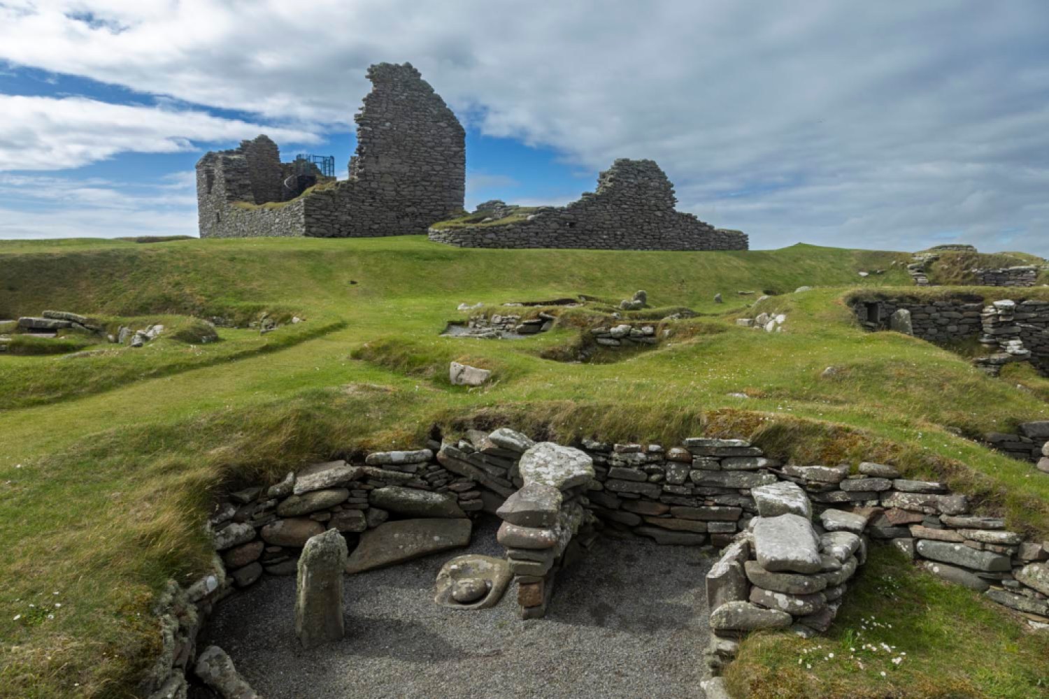
The Jarlshof prehistoric archaeological site containing remains from 2500 BC up to 17th century | Credit: Macduff Everton 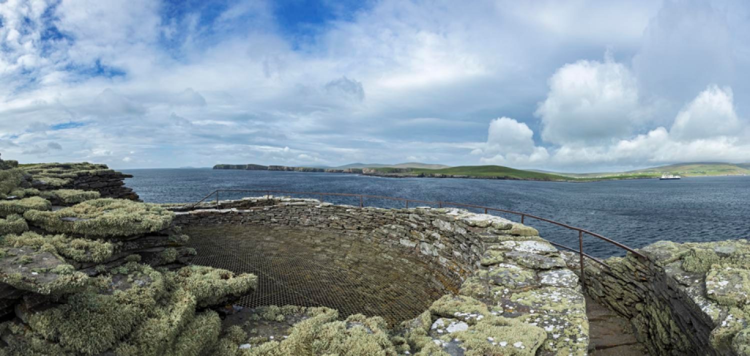
Shetland, Scotland | Credit: Macduff Everton 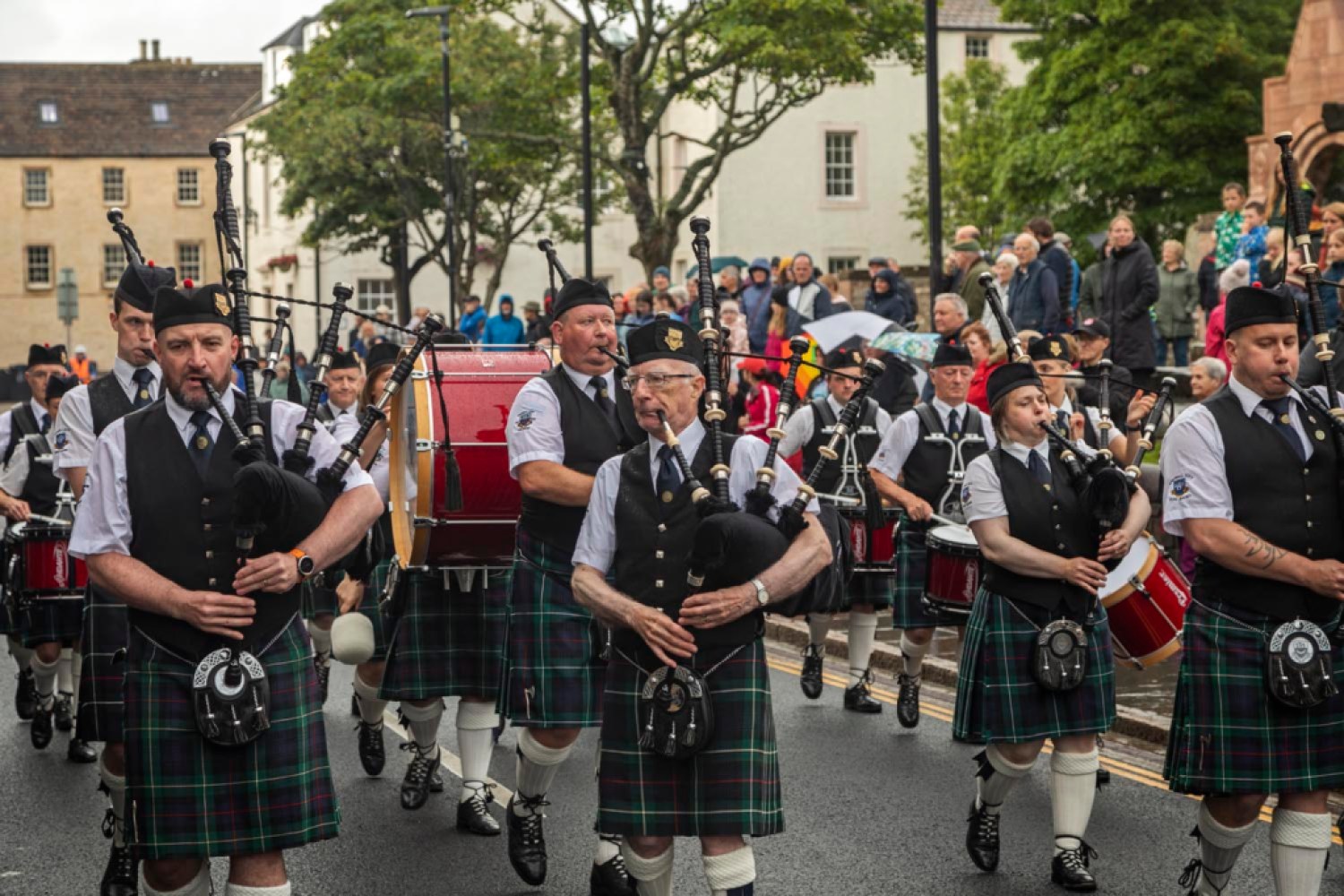
An evening performance by Kirkwall City Pipe Band on street in front of St. Magnus Cathedral | Credit: Macduff Everton 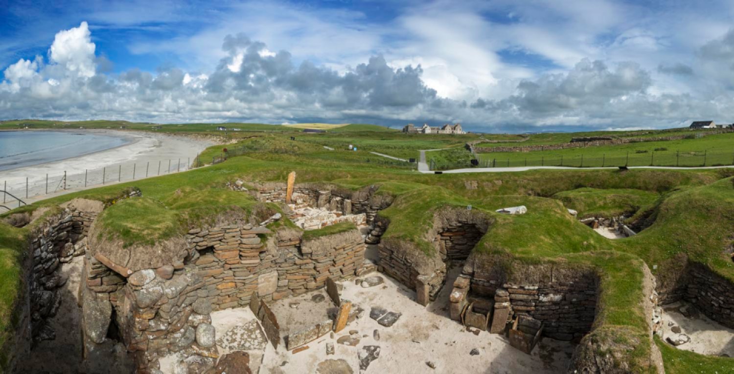
Skara Brae | Credit: Macduff Everton 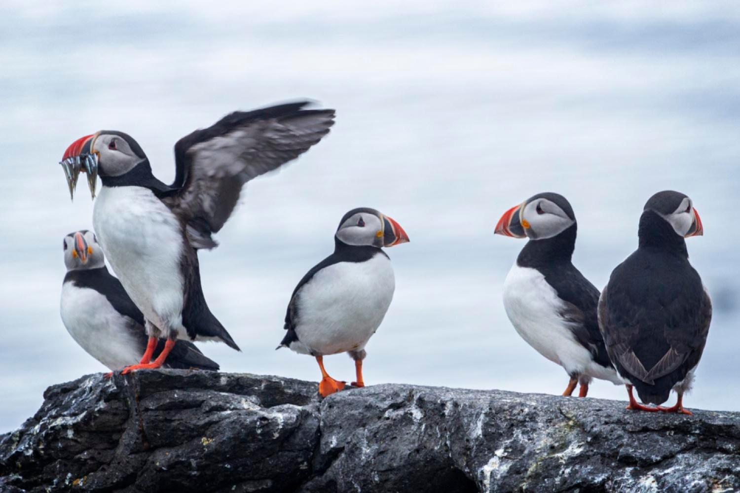
Puffins | Credit: Macduff Everton 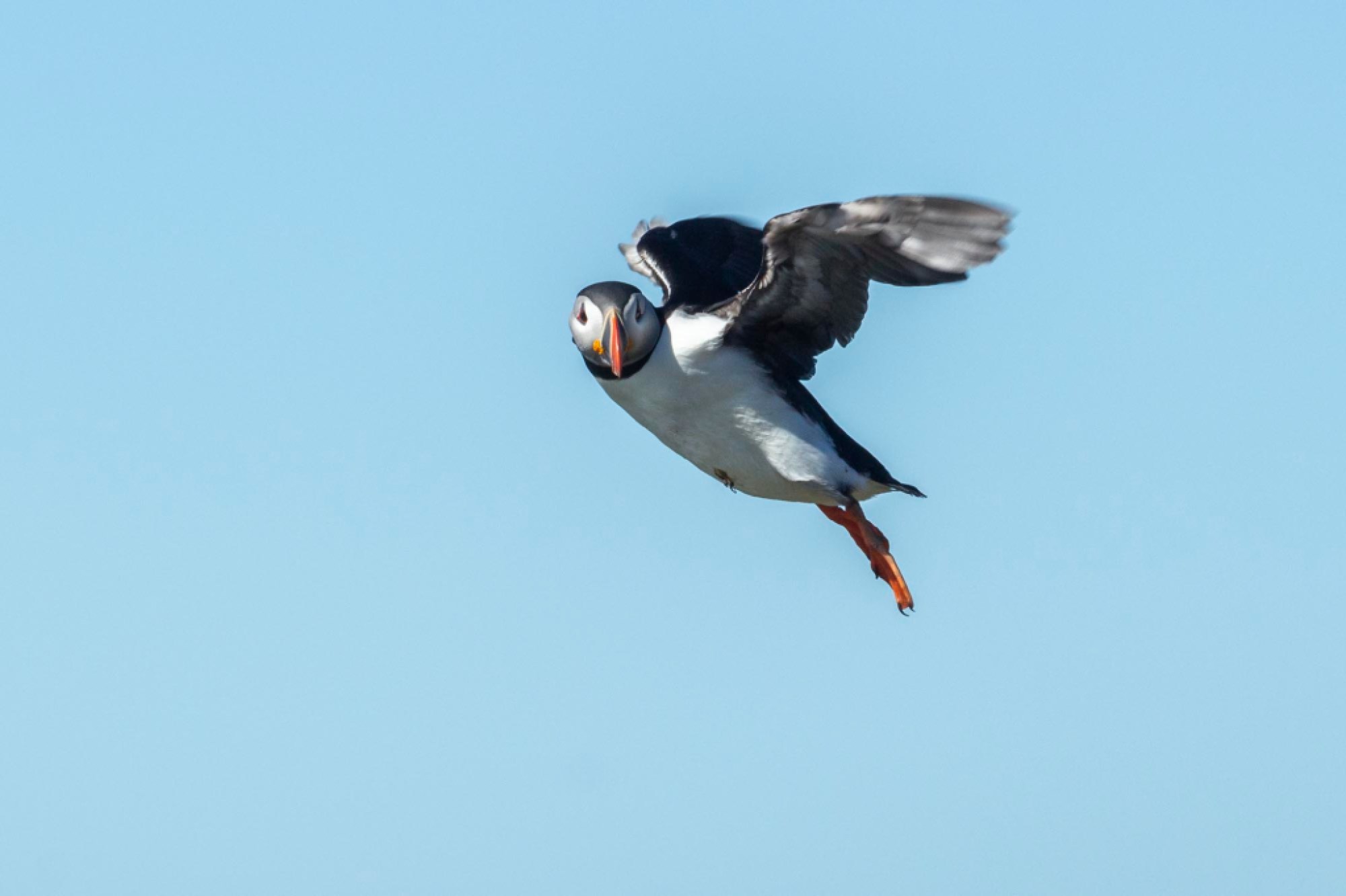
Puffins | Credit: Macduff Everton 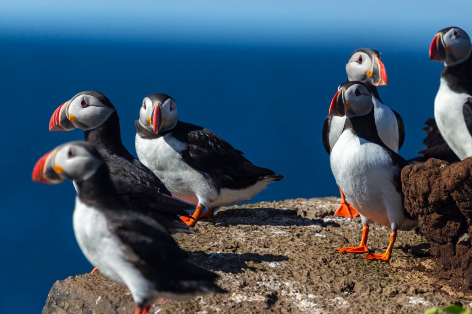
Puffins | Credit: Macduff Everton 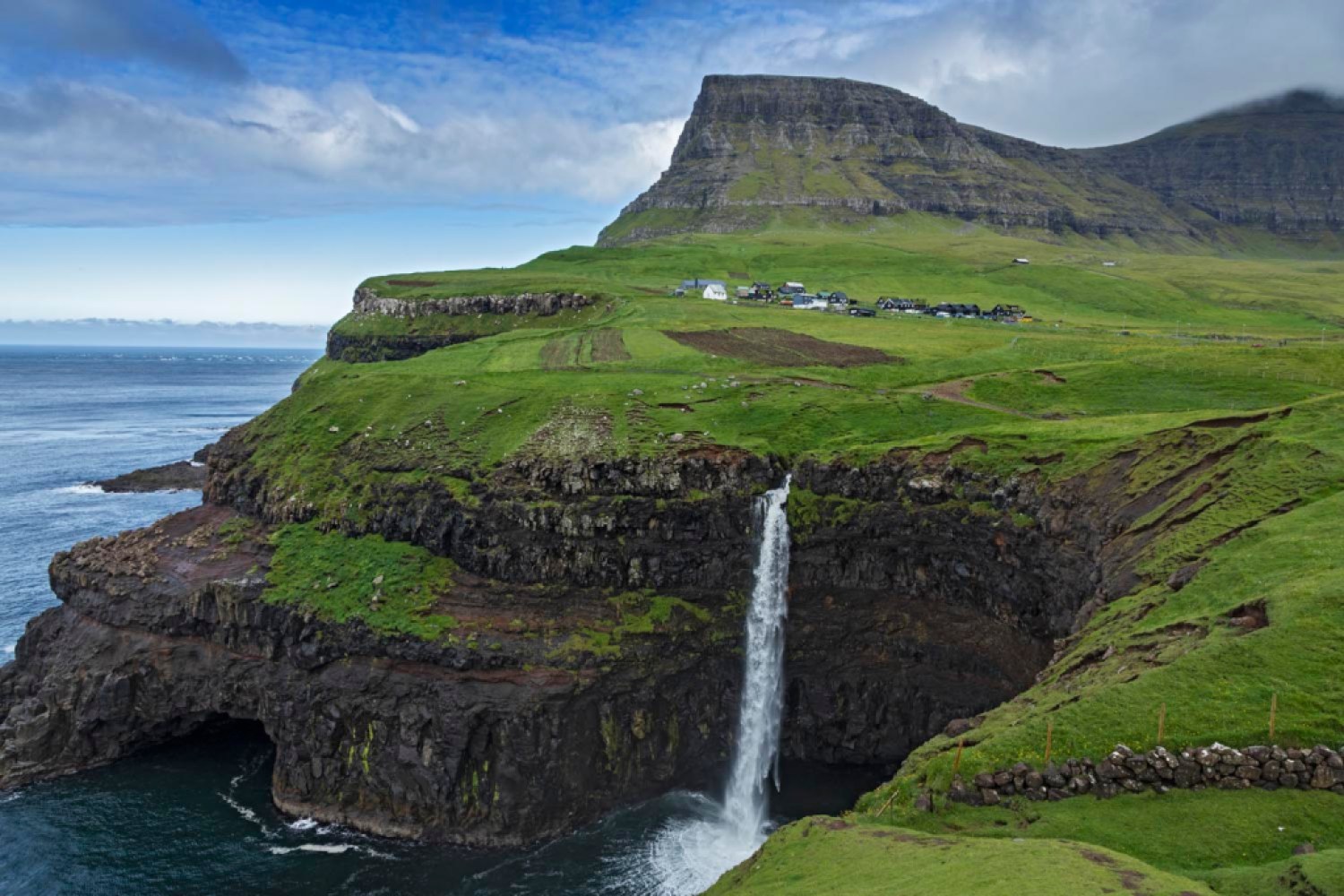
The Múlafossur waterfall pouring into the North Atlantic with Gásadalur village behind | Credit: Macduff Everton 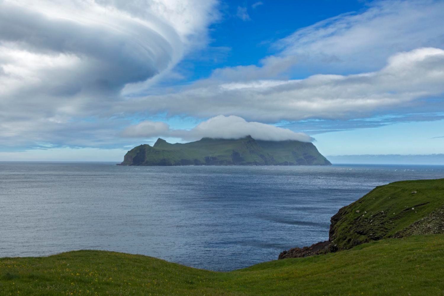
The view of island from Gásadalur, the island’s westernmost village | Credit: Macduff Everton 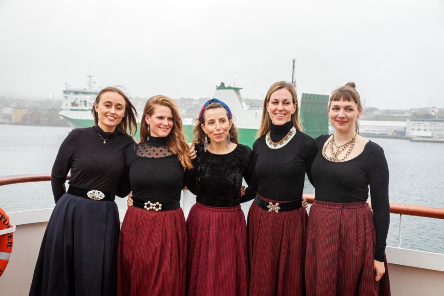
Faroese ensemble vocal group Kata with, left to right, Arnfrí∂ Lützen, Unn Paturson, Gu∂ri∂ Hansdóttir, Ey∂ Steinbjørnsdóttir, Anna Katrin Øssursdótir | Credit: Macduff Everton 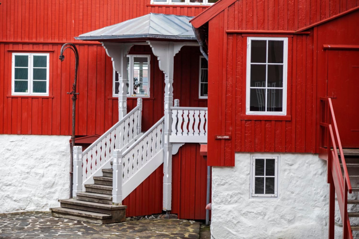
Tinganes | Credit: Macduff Everton 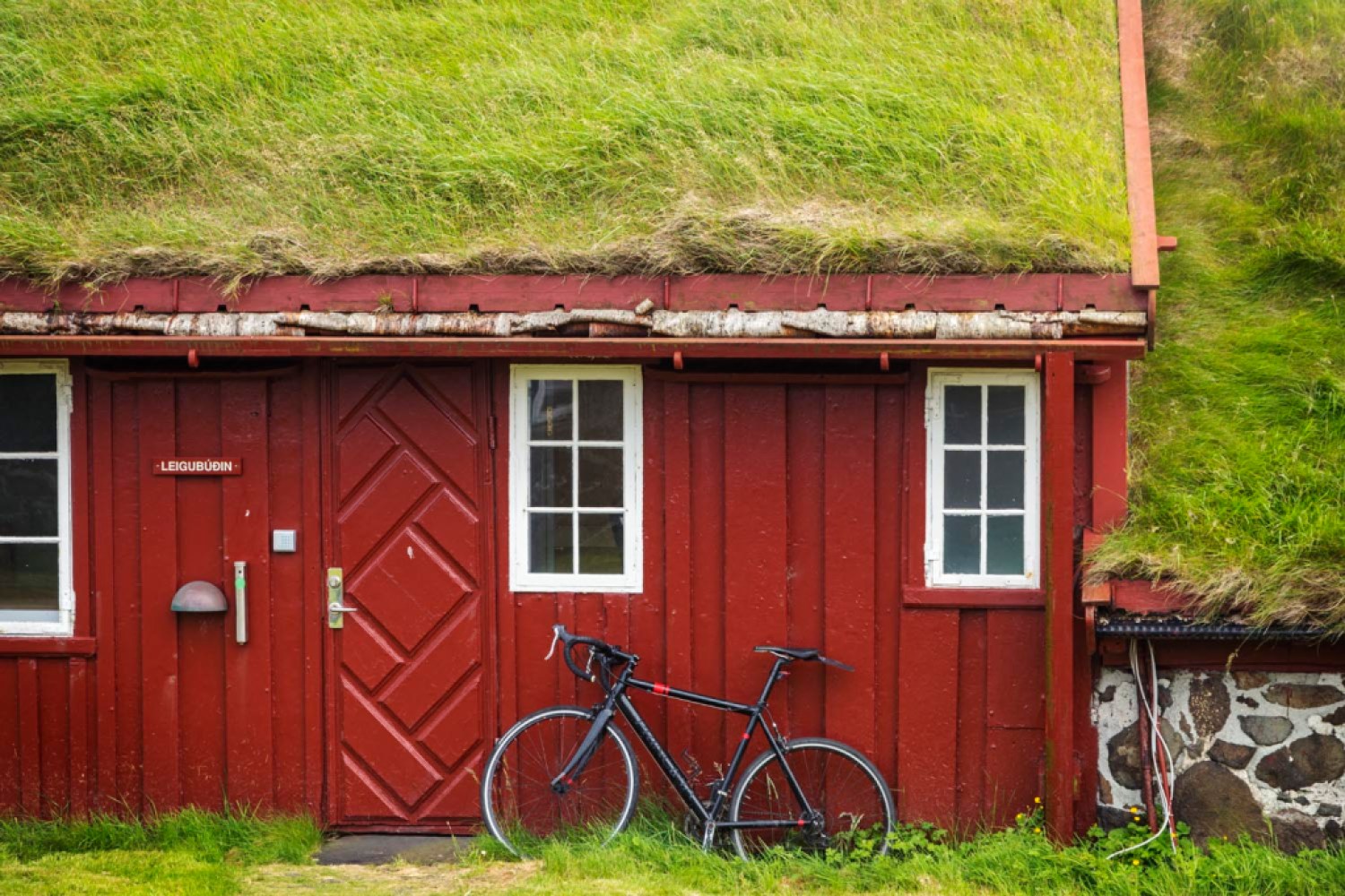
Tinganes | Credit: Macduff Everton 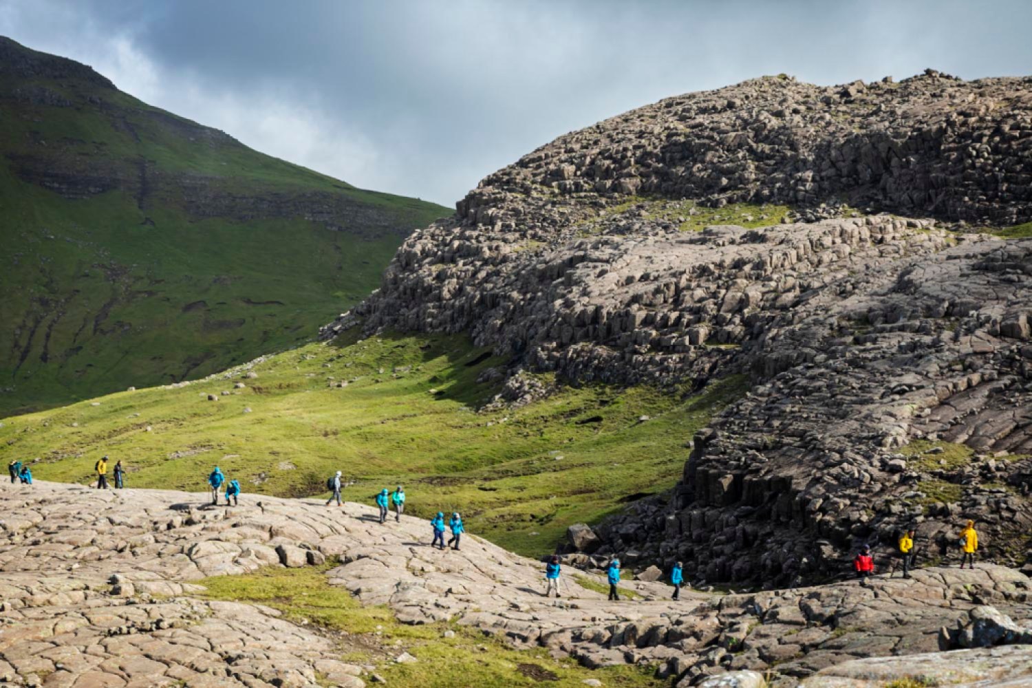
The hike to Streymoy sill, some of it over the top of columnar basalt lava | Credit: Macduff Everton 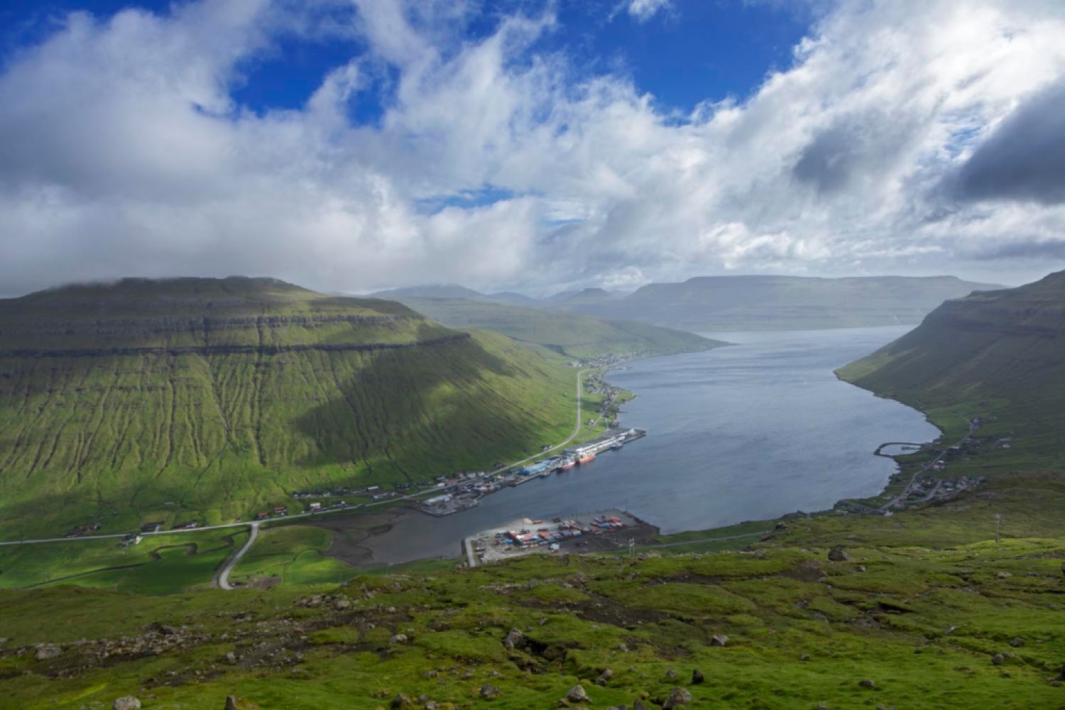
A view overlooking Ovrareingir and Kollafjørdur | Credit: Macduff Everton 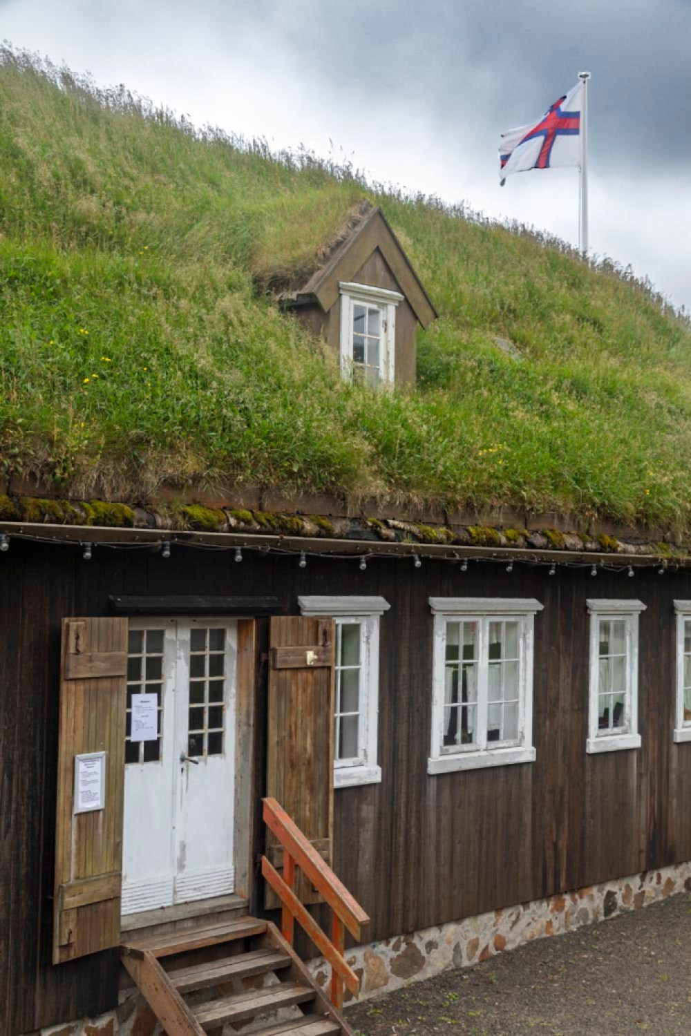
Museum in center of Tvoroyri | Credit: Macduff Everton 
Eypór Jóvinsson, fourth generation owner of Flateyri bookstore, reading a book he wrote in the oldest original store in Iceland where nearly everyone is literate and 10% of Icelanders will be published in their lifetime | Credit: Macduff Everton 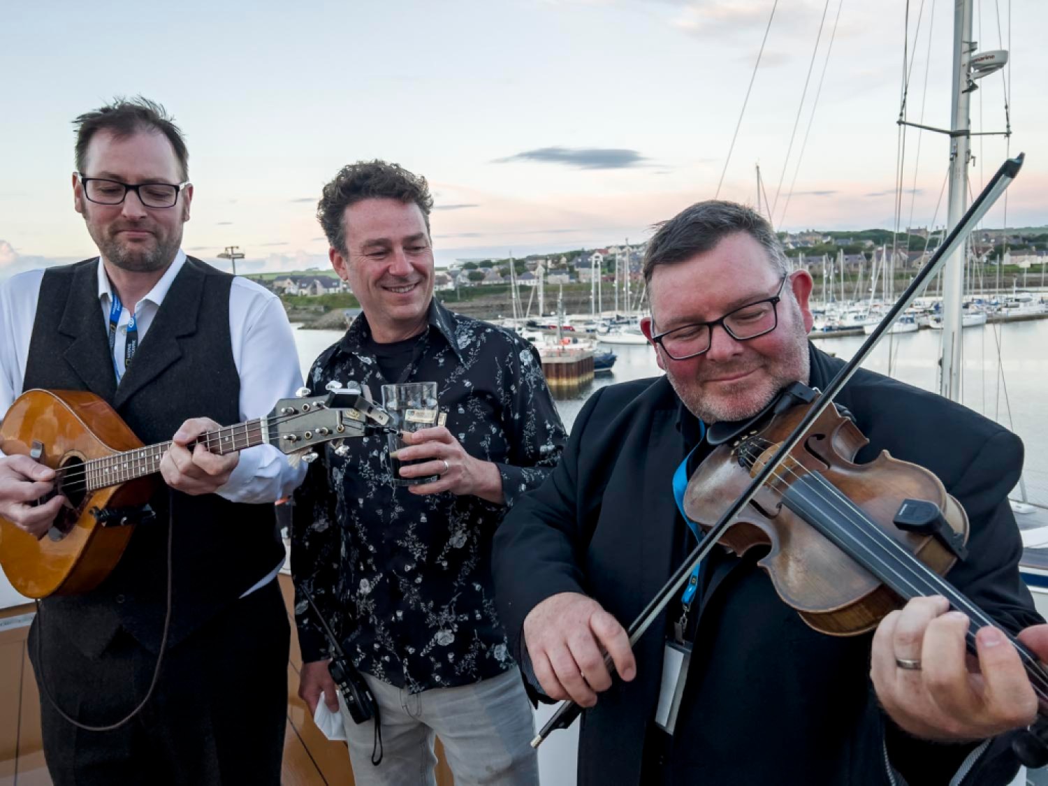
Brian Cromarty (mandola) and Douglas Montgomery (fiddle), Orkney musicians who perform as Saltfishforty, with enthnomusicologist Jacob Edgar, founder of Cumbancha | Credit: Macduff Everton 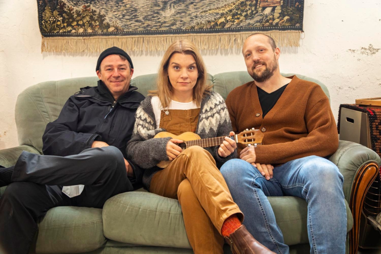
Musicologist Jacob Edgar with musicians Hafdís Huld, holding Jacob’s braguinha, and Alistair Wright | Credit: Macduff Everton 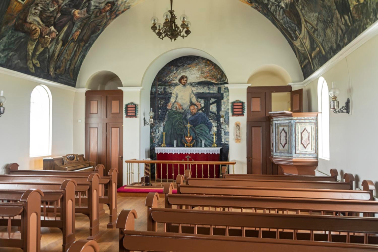
Interior of church built in 1926 with murals by artist Baltasar, a Spaniard holding Icelandic citizenship | Credit: Macduff Everton 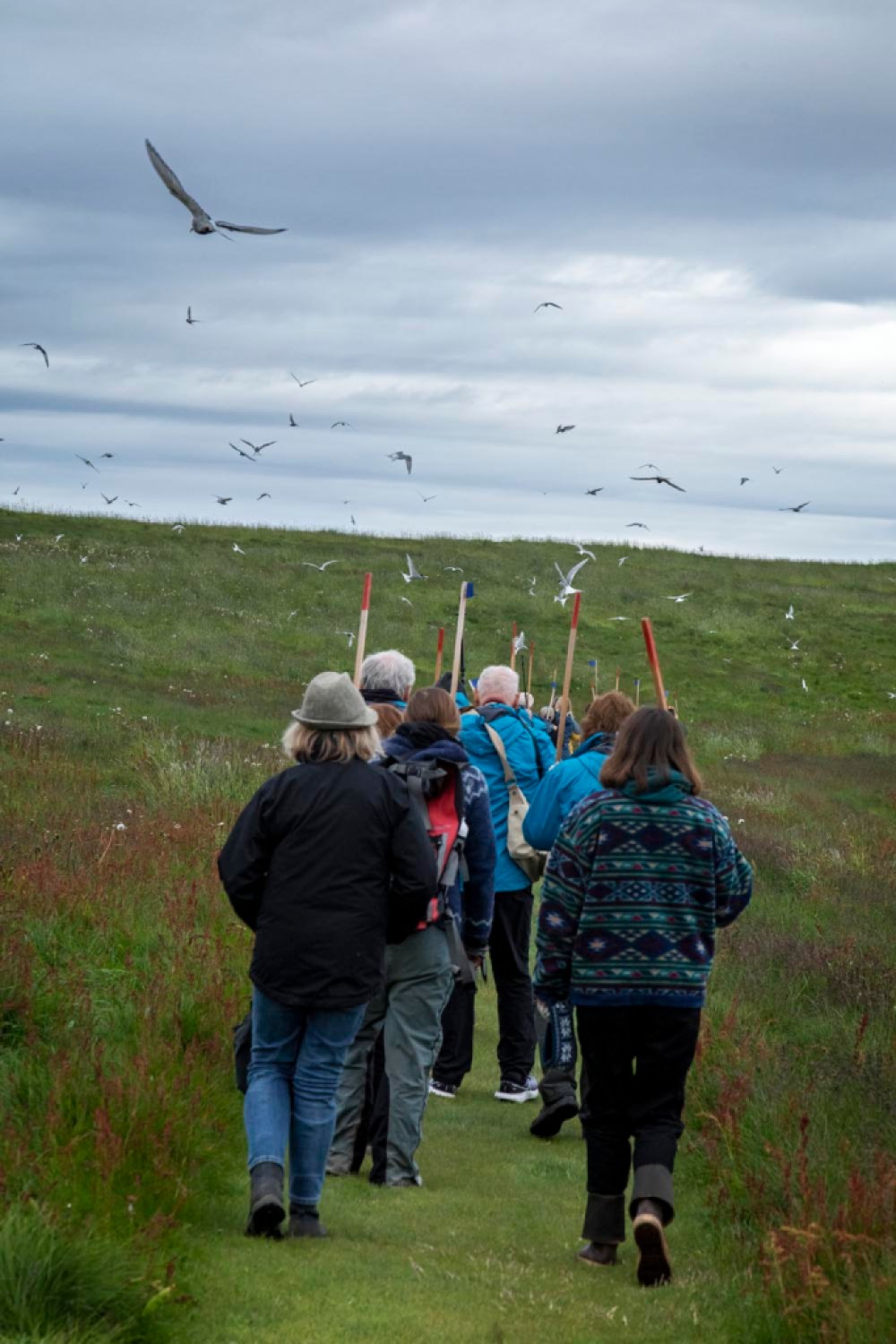
Walking through the arctic tern nesting area | Credit: Macduff Everton 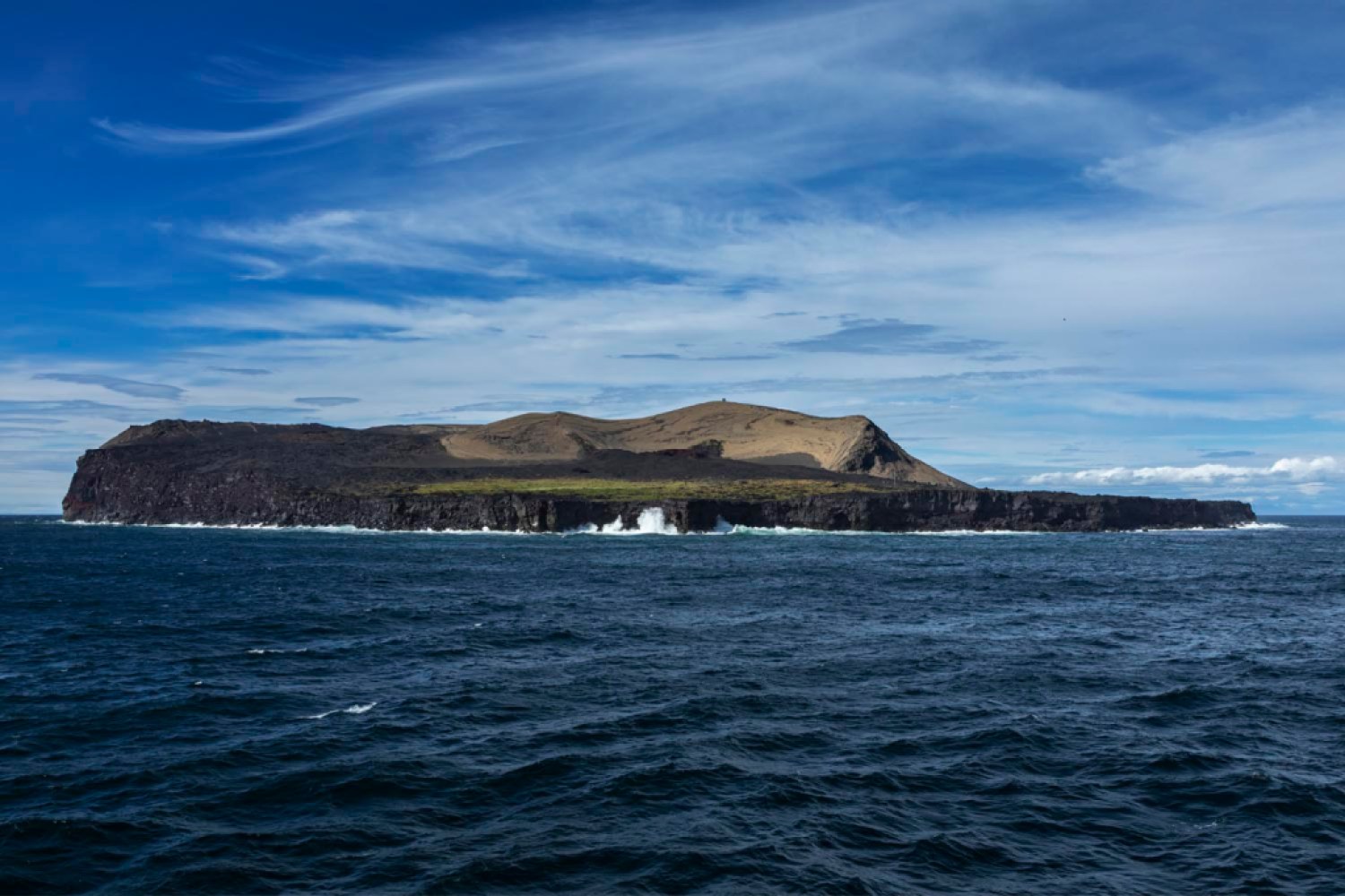
Surtsey, Iceland; the volcanic island that first appeared in 1963 | Credit: Macduff Everton 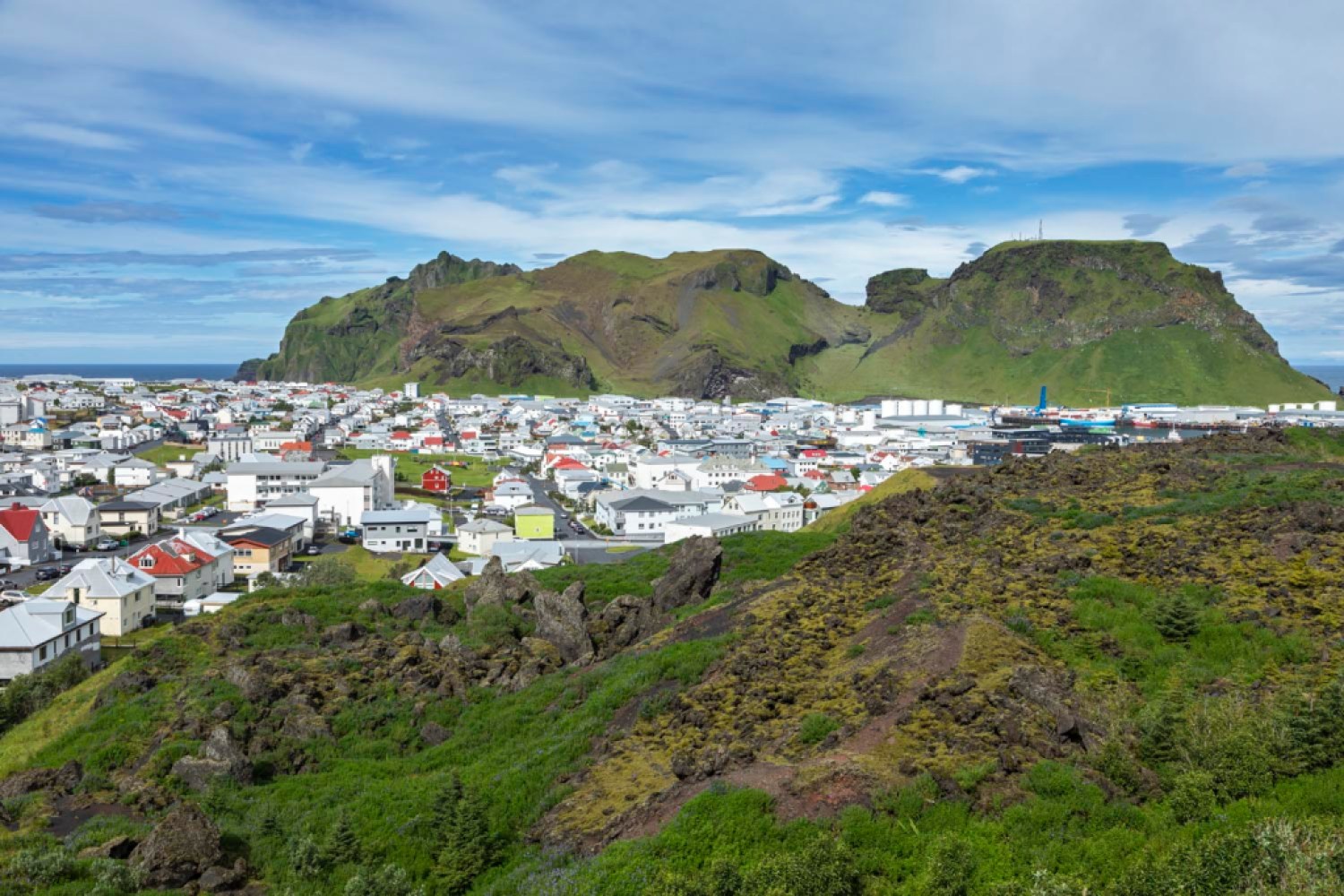
Heimaey, Iceland | Credit: Macduff Everton 
Flatey, Iceland; village | Credit: Macduff Everton 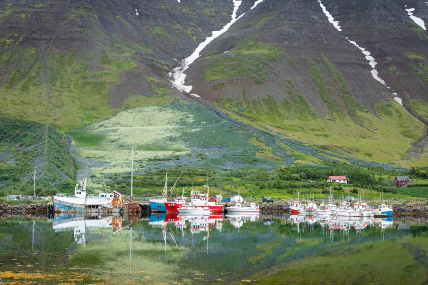
Flateyri, Iceland; boats in harbor | Credit: Macduff Everton 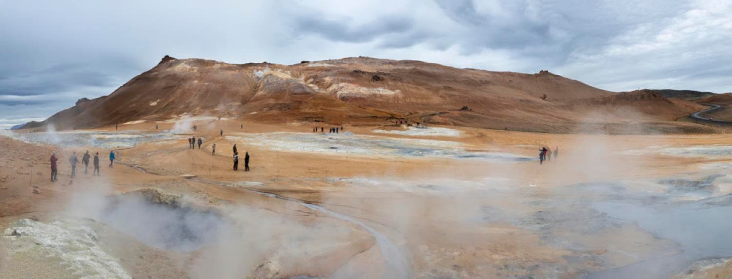
Hvevir (also called Namafjall) is one of Iceland’s largest hotspots or geothermal fields with solfataras and boiling mud pots with the smell of sulfur in the air | Credit: Macduff Everton 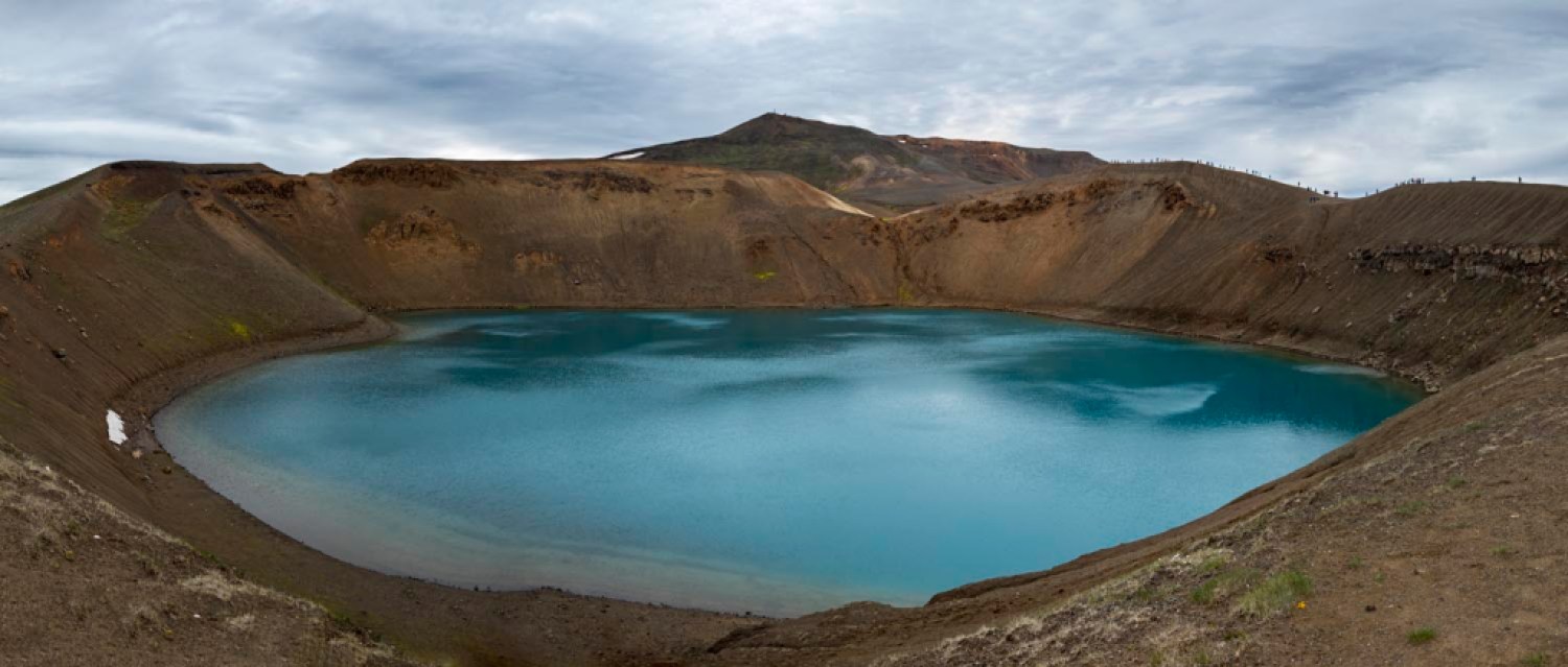
Viti, caldera of crater that erupted on May 17, 1724, now filled with turquoise and emerald-colored lake water in one of Iceland’s largest hotspots | Credit: Macduff Everton 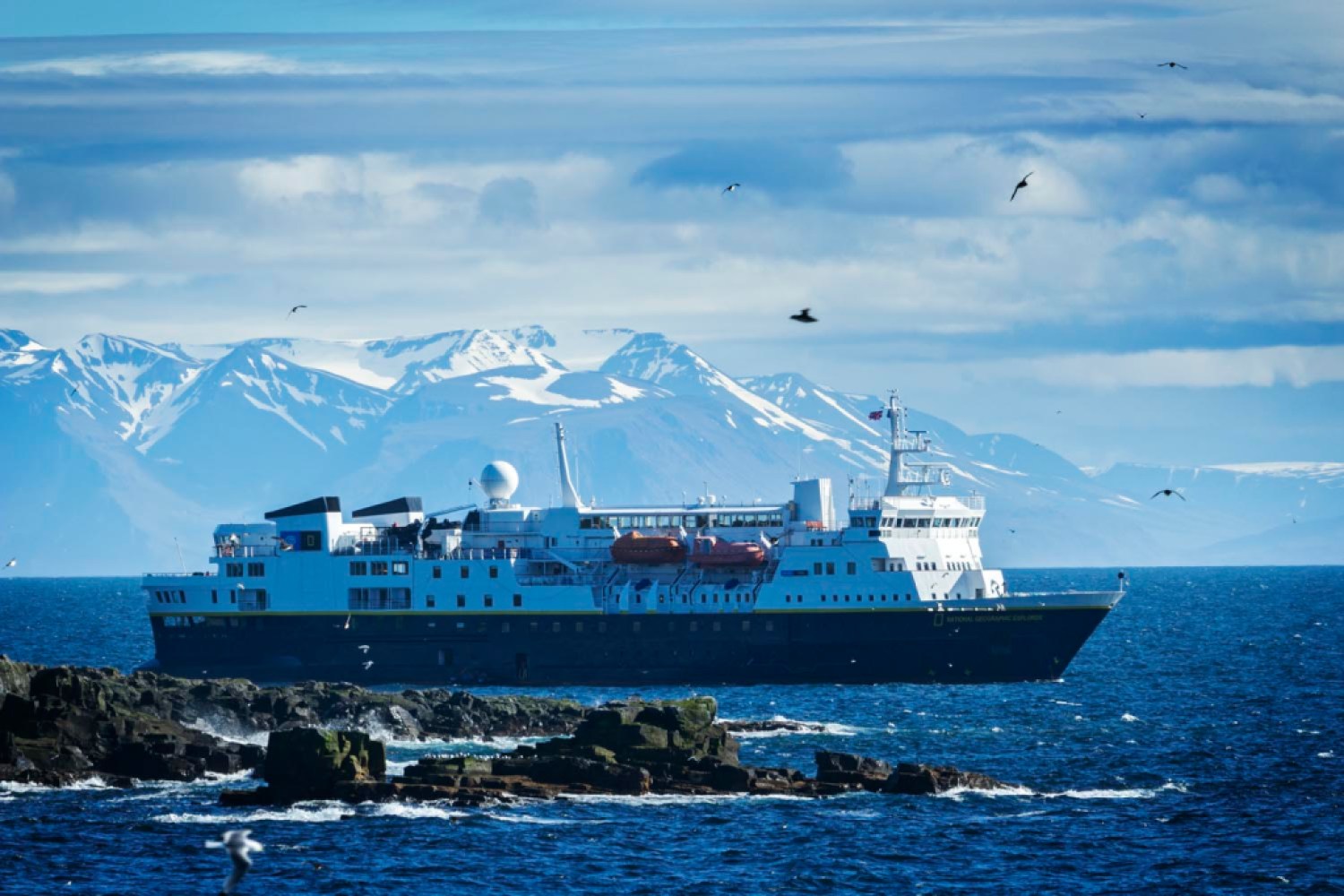
MV National Geographic Explorer anchored offshore Arctic Circle island | Credit: Macduff Everton
Support the Santa Barbara Independent through a long-term or a single contribution.


You must be logged in to post a comment.