
[Update: Tue., Oct. 14, 10:35am] The evacuation warnings from the night’s rainstorm were lifted as of 8:30 Tuesday morning. Little if any damage, flooding, or debris flow has been reported thus far. “It appears we have fared well as of this moment,” said Jackie Ruiz of the county’s Office of Emergency Management. She warned the rain will be continuing today and that residents should remain aware of changing conditions.
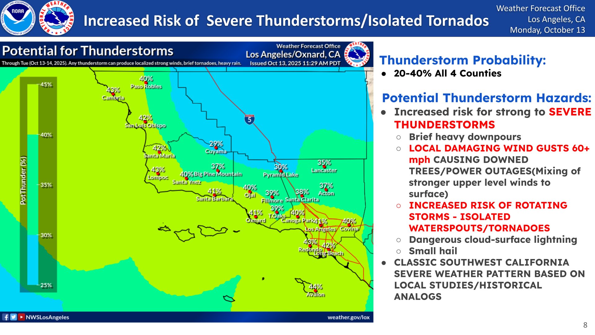
Wind and hail are forecast for the Point Conception region today. Advosories for areas of Los Angeles County went out from the National Weather Service for potential tornado action and hail.
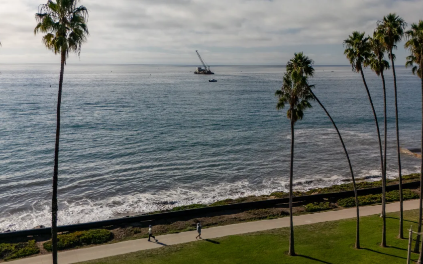
Around Santa Barbara County, most notable is the chill the storm swept in as early morning temperatures fell to the 40s in some places, rising into the 60s today. Overnight rain totals were largest at high elevations and to the east, according to the county’s hydrology information. Locally, the highest rainfall amount of 2.84 inches was reported at the Doulton Tunnel up in the heights of Toro Canyon. Overall, the coast received about an inch.
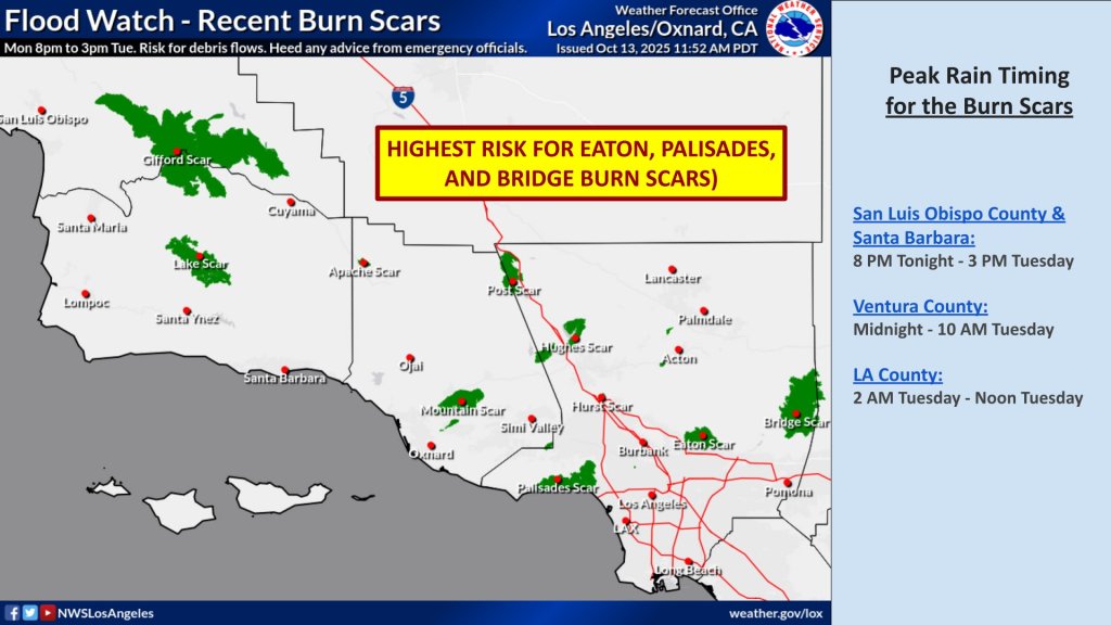
[Original Story] Sending a heads-up that a major storm was coming, the Santa Barbara County Sheriff’s Office issued evacuation warnings for areas below the Gifford and Lake fire burn scars. Click here to view the emergency zones map. Short bursts of heavy rain are predicted by the National Weather Service for all parts of the county, but particularly for south-facing slopes and foothill areas from Monday night through Tuesday.
Thunderstorms, high winds, and even tornadoes are possible, given the atmospheric lows, wind divergence, and high shears aloft overnight. Debris flows, rockslides, a potential for flooded roads and highways, and heavy traffic during the Tuesday morning commute are all part of the forecast that predicts from 0.75 to 4 inches of rain in parts of Santa Barbara, Ventura, and Los Angeles counties.
As well as being prepared to evacuate if below a burn scar, residents are advised to be ready for power outages, falling trees, and localized flooding. The storm is expected to reduce to showers by Wednesday, followed by dry, strong gusts of wind out of the northwest and northeast.
The county’s ReadySBC.org advises residents near burn scars to go ahead and leave their homes if they feel unsafe, or to be prepared to ride out a flooding or debris flow event for several days. In the City of Santa Barbara, free storm parking is available at City Lot 2 (Canon Perdido and Chapala streets). Visit ReadySBC.org for more storm readiness information.


You must be logged in to post a comment.