
Early results of an ongoing public survey to measure the effectiveness of warning messages issued ahead of and during the deadly 1/9 Debris Flow reveal significant failures by Santa Barbara County officials to properly alert Montecito residents to the dangers they faced. The study is being conducted by the University of Alabama’s Center for Advanced Public Safety in partnership with the National Weather Service. Several hundred Montecito residents thus far have completed the survey, which will be followed by individual interviews and focus groups. A final report will be published sometime this fall.
Respondents described being confused by a number of county communications, including the advisory issued to residents living in the “voluntary evacuation zone” south of Highway 192, said research scientist Dr. Laura Myers, with the university. Of the debris flow’s 23 victims, 19 lived in this voluntary zone. While the county had conveyed in general terms the potential hazards of the approaching rainstorm and the threat of debris flows, Myers explained, it also told residents in the voluntary area to “stay alert to changing conditions and be prepared to leave immediately.”
“The problem was the wording,” she said. “People sat there and assessed their risk and made the determination they were safe.” Many survivors said they packed their cars and kept watch of the weather only to have mud and boulders crash through their properties with little or no warning. Despite the urging to do so by disaster communication specialists from outside the area, county officials also never informed residents that they shouldn’t rely on rainfall intensity over their homes to gauge the ferocity of the storm in the mountains, where debris flows originate.

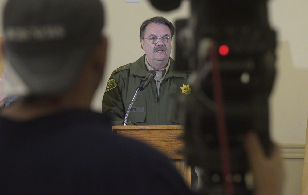
In the months after the disaster, the deadliest natural event in Santa Barbara’s recorded history, county officials suggested that residents misunderstood the evacuation messages. Sheriff Bill Brown said people incorrectly focused on the word “voluntary” rather than “evacuation” and they “misinterpreted” their level of safety. County Supervisor Das Williams accused news organizations of exaggerating reports that many residents were puzzled and frustrated by the evacuation notices. Just hours after the debris flow struck, Gina DePinto, the county’s top communications manager, posted a Facebook message addressing those who didn’t evacuate the mandatory area. “We called it and people ignored our mandatory evacuation order and search and rescue at their door when it was daylight and safe,” DePinto wrote. “Now all hell is breaking loose in the dark and pouring rain and they want help evacuating.”

Survey results also showed that the geological term “debris flow” — a potentially catastrophic event distinct from a flash flood or mudslide — was not well explained by officials, said Myers. Some people did grasp the magnitude of a rain-born avalanche, added Myers — they were Montecito trail hikers who connected the dots of giant boulders perched on mountain slopes to drainages and neighborhoods below. “Otherwise, people just couldn’t imagine it,” she said. “You’ve got to use particular words and images to get the point across.”
The 3:50 a.m. cell-phone alert issued in the midst of the disaster and instructing residents to “GO TO HIGH GROUND” was also unclear, Myers continued. Recipients said they were unsure if it meant they should run up a hill or scramble to their attic. “If you tell people to go to high ground, you better tell them exactly what that means,” Myers said. “Tell them exactly where to go.” According to eyewitnesses, some victims were swept to their deaths when they received the alert and then attempted to exit their homes.
The different maps the county published on its website before the debris flow — one that highlighted areas of extreme danger in Montecito along north-south creek beds, another that defined the voluntary/mandatory evacuation zone boundary across the east-west line of Highway 192 — were similarly confusing, the survey revealed. The written description of evacuation boundaries also contradicted the maps’ visual cues. The terminology around rainfall rates — the most important predictor for debris flows — was perplexing, too. “When you talk about inches per hour, that’s a scientific thing,” said Myers. “It’s important to translate that for people.”
Some respondents said they understood the risk but chose not to evacuate because they had just returned home after the Thomas Fire and were too tired to leave again. Brown has been faulted for potentially contributing to the community fatigue by waiting so long to repopulate Montecito after the fire danger had passed. Incident commanders had decided to allow most residents to move back by December 19, but just minutes before they made their public announcement at a Ventura County press conference, Brown directed them to stand down. He later lifted the evacuations on December 22. Brown’s critics claimed he wanted to deliver the good news on TV himself.

Eric Boldt, a warning coordination meteorologist with the National Weather Service (NWS), said the purpose of the survey is to help public agencies and media organizations improve their communication strategies for the next disaster. “We’re all in the same business of getting people out of harm’s way and saving lives,” he explained. Myers emphasized people relied on regional news outlets for information.
Boldt explained the NWS is directing people to the “CA Mudslide, 2018 Weather Warning Assessment” through its Los Angeles/Oxnard website, weather.gov/lox. It can also be found at independent.com/nwsdebrisflow. “We definitely want to get the word out there because the more people who take the survey, the more accurate our assessment will be,” he said. The County of Santa Barbara has not yet publicized its availability. Officials have also been reluctant to include news organizations in their discussions on improving public communication.
At a May 30 meeting to review the preliminary results, Rob Lewin, director of the county’s Office of Emergency Management (OEM), acknowledged he and his team had to educate themselves on the perils of debris flows. As he contemplated the evacuation orders and the risk of eroding public trust if no storm materialized, he recalled thinking to himself: “Am I Chicken Little, or am I Paul Revere?” Lewin said he still doesn’t know how to convince people to take action in the face of danger. “I’m at a loss.”
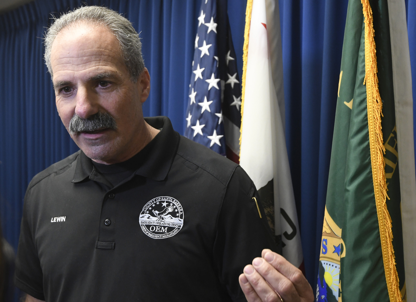
Like Brown, Lewin has responded to the notion that the county’s messaging was unclear. In an article titled “Emergency Management Leadership in Action” and published in the California Emergency Services Association Newsletter, Lewin described a “Black Swan” weather event that couldn’t be predicted or prepared for. He referenced a planning meeting held on December 21 with “fellow emergency response leaders” and quoted a warning statement he made during a January 7 press conference.
According to multiple sources with direct knowledge of the December 21 meeting, Yoli McGlinchey, the City of Santa Barbara’s emergency services manager, suggested that officials ought to consider drawing evacuation boundaries based on Montecito watersheds. She referenced the city’s own debris-flow response guidelines — developed in 2009 after the Tea and Jesusita fires — which designate evacuation zones by watershed. The sources, who asked to remain anonymous for fear of professional reprisal, claimed Lewin dismissed McGlinchey’s suggestion outright.
McGlinchey declined to comment on what was said at that December 21 meeting. “My role in the [city’s] Emergency Operations Center is to make sure that we support whatever is decided [by the OEM],” she said. Lewin disputed the accounts. “This was a planning meeting where all ideas were being expressed by the entire multi-agency group,” he said. “I was not in a position to dismiss anyone’s position, nor would I.”
Lewin and the OEM are now participating in the creation of an After Action Report required by the state’s Office of Emergency Services. A national consulting firm, Hagerty Consulting, is facilitating the process. The report is meant to capture everything that went well and everything that went wrong during the debris flow. It will likely be completed in the next four to six months.


