
Once in a Lifetime Adventure
Cachuma Lake Dry Water Hike

Sometimes there’s a walk you’ve got to do now; otherwise it might not be there when you’ve finally found the time for it. One of those is a walk along the edge of Lake Cachuma following the old state road for a mile or two along a section that in normal times would be well underwater.

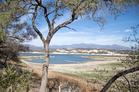
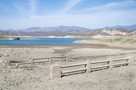
On a holiday weekend like this past extended President’s Day, you’d expect to find Cachuma full of campers and buzzing with activity. However, this year’s drought has not only emptied a good part of the reservoir but keep the crowds away as well. A quick check of the marina area is profoundly sobering: the twin plants that lead off the concrete apron hang against the side of the steep, rocky bank, at least 30-40 feet above normal water level. In the distance you can spot huge swaths of open space, usually underwater but now sprouting with greenery.
While the impact to tourism at Cachuma has to be a nightmare for the County Park officials who manage it, for those of us who love hike or bike it has presented us a perfect opportunity to explore a part of the lake most of us have never seen before and to walk along the edge of the lake in places that usually drop steeply straight down into the water.
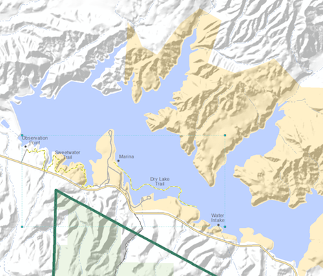
One of my favorite hikes in the valley (partly because there are so few of them) is the Sweetwater Trail, a 2.5 mile out and back hike that takes you from Cachuma along the edge of the reservoir to the Observation Point and back. It meanders through a bit of chaparral on both ends of the walk but mostly it meanders in and out and around several small inlets through grass and oak-covered knolls. Usually you need to stick to the trail or one of several side shoots that take you to a viewpoint but with the water as low as it is there are plenty of places where you can meander along the edge of the water on the sandy shelves now exposed by the drought.
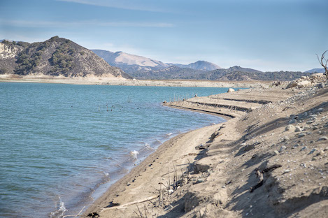
But more-than-likely if you head out to Cachuma you’ll want to check out what I’ve labeled as the Dry Lake Hike. The easiest place to begin is at the boat ramp and with so few boats out on the lake there is plenty of parking. When you’re ready to head out, follow the paved road the boaters now take to get to the lower ramp and then where they turn and drop down to the marina area continue straight. You are now more or less on old State Highway 154. The dirt road drops down and around several inlets then crosses what was an old bridge across Tequepis Creek.
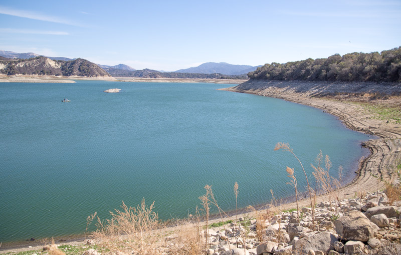
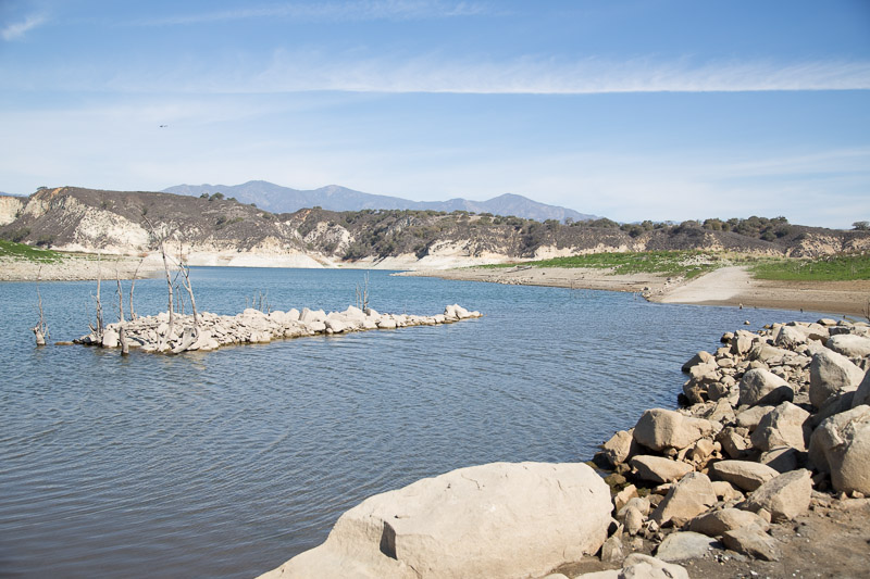
East of the crossing the road climbs a bit then heads directly east. Though normally well covered by water, amazingly, there’s now several hundred more yards of dry land between the road and the current edge of the water. There are several rough paths leading away from the road and over to the water’s edge that make it easy to get there whenever you feel like it. It’s also easy to walk along the bank too so no need to stay on the road if you’d like to walk along next to the water.
Eventually, though the one of the deeper inlets will force you to cut back over to the old road. You can continue on that for several hundred more yards until it finally dives down into the water and disappears for good. For most of you that may end up being the turn around point but for those who have good scrambling skills you can continue along the edge of the water for another 300-400 yards until the bank finally gets too steep to go any further. Just beyond you can spot the water intake that moves water from Cachuma through the Tecolote Tunnel to the Goleta area. While it is still gravity flow for the water to get there now, the reservoir level is low enough the water will need to be pumped up to the tunnel level to get it to us on the other side of the Santa Ynez Mountains.
If you still have energy for more hiking, consider a short jaunt out along the Sweetwater Trail. The scenery is spectacular and if not this time, find time for a hike along it another time. To avoid park fees, begin the hike from the Observation Point a half mile west of the Cachuma entrance. Either way it is a great hike.
Cost to visit Cachuma Lake Recreation Area is $10 per day for vehicles or $5 for hikers or bicyclists.


