Camuesa Connector
Best short single track ride in the area.
Distance-3 miles to the Connector; 12 miles
Elevation Gain-Total gain to Camuesa Connector trail is 1015′; there are several saddles on the trail requiring climbs and drops of from 100′ to 300′
Trail Conditions-Trail is in generally good condition with some overgrown brush and deep ruts after the first saddle. Ride with care.
Difficulty-Moderate. Three miles of uphill on dirt road; four miles of mostly Level 2 single track with some Level 3 sections, The ride back to the car is on pavement
Topo-San Marcos Pass and Little Pine Mountain (Camuesa Connector Trail not on the map)
HIGHLIGHTS
This is an excellent morning or afternoon ride which takes no more than 3 hours to complete, though more may be added either by picnicking along the way or stopping at Live Oak picnic area near the trail’s end, where you’ll find a great swimming hole waiting for you. The single track on Camuesa Connector is the best 3-mile section found anywhere in the valley.
DIRECTIONS
From Upper Oso ride up Buckhorn Road (same route as for Little Pine) for 3.2 miles to the Camuesa Connector trailhead. It is marked by a sign which is easily spotted, at the edge of a large meadow. Turn right and at first ride down a dirt road through the meadow. At the point where the road drops down to a low point and then seems to head up an extremely steep hill, look to the left for the trail. It winds up a small drainage towards a small saddle which can be seen in the distance.
A CAUTION
The Buckhorn Road is open to ORV use. You should be alert for their presence. Please be extremely cautious and on the lookout for horse riders. The area is used extensively by equestrian groups. Assume a rider is just around each corner. If necessary, dismount from your bike and ask the horse rider what he/she would like you to do.
THE RIDE
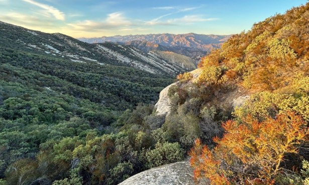
For single tracking, there is none better to be found than on the Camuesa Connector, which is cut along a fault line that creates a series of saddles leading southeast and eventually down to the Santa Ynez River near Live Oak picnic area.
The first half mile of the trail is the toughest, a twisty, winding path leading up to the first of a number of saddles and short trials sections providing a test of your riding ability. Undoubtedly you’ll find yourself pushing a few of them. At the top of the saddle the trail drops down into a brushy canyon and then up to a second saddle. The ruts are deep on the downhill and may be difficult to ride but they do not last too long. An easy 100′ uphill brings you to the next saddle.
Beyond this the countryside has been blackened by wildfire, and it has a different kind of beauty-that of nature’s fire cycle-the chaparral undergoing the process of renewal. It is now ten years since the last fire in this area and it may not be as easy to spot the effects.
Several gentle switchbacks take you down into a larger, more open canyon and the trail follows this downhill. The drop is down a narrow deep “vee” canyon and the riding is a bit more technical but really exciting as you cut back and forth across the creek several times. Then, a short climb and a switchback or two bring you up and over a third saddle. From here the route is almost continuous downhill, first across a large plateau, then through a small “window” between two knolls to a large flat bluff overlooking the river. Either the top of the knolls or the bluff provides a perfect lunch or picnic spot.
Just before you drop down onto the bluff notice the sharp outcroppings of white rock just to the left of the trail. This is limestone, a remnant from when this area was beneath the ocean. Right below this formation you will have a good view looking almost directly down onto Live Oak picnic area and its very enticing water hole.
The trail veers right, continues west across the bluff and then down through a series of switchbacks to the river. You can either head directly across the river to Paradise Road or continue downstream along the right side of the river for a half mile and then cross.
The swimming hole at Live Oak picnic area is .5 mile left of the upper river crossing. To complete the loop ride down Paradise Road 3 miles to Lower Oso, then 1.3 miles to your car at Upper Oso.


