County Flood Officials Begin Post-Fire Preparations
The Good News is That There is Plenty of Time to Get Ready

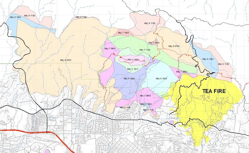
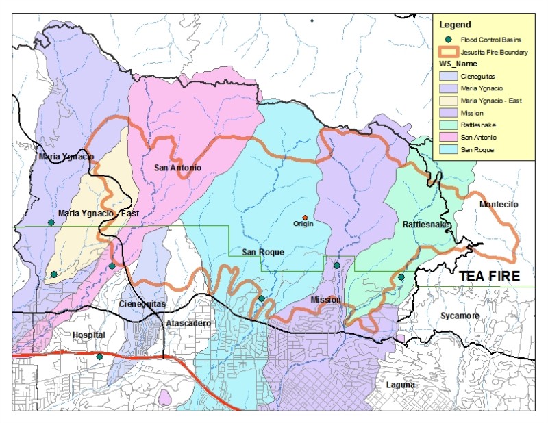
Wednesday morning I sat down with Tom Fayram, deputy director of Santa Barbara County’s Public Works Department to get an assessment of the impacts of the Jesusita Fire on the watersheds immediately above Santa Barbara. When I arrived Fayram was already studying a huge map of the burn area with each of the canyons highlighted in color. On top of the watershed boundaries was a thick red outline of the fire’s boundary.

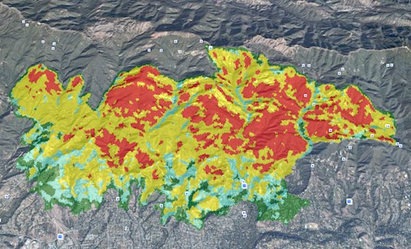
The problem became apparent immediately. “The San Roque, Mission and Rattlesnake areas got hit hard,” Fayram says. “We’re just now getting the burn intensity information and it doesn’t look good. All three canyon areas have sustained a large percentage of vegetation loss in the upper areas.”

Fayram adds, “There are a lot of parallels to the Gap Fire in the Goleta area.” He ticks a series of points off on his fingers “The acreage burned and the amount of vegetation burned is almost the same. There are multiple canyons involved too and the topography is extremely steep. We may use many of the same techniques for mitigating the damage here as we did on the Gap Fire.”
These techniques include opening up flood control basins, brush clearance along the riparian areas and the use of debris racks. Fayram also mentions the use of hydro mulch as well in some areas, though he acknowledges there were problems with the quality of the material used on the Gap Fire.

But I point out there is one big difference in that the urban interface is much closer to the burn area and there isn’t much of a buffer between the potential mudslide and flood areas and the homes. “In that respect, the Jesusita Fire was much more like the Tea Fire,” Fayram responds. “In Goleta we had a mile or more of buffer with the orchards but in the upper parts of these canyons there are houses immediately below the burn area. That’s a challenge.”
The good news, Fayram points out is that it is only mid-May and we’ve got six months to prepare before winter rains are upon us.
Look for community meetings sponsored by the local agencies in the next few months to answer homeowner questions and help the community prepare.


