The Ventura-Pitas Point fault courses through downtown Ventura before cutting outward to the coast and along the Santa Barbara Channel. There, it tilts at a steep angle, pushing under the coastline and extending 20 kilometers into the earth’s crust. “It’s about as deep as earthquakes get,” says James Dolan, an earth sciences professor at University of Southern California.
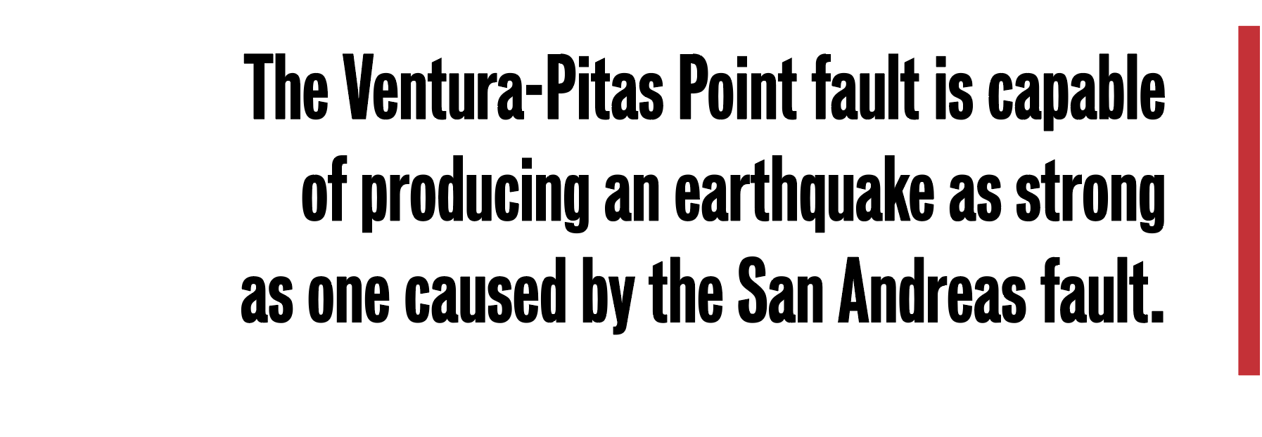
Until just a few years ago, the fault was thought to be relatively shallow, capable only of a moderate earthquake. But a group of scientists intrigued by the area’s complex seismology began to develop a different picture. Their research suggested that the Ventura-Pitas Point fault is capable of producing an earthquake as strong as one caused by the San Andreas fault, potentially setting off temblors from Santa Barbara to Los Angeles.
“For a long time, everyone assumed that the San Andreas fault was the big gorilla,” explained David Oglesby, a seismologist specializing in the physics of earthquakes. But today, he said, scientists believe possible earthquake dangers occur when smaller faults slip together. The Ventura-Pitas Point fault’s depth and length, for example, make it likely that it connects to other faults in the area, such as the Red Mountain and San Cayetano systems.
At the Southern California Earthquake Center (SCEC), researchers are working to reduce the impacts of earthquakes by developing computer models simulating seismic activity. One such project is the Ventura Special Fault Study Area created in 2012. An emerging understanding of the Ventura-Pitas Point fault shows that it’s capable of producing an earthquake in the range of magnitude 7.7-8.1. Those few decimal points indicate a wide range of potential energy release—an 8.1 earthquake is nearly four times as strong as a 7.7. But in any case, the shaking would be severe enough to cut off power and water supplies for Santa Barbara. This year the Santa Barbara area experienced a spate of small earthquakes in April and May—the largest, of 4.1 magnitude, was off the coast of Isla Vista. According to Oglesby: “Every time there’s an earthquake, it slightly raises the likelihood of another nearby … though it’s not a good indicator” of a major event.
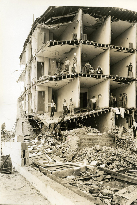
Santa Barbara is no stranger to seismic activity. In 1812, a 7.2-magnitude earthquake destroyed the original Mission Santa Barbara, and, according to witness accounts, produced a tsunami that caused the Chumash community living on Santa Rosa Island to relocate. A 1925 earthquake of magnitude 6.8 killed 13 people and severely damaged the downtown area. Small tsunamis resulting from the 2010 earthquake in Chile and the 2011 quake in Japan were recorded along the California coastline, according to a SCEC report published in April.
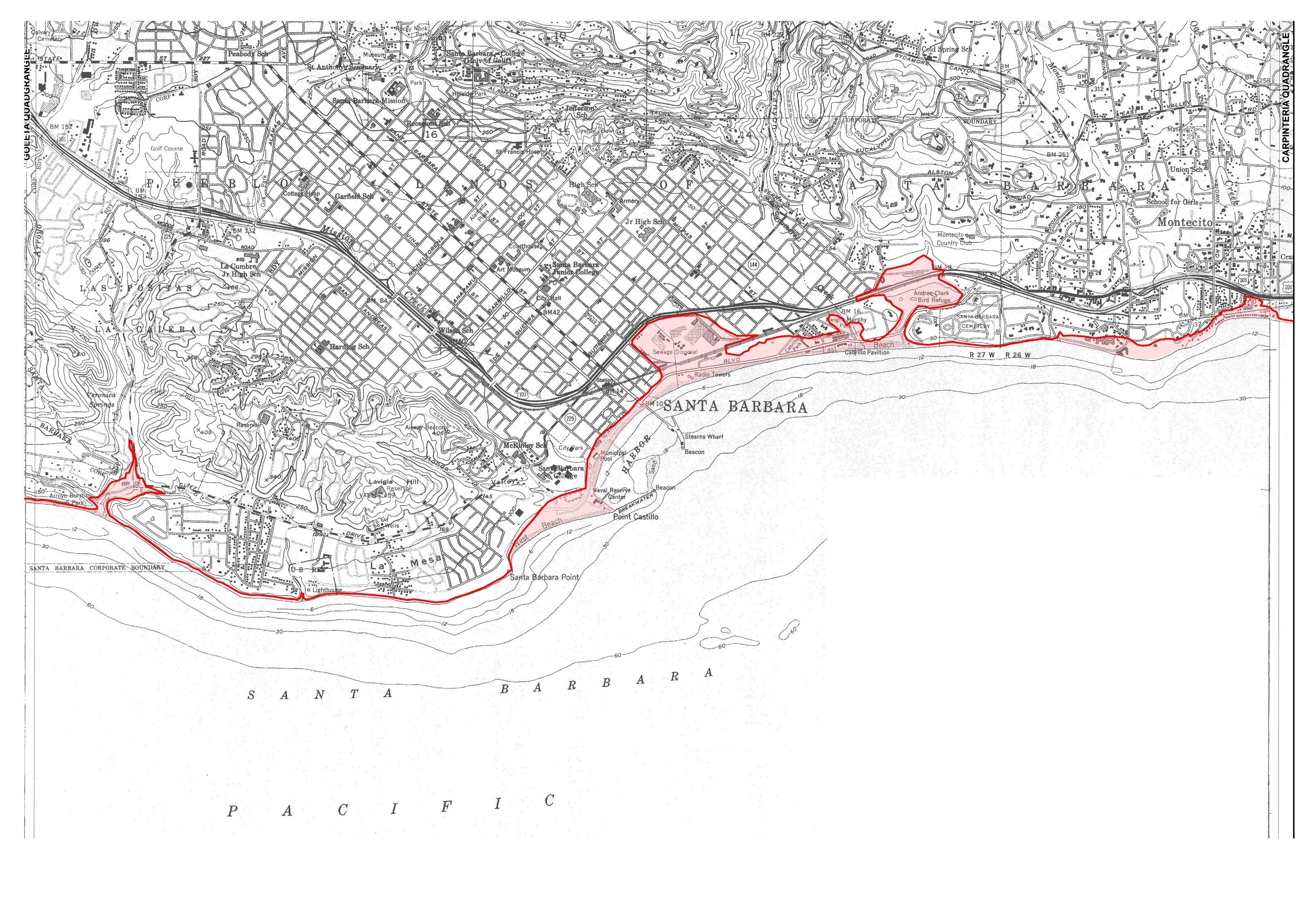
When faults are slipping underwater, they push the seafloor up and down, forcing water outward to recapture its equilibrium. “That flow [outward] is the tsunami,” Oglesby explained. A tsunami from the Ventura-Pitas Point fault would probably only affect the local area, according to a 2015 model developed by Kenny Ryan, then a grad student of Oglesby and now a research fellow at the U.S. Geological Survey. One part of the tsunami would reach the Santa Barbara coastline within five or six minutes, Ryan said, producing waves possibly as tall as seven meters; another would be refracted by the seafloor and move toward Ventura and Oxnard within half an hour. According to Hong Kie Thio, a principal seismologist at the engineering company AECOM, offshore islands, such as the Channel Islands, could limit a locally generated tsunami from leaking into the larger Pacific Ocean (such a leak would reduce its strength and potential impact) and amplify the waves coming onshore.
A clue to the fault’s nature first emerged in the 1980s, when a prominent geologist, Thomas Rockwell, identified four marine terraces at Punta Gorda and Pitas Point during a sudden “uplift event”—an earthquake that pushes the earth’s surface upward abruptly. Rockwell’s most recent findings suggest that a large-scale earthquake along the Ventura-Pitas Point fault occurs every 1,100-2,300 years. The most recent event took place about 950 years ago. (By comparison, the San Andreas fault ruptures around every 150 years.) “‘The likelihood of it recurring during one of our lifetimes is very small,” Dolan said, referring to the Ventura-Pitas Point fault. And the research primarily focuses on what a seismic event can do, not what it’s most likely to do, since a main goal is to help communities prepare for the most extreme situations.
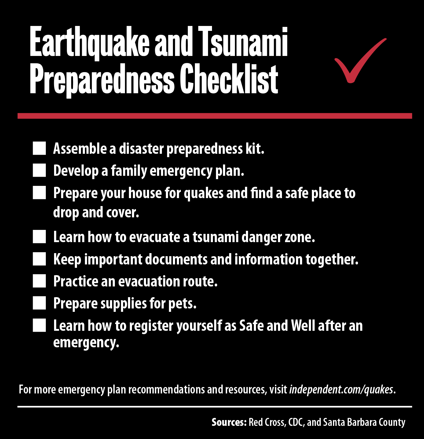
Santa Barbara’s tsunami flooding maps were developed in 2009, and the National Oceanic and Atmospheric Administration (NOAA) declared the city officially “tsunami-ready” in 2012. The city’s detailed Tsunami Response Plan is up for revision in 2018. (Maps are available here; a recent tsunami evacuation plan is here.) Local officials have also signed up to access IPAWS, a new national warning system that transmits information from a number of public alert systems (including the Emergency Alert System and NOAA Weather Radio) to Santa Barbara residents through electronic devices like cell phones, televisions, and computers, as well as public signs. For anyone wanting to take a proactive approach, Jason Ballmann, a communication specialist at SCEC, suggests participating in a California ShakeOut drill or getting involved with TsunamiZone, both organizations that educate the public about disaster preparation.
While scientists focusing on the area talk excitedly about Holocene uplifts and sediment deposits, atomic bonds and bathymetry, under the enthusiasm is a sense of concern for the communities their research is designed to protect.
“People go about their daily lives; they don’t really think much about earthquakes and tsunamis,” said Rick Wilson with the California Geological Survey. “We don’t want to scare people … but we really do need to be prepared.” And that preparation is, practically speaking, the most valuable thing that studying the Ventura-Pitas Point fault can produce. “There’s nothing we can do to prevent or speed up or slow down these [events]. It’s incumbent on us to improve our infrastructure,” said Dolan. “I want to understand any threat we’re faced with. There’s a reason I became a professor: we need to be doing something that has direct social relevance.”