[Update: Tuesday, 8:30 a.m.]: Weather Underground is predicting a high chance of rain — just over an inch — for most of Thursday. Temperatures are forecasted to be in the mid 50s with winds about 10 mph.
A pre-evacuation advisory issued by county officials is in effect. “The public must remain vigilant as flash floods, mud and debris flows can happen with little or no warning,” a statement released Monday evening stated.
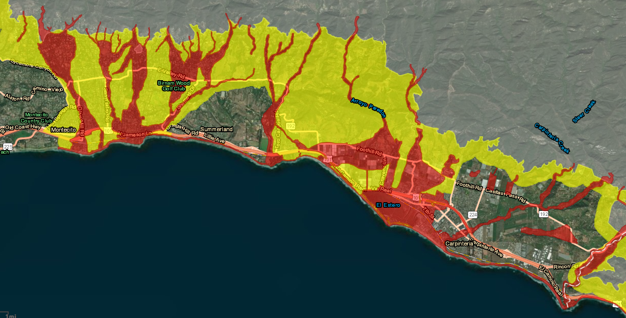
They disseminated this Debris Flow Risk Map.
[Original Post]: As the sun went down Monday afternoon, a chilly wind swept through the Santa Barbara area. A storm was coming. But county officials were less concerned about debris flow on Monday evening than they were that morning.
County emergency forecasters reduced the threat Monday afternoon for minor debris flows to 5 percent due to possible thunderstorms between 4 a.m. and 10 a.m. Tuesday.
According to the National Weather Service, rain is likely to come before 11 p.m. Forecasters are predicting a quarter inch “depending on where the cells line up,” said National Weather Service spokesperson Eric Boldt. The low overnight is predicted to be 47 degrees with variable winds 15-20 mph.
Previously, on Monday morning, county officials announced rains could produce minor debris flows and flooding below the burn areas caused by the Thomas, Sherpa, and Whittier fires.
“Because of the configuration of this storm, there is some uncertainty as its track and therefore the forecast. Closely monitor the situation and prepare for the possibility of evacuation,” the alert stated. “If at any time during this storm you feel threatened you should take action.”
Forecasters predicted slight chance of rain Tuesday morning and mostly sunny in the afternoon.