
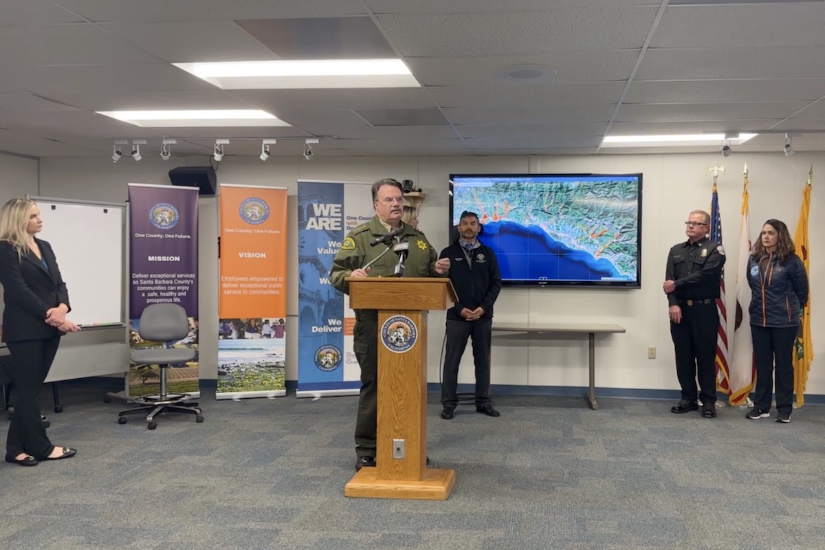
[Update 3 p.m.] Mandatory evacuation orders have been issued for three burn scar areas in southern Santa Barbara County due to the possibility of potential flooding and debris flows, Santa Barbara County Sheriff Bill Brown announced during a Wednesday press conference.
The impacted areas are the Thomas, Alisal, and Cave Fire burn scars. To see if you are in the evacuation zone, enter your address on the county’s evacuation map.
Sheriff Brown asked people to call 211 or the Office of Emergency Management at (833) 688-5551 with any questions about the notifications instead of 9-1-1.
For the latest information, visit ReadySBC.org.
[Update 2:48 p.m.] A livestream of Wednesday’s press conference can be found on the Santa Barbara County Facebook page. This is also live on cable Channel 20 and will momentarily be live on CSBTV’s YouTube in higher quality.
[Original story] Santa Barbara County officials will be announcing evacuation areas this afternoon ahead of a significant storm arriving tonight and carrying the potential for flash flooding and debris flows.
The incoming storm is expected to bring heavy rain, strong winds, and high surf across the county late Wednesday, January 4, through Thursday, January 5. The National Weather Service yesterday issued a Flash Flood Advisory and warned that flooding caused by excessive rainfall is possible within the entire watch area, which includes the burn scars of the Alisal Fire, Cave Fire, and Thomas Fire.
In an email to the press this Wednesday, County Public Information Officer Kelsey Gerckens Buttitta said the county will be holding a press conference today to “convey current situational information” and announce evacuation areas.
“It is imperative to understand the seriousness of the situation and prepare to take actions to protect oneself, family, pets, and any tenants, visitors, and workers,” Gerckens Buttitta said.
County Sheriff Bill Brown, County Fire Chief Mark Hartwig, Montecito Fire Chief Kevin Taylor, and California Highway Patrol Captain Mike Logie are slated to speak at the press conference.
In a statement issued Tuesday, Gerckens Buttitta noted, “Recent storms have produced on south-facing Santa Barbara County slopes 8-13 inches of rain in the last 30 days. Ground saturation is a concern as the forecast incoming storm may produce 4-8-plus inches of rain on south-facing slopes. This includes the area of the Alisal Fire burn scar (located in the Gaviota area west of Goleta), the Cave Fire burn scar (located in the Santa Ynez Mountains above Santa Barbara), and the Thomas Fire burn area.”
She noted, “Thus far, the local watershed and flood control systems have been able to handle the runoff properly and are prepared to manage the incoming rain,” but cautioned that “it remains imperative for community members to monitor the weather closely and be prepared for changing conditions that may require evacuation.”
“If you live in the Alisal, Cave, or Thomas burn area and are concerned that this storm may cause unsafe conditions to your home,” Gerckens Buttitta advised, “do not wait for an official evacuation notification to leave.”
The Independent is covering Wednesday’s press conference and will publish the evacuation areas as soon as they are available. Visit readysbc.org to sign up for emergency alerts.
Support the Santa Barbara Independent through a long-term or a single contribution.


