
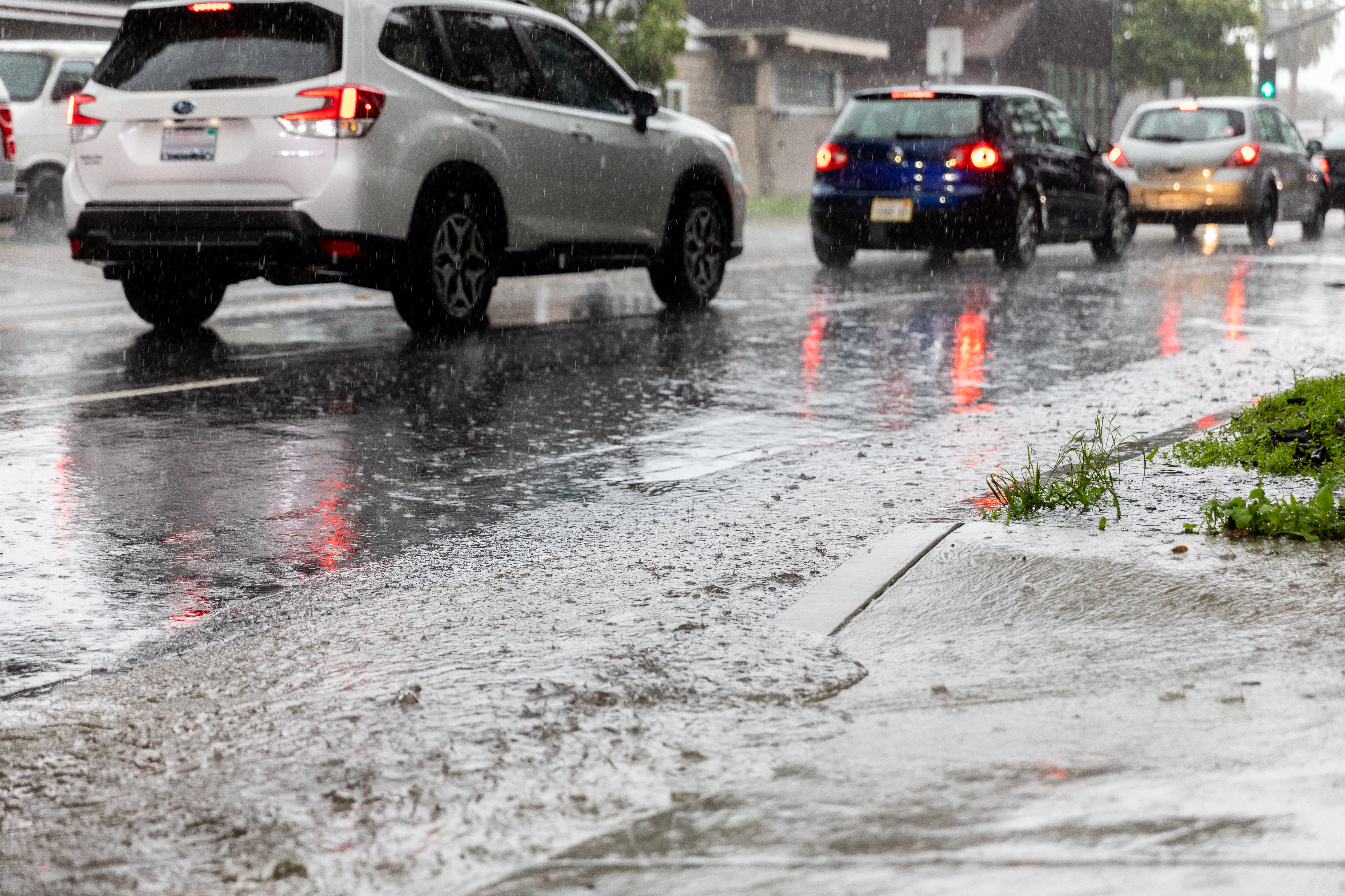
Heavy rain is expected countywide this week and has Santa Barbara preparing for yet another storm system, with consistent downpours starting Tuesday and continuing through Wednesday morning. Evacuation orders have been issued for the Thomas, Alisal, and Cave Fire burn scar areas ahead of the storm and go into effect 8 a.m. on Tuesday and remain evacuation warnings until then. Click here for a map of the evacuation areas.
Because of the forecasted storm conditions and potential flooding, all Santa Barbara Unified, Carpinteria Unified, and Montecito Union schools will be closed on Tuesday, as well as the Santa Barbara City College campuses. In addition, the Santa Barbara City Council meeting scheduled for Tuesday will be moved to a virtual format.
A flood watch has been issued for Santa Barbara County all day Tuesday due to excessive rainfall predictions, the National Weather Service announced on Monday. The county could see 2-3 inches of rain on Tuesday alone, with up to an inch of rain an hour falling between noon and 6 p.m. Expected rain totals have increased to 2 to 5 inches for the coast and 4 to 8 inches for the South Coast mountains and foothills from Monday evening through Wednesday night.
“Heavy rain and excessive runoff may result in dangerous flooding of rivers, creeks, streams, and other low-lying and flood-prone locations,” the Weather Service said in its advisory. “Rivers and creeks that may be affected include, but are not limited to, the Sisquoc River, the Santa Ynez River, and San Antonio Creek. Extensive street flooding is likely. There may be mudslides and rockslides, especially in and near steep terrain.”
According to Eric Boldt, Warning Coordination Meteorologist with the National Weather Service out of Oxnard, rainfall in higher elevations above Santa Barbara could approach up to 10 inches with this storm. However, it is not predicted to reach the same historic levels as the storm on January 9 earlier this year, which delivered more than 12 inches of rain to San Marcos Pass in a 24-hour period.
“Not every storm is the same, but this one does have a lot of similarities to January 9,” Boldt said, “part of it being that there will be some winds that help force the air up the mountain slope, and that gives us more enhanced rainfall amounts.”
This week’s storm will bring more rainfall than the atmospheric river that blew through the county last week, which dropped 2-4 inches of rain across the region and caused several road closures due to flooding and mudflows. Friday’s rains particularly drenched the county, with much of the region seeing between half an inch to more than one inch of rainfall in 24 hours, resulting in some North County highways being closed due to flooding.
“As far as saturation goes, we just had a storm on Friday and we’re above normal on precipitation, so it’s not going to take a whole lot of rain to start causing problems,” Boldt said about the upcoming storm. “Also, our National Center issued an excessive rain outlook to a high risk over Santa Barbara County. And that’s fairly rare; it doesn’t happen very often.”
Boldt said part of the reason forecasters issued the rare “high risk” warning for excessive rain is because of the combination of storms the county has seen recently. After last week’s storm and with the ground already saturated, the amount of rainfall it will take for flash flooding to occur will be significantly less than if the storm followed a typical dry scenario.
In anticipation of the predicted heavy rain from the upcoming storm, the Santa Barbara County Fire Department and the Operational Area departments will be prepositioning resources with increased staffing funded by California Office of Emergency Services to respond to incidents caused by rain, wind, and flooding, County Fire spokesperson Scott Safechuck said on Monday.
Officials are recommending that residents monitor rain forecasts and potential flood and evacuation warnings, and be prepared to shelter-in-place or leave their homes if conditions become unsafe, as well as avoid traveling on Tuesday during heavy rain and hazardous conditions. Public safety officials will continue to monitor the storm and assess if additional emergency protective actions are necessary.
Residents are encouraged to register for emergency alerts at ReadySBC.org.


