
[Update: Fri., July 4, 12:30pm] The Madre Fire has expanded to 70,800 acres as of noon on Friday, with containment now at 10 percent, according to CalFire. Evacuation orders and warnings expanded Thursday night, adding more areas of San Luis Obispo County and parts of Kern County. Visit the links to the evacuation maps below for the latest information:
San Luis Obispo County Evacuation Map
Kern County: Genasys Evacuation Map
Santa Barbara County Evacuation Information & Map
[Update: Thu., July 3, 5:36pm] The Madre Fire has expanded to 52,593 acres as of 5:17 p.m. on Thursday, still with only 5 percent containment, according to CalFire. Now the largest fire of 2025 in the state, there are 303 total personnel including 39 engines, four helicopters, four water tenders, and two handcrews on the scene as of 1:23 p.m.
State Route 166 is closed from the south junction of Highway 101 in Santa Maria to Perkins Road in New Cuyama.
The fire is affecting largely unpopulated areas in the hills west of Carrizo Plain National Monument, with only 50 structures threatened. Evacuation orders are in place for one zone in Los Padres National Forest and 10 zones in San Luis Obispo County. Evacuation warnings have been issued for six additional zones in San Luis Obispo County.
The Bureau of Land Management announced Thursday afternoon that “all BLM lands in Carrizo Plain National Monument are closed to public access effective immediately.”
At around 4:30 p.m. on Thursday, Santa Barbara County’s Air Pollution Control District (APCD) upgraded its air quality watch to an an air quality alert for the Cuyama area, leaving the watch in place for the rest of the county, due to the large amounts of smoke blowing into the area from the fire. Ash from the Madre Fire is also present, the APCD warned, so county residents and landscapers are encouraged to not use leaf blowers if ash is present.
Check the EPA Fire & Smoke map at fire.airnow.gov, and readings are available on APCD’s website at http://www.ourair.org/todays-air-quality.

[Update: Thu., July 3, 9:20am]: Thursday morning’s reports for the Madre Fire indicate it has grown rapidly to 35,530 acres after sparking around 1 p.m. the day before along State Route 166 on the Santa Barbara-San Luis Obispo county borders. Evacuation zones in the arid, hilly region have increased to eight overnight in S.L.O. County and Los Padres National Forest, according to CalFire’s Inciweb site. Seven zones in S.L.O. County and across the Carrizo Plain are under an evacuation warning. The 166, which runs from Santa Maria to Kern County, is closed to through traffic near New Cuyama.
After pushing the fire uphill and throwing embers, the winds died down overnight, allowing fire crews to gain 5 percent containment as of the morning.

[Original Story]: A fire along State Route 166 between New Cuyama and Highway 101 grew to more than 8,000 acres just a few hours after being reported around 1 p.m. on Wednesday. An evacuation order is in effect on a mid-portion of SR 166 in San Luis Obispo County and is currently closed to traffic. An evacuation warning exists to the area to the north into San Luis Obispo County.
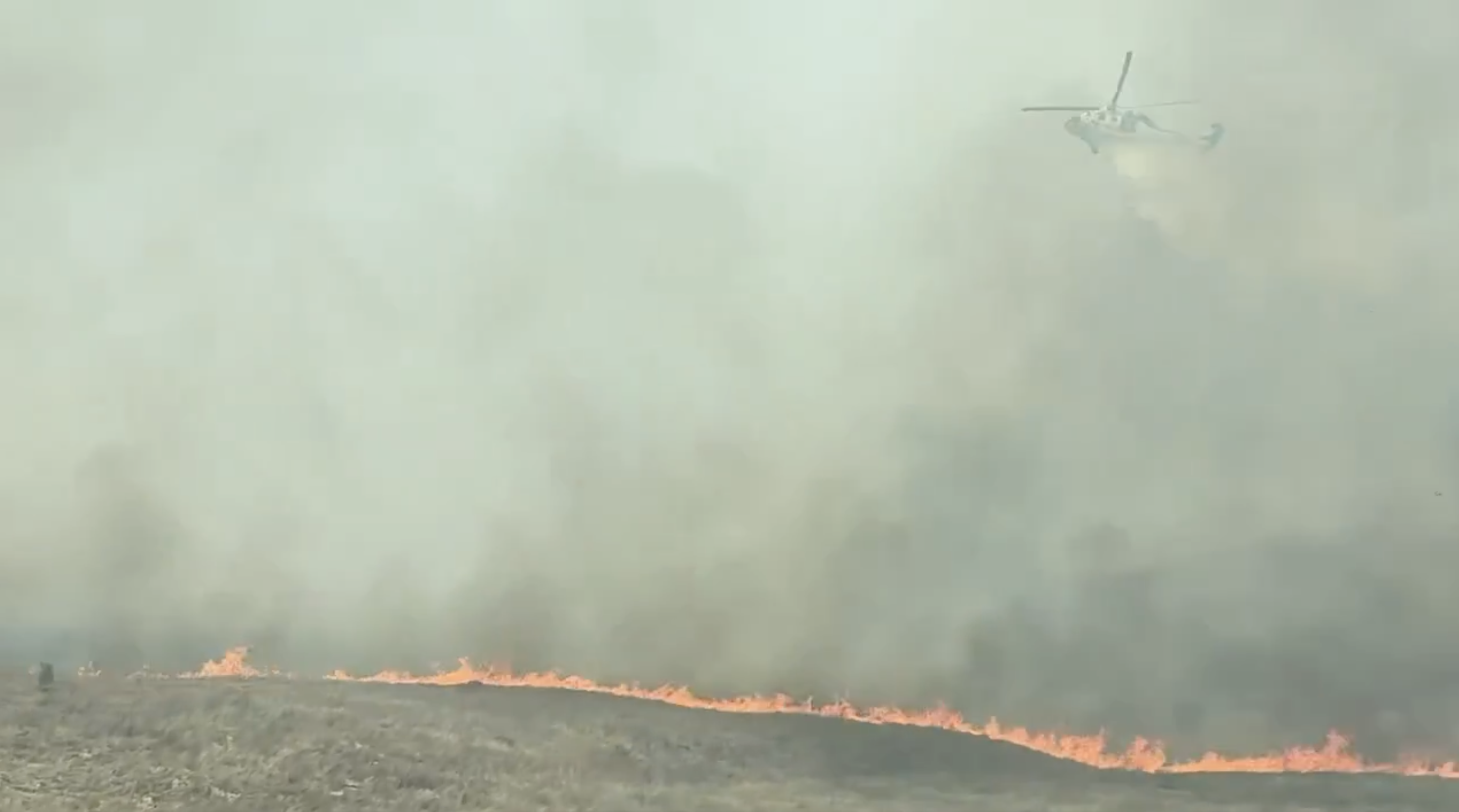
About half the Madre Fire, as it’s been named, is on National Forest lands and the rest on state lands, said Andrew Madsen, a spokesperson for Los Padres National Forest. Wind-driven by steady gusts of about 22mph out of the west and north, the Madre Fire is burning in thick, old brush and quick-burning grasses as it crosses into Bureau of Land Management forest lands and races into the Carrizo Plain.
A lot of resources are on hand, Madsen said, from the U.S. Forest Service, CalFire out of SLO, Vandenberg, and Santa Barbara County as the southland has few fires at the moment. As many as 200 firefighters are expected to be on scene and already six large air tankers, one very large tanker, and two helicopters are dropping retardant and water on the flames. The rate of advance was about 3,000 acres an hour at one point.
With smoke from the growing fire blowing into Santa Barbara County, an air quality watch was issued by the county’s Air Pollution Control District. Significant amounts of smoke were being produced, the advisory stated. Should smoke levels grow, the advice is to remain indoors, drink fluids, and try to filter out the smoke particles.
Editor’s Note: This story was updated to correct a misspelling of the Madre Fire in the headline and captions.


You must be logged in to post a comment.