Press releases are posted on Independent.com as a free community service.
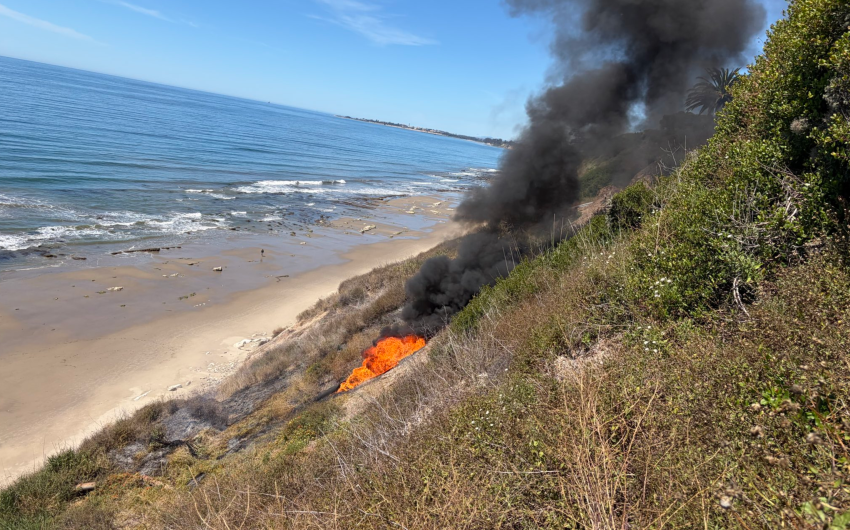
WHAT: Approximately 20 piles of cut vegetation (approximately four combined acres) will be burned as part
of the San Antonio Creek pile burns.
WHEN: March 9-15, depending on conditions.
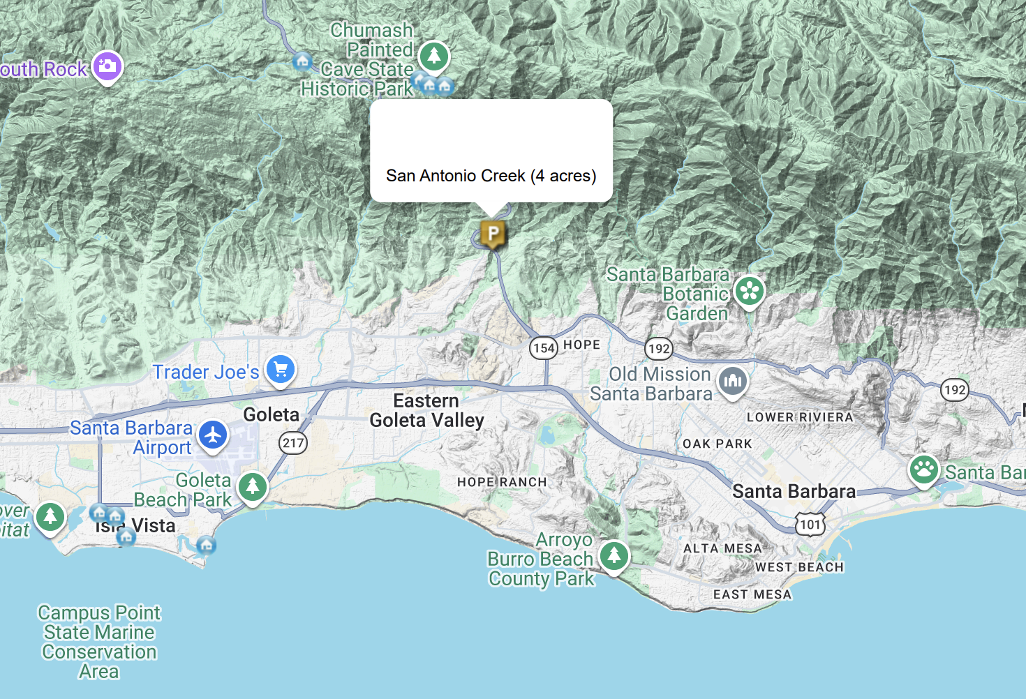
WHERE: San Antonio Creek area, near Highway 154. (see map)
WHY: Prescribed burns can help prevent the spread of wildfires and can reduce impacts to watersheds that
can result in soil loss and sedimentation. The burn will be conducted when the meteorological conditions
are highly favorable to direct smoke away from population centers.
WHO: This prescribed burn is planned and coordinated by the Santa Barbara County Fire Department with
Santa Barbara County APCD, San Luis Obispo County APCD, San Joaquin Valley APCD, Ventura County APCD,
and the California Air Resources Board to minimize impacts on air quality on surrounding communities.
HEALTH PRECAUTIONS: When you can see or smell smoke in your area, avoid strenuous outdoor activity
and remain indoors as much as possible. These precautions are especially important to children, older
adults, and those with heart and lung conditions. If you are sensitive to smoke, consider temporarily
relocating and closing all doors and windows on the day of the burn. Symptoms of smoke exposure can
include coughing, wheezing, shortness of breath or difficulty breathing, chest tightness or pain, nausea, and
unusual fatigue or lightheadedness. Use caution when driving near prescribed burns.
This burn depends on weather and air quality conditions that are favorable for smoke dispersal. If the
conditions are not as desired, the burn will be rescheduled.
To view a statewide prescribed burn map and other features, visit the Prescribed Fire Information Reporting System (PFIRS) website: https://ssl.arb.ca.gov/pfirs/firm/firm.php