

California hit an all-time record when the demand for electricity peaked on Tuesday, but a statewide text alert asking people to conserve energy succeeded in dropping demand and curtailing rolling blackouts, according to the state’s electricity system operators. While the heat wave is forecast to continue for a few more days, by Saturday, a marked change is expected as Hurricane Kay moves northward
Tuesday’s Flex Alert marked the seventh day in a row that the state’s power grid operators called for voluntary cutbacks of electricity usage. Power grid operators stated the text alert resulted in an “immediate and significant” drop in energy use, calling the effort a success. The texts came after a warning on Monday that two to three times more energy conservation would be needed for California to weather the heat wave.
While the emergency alert from the California Independent System Operator (Cal ISO) was encouragement for residential and commercial electricity consumers, the City of Santa Barbara announced its Water Resources Division reduced its energy demand by 10 percent during the emergency. Operations at the city’s Cater, Meyer, and El Estero treatment and desal plants were condensed to achieve the energy savings, the city said in a press statement.
The state’s electricity draw hit a record 52,061 megawatts on Tuesday just before 5 p.m., surpassing Cal ISO’s estimated demand. After the text message went out around 5:45 p.m. demand dropped by almost 2,000 megawatts over the next 20 minutes, as shown on the charts at the Cal ISO website. At the time, the electricity purchasing system was entering a Stage 3 emergency — one step below ordering rotating power outages — as energy supplies were insufficient to cover demand and reserve capacity. Rotating power outages were imminent, the Cal ISO announced at 5:17 p.m.
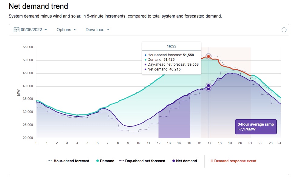
The state’s electricity draw hit a record 52,061 megawatts on Tuesday just before 5 p.m., surpassing state power grid operators’ estimated demand. After the text message went out around 5:45 p.m. demand dropped by almost 2,000 megawatts over the next 20 minutes. | Credit: Courtesy
On Monday, Elliot Mainzer, CEO for Cal ISO, had said the system faced demands up to 4,000 megawatts more than they were prepared to handle during the heatwave. He explained that they were currently importing energy from areas like the Northwest, which weren’t as beleaguered by heat; Stage 2 would mean California would call on backup emergency generation. Stage 3 meant 3,000 megawatts or more were needed, and rolling blackouts became a possibility if Cal ISO was not able to purchase power or decrease demand across the state.
Today, state officials issued yet another Flex Alert, urging residents to continue to reduce energy consumption for the eighth straight day. They said that pre-cooling homes during the day with thermostats set to 72 degrees, and then turning them up to 78 degrees between 4 and 9 p.m. were “really essential,” as well as avoiding the use of electric dryers, dishwashers, and other large-wattage appliances during those critical hours. The Flex Alert status also means consumers who’ve enrolled in the Power Saver Rewards program with their electricity provider can earn $2 for each kilowatt hour saved during such emergencies. See more at powersaverrewards.org.
Hurricane Kay to the Rescue?
The hot temperatures aren’t yet over, according to the National Weather Service, though its meteorologists are pondering the northward effects of Hurricane Kay, currently whirling off Baja California and bringing a potential for rain.
Hurricane Kay’s trajectory isn’t entirely predictable, but so far weather forecasters are expecting Thursday temperatures to be above normal, and Friday — when Kay’s effect is expected to be felt in Central California — to be either be hotter than Thursday or cooler as the clouds pile in overhead, blocking the sun but trapping the heat. Friday night is expected to be in the eighties.
As Kay advances northward, the hurricane is bringing a cooler mass of air with it and possible light rain, mostly to the south of Point Conception. The National Weather Service’s long-term forecast predicts weekend temperatures dropping 10-20 degrees from Friday’s and “measurable” rains, with a chance of thunderstorms.

Support the Santa Barbara Independent through a long-term or a single contribution.


You must be logged in to post a comment.