
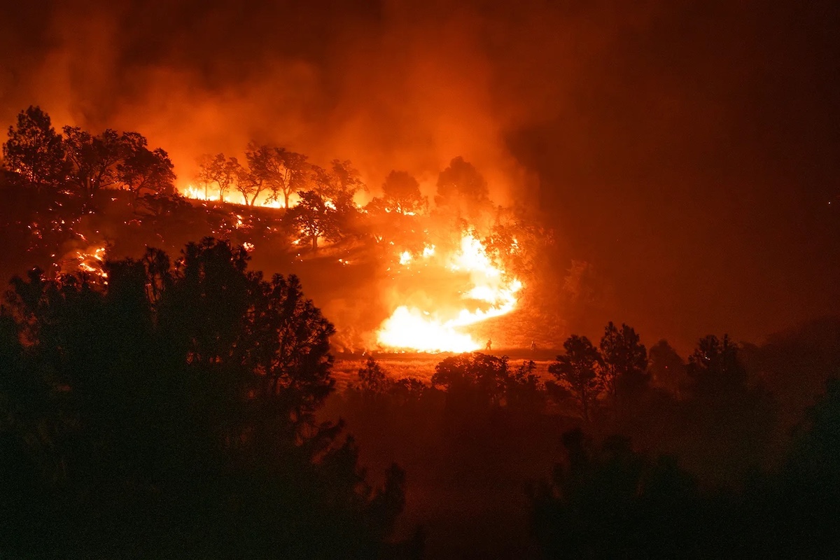
Which Santa Barbara County neighborhoods are the most flammable?
Last month, Cal Fire released updated fire hazard maps for Santa Barbara and the rest of the state, showing where to beware of potential blazes — categorized into moderate, high, or very high fire hazard zones.
After reviewing the maps, Santa Barbara County fire departments amended and expanded the hazard zones using their own knowledge of the region’s tinder boxes. Following a public comment period, local jurisdictions must adopt the new maps within a few months.
State Maps
This is the first time the state updated local fire-prone zones (or Local Responsibility Areas) since 2009, following several years of effort.
Many hazard zones across the state were significantly expanded, likely coinciding with increased fire dangers caused by warmer temperatures and drier fuel conditions.
The new state maps were created using computer modeling to take into account an area’s fire history, potential fuel (vegetation), predicted flame length, blowing embers, terrain, and typical fire weather for the area, Cal Fire’s website states.
The maps evaluate “hazard,” not “risk,” the agency emphasized. Hazard is based on physical conditions that coincide with the likelihood of fire, while risk is the potential damage a fire can do to the area.
“Hazard” does not account for home hardening, recent wildfire, or fuel reductions (such as the prescribed burns Santa Barbara County frequently employs).
According to CalMatters, some notable hazard areas did recede, but across the state, “high” and “very high” hazard zones have “exploded” by 168 percent since 2011.
More than 3,000 square miles of California are in these danger zones, including the homes of about 3.7 million people, CalMatters reported.
Local Maps
Local agencies’ proposed maps incorporate the state-designated zones, while also reflecting local knowledge and fire history, “such as terrain-specific hazards, sundowner wind patterns, and evacuation complexities,” fire agencies said in a joint press release this week.
Agencies are not allowed to reduce the state-designated severity levels of the zones. However, they are allowed to raise the hazard classification and add on additional areas.
“We’re only allowed to either adopt or increase,” said Santa Barbara County Fire Marshal Fred Tan.
Tan said the state did not add many new areas to existing hazard zones in the county. But some local jurisdictions are proposing amendments.
Although a couple of cities don’t have much to worry about, namely Carpinteria and Santa Maria, most regional maps feature some bright orange (high hazard) and red (very high hazard) zones.
The City of Santa Barbara, for one, plans to merge the state map with its Community Wildfire Protection Plan, which already identified many of the state’s new hazardous areas.
Still, the new maps show more areas of in the city of Santa Barbara have been dubbed as hazardous, the city said in a statement this week.
“That includes parts of the Mesa neighborhood, especially near Cliff Drive and Flora Vista, and areas in the northern parts of San Roque and La Cumbre,” the city said.
“New Moderate, High, and Very High Fire zones have been created by CAL FIRE in these areas,” it continued. “The Fire Department will be incorporating these zones but will further align them with streets and neighborhoods.”

Impact on Properties and Insurance
Tan said that, as far as property owners are concerned, the maps will primarily guide defensible space inspections and construction standards, particularly in high fire hazard zones. Local fire departments will conduct inspections of properties in new high fire hazard zones. As of now, they do around 15,000 of these inspections a year.
Tan also said that new construction in high fire hazard zones will have to comply with fire-resistant building standards.
However, since the maps do not take into account fire mitigation measures (e.g. home hardening and defensible space buffers), they are not intended for insurance companies to calculate risk for homes, Tan explained.
Wildfire risks have contributed to Santa Barbara County homeowners losing their insurance policies or seeing premiums increase in recent years. But the maps should not exacerbate this, he said.
“Let me be clear: The CAL FIRE hazard maps are not used for insurance rates or underwriting decisions,” Insurance Commissioner Ricardo Lara said in a statement. “But they will empower communities with more accurate information about the very real hazards we face.”
Community members are encouraged to visit their local fire department’s website to review the map where they live and share comments. Over the next three months, fire departments will be reviewing and incorporating these changes from Cal Fire through local ordinances.
Find your address on the interactive fire hazard zone map here.
Compare the current maps to the proposed new state maps here.
View individual regions’ fire hazard severity maps and learn more:
Related Posts


Premier Events

Sun, Jun 07
All day
Santa Barbara
SEIMANDI & LEPRIEUR – Hunt Slonem Exhibition Now – June 7

Wed, Jun 03
11:40 AM
Santa Barbara
Women’s Prosperity Partners S.B. LEADS Club Virtual Meeting- Female Entrepreneurs

Wed, Jun 03
6:00 PM
Santa Barbara
Chaucer’s Book Talk – Greg Orfalea
Wed, Jun 03
6:00 PM
Santa Barbara
Bingo for Bottles at Carr Winery

Wed, Jun 03
7:30 PM
Santa Barbara
Ensemble Theatre Company Presents “Every Brilliant Thing”

Thu, Jun 04
5:00 PM
Santa Barbara
LGBTQIA+ Pride Artist Showcase
Thu, Jun 04
6:00 PM
Santa Barbara
SBCAST – UCSB Media Arts & Technology End of Year Show (EoYS): “re:agency”

Thu, Jun 04
8:00 PM
Santa Barbara
Orangepit! with Magnetize

Fri, Jun 05
7:00 PM
Santa Barbara
Novus Contemporary Ballet’s Alice! in Wonderland

Fri, Jun 05
7:30 PM
Santa Barbara
The Devereux String Quartet Presents: Intone
Fri, Jun 05
8:00 PM
Santa Barbara
Noise Rock at The Tully June 5th
Sun, Jun 07 All day
Santa Barbara
SEIMANDI & LEPRIEUR – Hunt Slonem Exhibition Now – June 7
Wed, Jun 03 11:40 AM
Santa Barbara
Women’s Prosperity Partners S.B. LEADS Club Virtual Meeting- Female Entrepreneurs
Wed, Jun 03 6:00 PM
Santa Barbara
Chaucer’s Book Talk – Greg Orfalea
Wed, Jun 03 6:00 PM
Santa Barbara
Bingo for Bottles at Carr Winery
Wed, Jun 03 7:30 PM
Santa Barbara
Ensemble Theatre Company Presents “Every Brilliant Thing”
Thu, Jun 04 5:00 PM
Santa Barbara
LGBTQIA+ Pride Artist Showcase
Thu, Jun 04 6:00 PM
Santa Barbara
SBCAST – UCSB Media Arts & Technology End of Year Show (EoYS): “re:agency”
Thu, Jun 04 8:00 PM
Santa Barbara
Orangepit! with Magnetize
Fri, Jun 05 7:00 PM
Santa Barbara
Novus Contemporary Ballet’s Alice! in Wonderland
Fri, Jun 05 7:30 PM
Santa Barbara
The Devereux String Quartet Presents: Intone
Fri, Jun 05 8:00 PM
Santa Barbara

You must be logged in to post a comment.