

The Basics: Acres Burned: 67,675; Cost to Date: $50.3 million
Is This the Big Fire?
Three weeks ago, on July 17, Santa Barbara County Fire Chief John Scherrei told the Board of Supervisors the Zaca Fire had the potential to become the largest fire in California history. “In a nutshell,” he told them, “this is a very dangerous fire.”
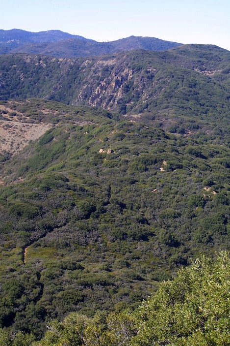
“The country back there is like a bucketful of shark’s teeth,” Scherrei added at a community meeting just last week. “It is very difficult to operate; very difficult terrain to fight a fire. It’s like a mattress fire; it just keeps on smoldering then bursts back to life. With a mattress you’ve got to cut it up into little pieces and soak it good with water if you want to get it out.”
The problem with the backcountry, however, even with larger helicopter’s known as the “heavies”, dropping a thousand gallons of water on any part of the fire is like what one fire fighter called “spitting into the wind.” If you have a significant ridge you need to hold and have dozer lines, engine crews, hotshots and overhead support from air attack available in abundance, more than likely you can hold the main ridges.
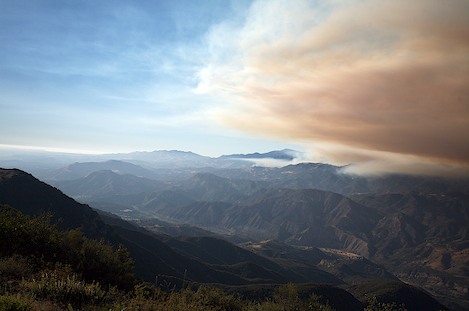
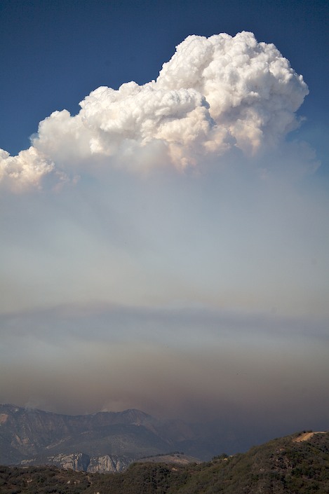
Crews have done a spectacular job of holding high points such as the Zaca and McKinley ridges and just yesterday the east-west ridge running from Little Pine Mountain west past Alexander Peak to Old Man Mountain. With the wind at their backs, crews deliberately burned out the brush on the backside of the Alexander ridge, creating a 5,000′ tall plume of smoke that had spectators at the Observation Point on Highway 154 fearing the fire had blown out again late in the afternoon.
With today’s morning fog – almost a misty drizzle – Paradise, Rosario Park and Camino Cielo residents can rest assured that the danger is over for them.
New Threats Emerge
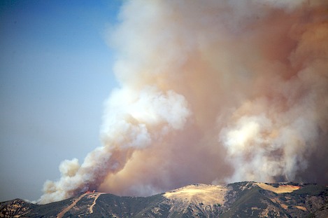
While there are successes such as this, the fire has proven almost impossible to put out. Friday’s dramatic blowup forced firefighters on the defensive as the flames moved on a ten-mile-wide front towards Buckhorn Road. Unfortunately, they were not able to hold the Buckhorn.
“This is absolutely huge,” one fire fighter told me. “With the San Rafael Wilderness you had topography that was well defined, with the ridges funneling everything east. Once it moved over into the Dick Smith you’ve got completely different topography – and a lot of it flows directly towards Santa Barbara.”
Over the weekend the road was breached in a few places and fire command considered requesting use of dozers on the ridges on either side on the edges of the San Rafael and Dick Smith Wildernesses.
Yesterday the point became moot when the wind shifted direction and began pushing the fire line northeast. This was great for Santa Barbara because it kept the ash away but not so good for fire fighters who watched the fire line spread into brush that hadn’t burned in the earlier runs. Areas most affected included Grapevine Canyon in the area near Jackrabbit Flats and the upper parts of the East Fork of Santa Cruz Canyon.
By day’s end the fire had crossed almost the entire length of Buckhorn Road from Little Pine to Big Pine Mountain – more than a ten-mile section – causing the fire to expand dramatically into the Dick Smith Wilderness and, more ominously, towards Santa Barbara. What had been a relatively narrow fire confined to the deep interior of the backcountry now has more than twenty miles of uncontrolled fire line that now has multiple heads, with each posing its own threat.
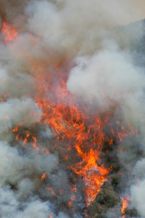
The Zaca Fire has not only moved into an entirely new phase, there is a potential for major fire growth, loss of huge chunks of habitat and a serious threat to the South Coast.
Sisquoc River
Every effort once the fire crossed the Manzana and moved up onto Hurricane Deck has been directed towards keeping the fire out of the Sisquoc, both to protect Tepusquet on the east, to avoid a massive burnout on the south facing slopes of the Sierra Madres and to keep it from spreading into the Dick Smith Wilderness.
Yesterday the fire blew up Grapevine Canyon, over Mision Pine Ridge about a mile east of the Basin and started down into the Sisquoc about a mile above Heath Camp.
A second command enter is now being established in New Cuyama and an additional Type 1 incident management team is heading there to take command of the fire on the north (Sisquoc, Sierra Madres, upper Dick Smith Wilderness). Expansion of the fire line here may take it onto the Sierra Madres, up the Sisquoc and over into the Dick Smith Wilderness at Alamar Saddle. Should the fire continue down Alamar there is a potential for it to burn out a large portion of the upper Dick Smith Wilderness and eventually reach the Ventura County line near Potrero Seco.
Bluff Camp
Yesterday, the fire also burned out the upper Santa Cruz drainage below the West Big Pine Cliffs, burned completely over the top of Big Pine Mountain and is now approaching Alamar Saddle from the south. More than likely by this afternoon the fire will be down the Alamar, possibly to the area near Bill Farris Camp.
At Bluff Camp, the fire moved past the old CCC-era admin building there was burning down into Indian Creek. The fire has the potential to burn down Indian Creek and join with fire burning south of it in Buckhorn Canyon, continue east up to Loma Pelona and from there down into the Mono or move up onto the eastern flanks of Big Pine.
Buckhorn Canyon
By late day yesterday, fire line had almost reached the bottom of Buckhorn Canyon, four miles and several thousand feet elevation drop from where the fire had crossed Buckhorn Road. More than likely the fire has reached Indian Creek by late today. If so, this would indicate the fire line is within 4-5 miles of the Santa Ynez River.
Worsening the situation, the winds are expected to shift tomorrow to a more southerly flow and could accelerate the fire movement towards Santa Barbara.
More tomorrow when it becomes much clearer how each of these situations plays out. There is little good news to report.
Author’s note: Due to the difficulty of providing maps that give a better understanding of the locations, every effort will be made to get them in place by tomorrow.


