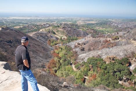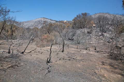
Community leaders for the City of Goleta and Santa Barbara County met on Tuesday evening to present further information to citizens concerned about the specter of floods and mudslides. Such disasters are likely to result from upcoming rains on the Forest Service and county lands that were denuded by the Gap Fire this summer.
About 100 people showed up at the event held at Goleta Valley Junior High School, and it included a question-and-answer session at the end. Officials were optimistic about their efforts to mitigate fire damage and prepare for floods and debris flows, and the main thrust of the meeting was preparedness and planning for the worst. “Don’t wait until the first flash across the bottom of your TV screen saying there’s a flash flood coming to get ready. You should be getting ready now,” said Tom Fayram, Director of the County’s Flood Control District.
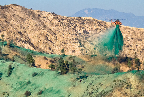
Fayram explained that the Flood Control District, Public Works, the Fire Department, and other agencies have been working on a mitigation plan that includes clearing creeks of brush and debris, clearing sediment basins (particularly the main one at Santa Barbara Airport), installing debris racks (steel grates that catch larger debris and which will be cleaned out regularly), and aerial hydromulching, which began this week.

Once hydromulching is nearing completion over 1,531 acres of Forest Service land, the National Resource Conservation Service will continue the operation on private lands in the burn area. “Once this work is done, the real work begins,” said Fayram of the continued vigilance that will be required to make sure mitigation measures maintain their effectiveness throughout the rainy season.
The City of Goleta has been busy, too, installing bridge culverts and other flood damage prevention improvements, although Community Services Director Steve Wagner admitted to probing members of the audience that they haven’t gotten around to fixing some that could be considered bottlenecks. Citing deficiencies in Caltrans culverts, Fayram said that some could not be replaced this year as a result of the time and cost involved. “We can’t know what the actual impact will be : it depends upon the rain,” Fayram said.
Officials encouraged homeowners to invest in flood insurance, regardless of whether or not they live in a flood zone, and said that sandbags will be available free of charge at Fire Station 14 on Los Carneros Road. “If you have a property in the flood zone, stock up. They’ll show you how to fill them,” said Vyto Adomaitis, Goleta’s Director of Redevelopment and Neighborhood Services. Goleta City Manager Dan Singer said that area residents should plan ahead by readying their properties: purchasing flood insurance, getting sandbags, signing up for Goleta City Alert, and having a family plan. “Let’s assume we’re going to get that big storm and be prepared,” he said.

The parameters of what is and isn’t covered by flood insurance is somewhat dubious, but there was a general consensus among officials present that flood insurance does not cover landslides or mud flow from a hillside. There is also some question as to the maximum amount of coverage that will be provided by insurance companies, but it seemed to be aimed more at repair rather than replacement. Mike Schaumburg, who lives in one of the areas faced with the potential of flooding, said that his insurance company directed him to FEMA flood insurance, which he said costs $350 per year, but only provides $250,000 of maximum coverage. More information can be obtained by visiting floodsmart.gov.
As far as early warning systems go, the U.S. Geological Survey has cameras, sensors, and inspection personnel in place to monitor creek beds and areas with a potential flood risk. However, some members of the audience said that the efforts being undertaken by the county are inadequate and being performed in the wrong areas, saying they should instead be focused on removing debris in the higher altitude segments of the burn area on Forest Service land in the upper reaches of creek systems, one audience member said.


