

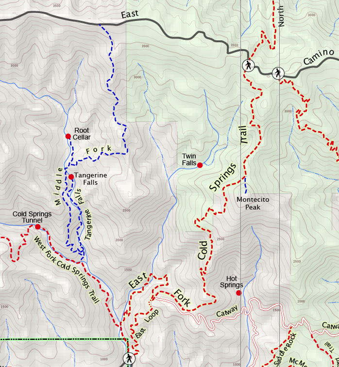
TRAIL INFORMATION
Distance-0.25 miles to West Fork intersection; 1 mile to Middle Fork intersection; 2 miles to top of the falls; 2.5 miles to the remnants of the homestead.
Elevation Gain-450 feet to Middle Fork intersection; 1,075 feet to top of the falls; 1,300 feet to homestead.
Difficulty-Moderate to strenuous
Topo-Santa Barbara
View Canyon Gallery | View Trail Gallery
HIGHLIGHTS
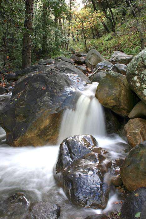
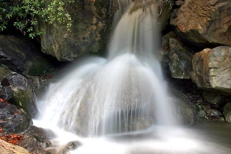
Though not a long nor well-known trail, it leads up to a series of beautiful cascades culminating in a 200-foot high waterfall. A small pool is at the base of the falls, making this a great place to hang out for the afternoon. A trail leads around the west side of the canyon to the top of the falls and into the upper canyon where you can find remnants of an old homestead.
DIRECTIONS
The trail is reached from Hot Springs Road in Montecito. From Santa Barbara, take the Hot Springs exit (you’ll need to be in the fast lane) and follow it about 0.75 miles until you reach the Highway 192 intersection. Turn left on Highway 192 and follow this for one mile to Cold Spring Road. Turn right and continue up past Westmont College to Mountain Drive. Turn right and go a half mile east to the trailhead. Park near the point where the creek crosses the road.
SETTING THE SCENE
“Yesterday Mr. Shedd and two men, two donkeys, and two mules came over from the Los Prietos mines by a new trail in less than eight hours, two of which were used to clear the trail of brush to the top of the mountain on the other side,” the Santa Barbara newspaper reported on February 21, 1878. This is one of the earliest recorded accounts of use of the original Cold Springs Trail.
Originally, the main trail went up the Middle Fork of Cold Springs rather than its current route. Passing the site of the Cold Springs water tunnel, bored into the mountain on land donated by Eugene Sheffield, the trail led up and around a 300-foot waterfall (known now as Tangerine Falls) and a large pointed rock at the top of the falls named “The Pinnacle” by E.M. Heath in his 1904 book, A Guide to Rides and Drives in Santa Barbara.
From there, it continued up the creek bottom through a narrows, then began to wind its way up shale slopes to the crest, where it crossed over and down the head of Gidney Creek (where Forbush Flats is now located) to the Santa Ynez River.
When the Santa Ynez Forest Reserve was created in 1899, the Cold Springs Trail was improved by the forest rangers. Rather than having to split their efforts on trails up each branch of Cold Spring Creek, they decided to concentrate on the East Fork.
“It is considered advisable,” Forest Inspector Louis A. Barrett wrote to his superiors in Washington in 1905, “to have one well built main trail crossing the Reserve from the Coast to the desert side and one half of the field force will be at work on this trail all the spring.”
THE HIKE
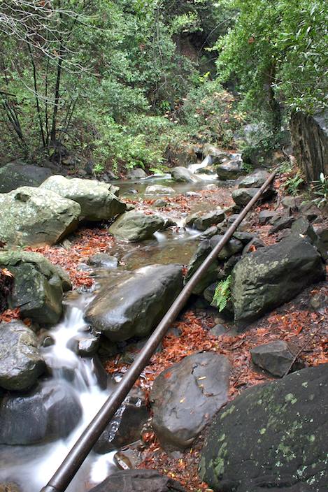
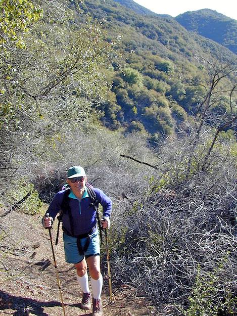
To reach the Middle Fork of Cold Springs you will need to hike up the West Fork trail for three-fourths mile to the turnoff to the falls. The lower canyon is extremely narrow, the creek flowing over solid bedrock. The upper part opens into a large semi-circular valley, which is hidden from view until the last moment. As you hike up the West Fork look up across the canyon every so often. When you spot Tangerine Falls you will know you are close to the trail intersection.
There is no sign marking the turnoff because the route up into the Middle Fork canyon isn’t an official trail-even though the original route went this way. Drop down across a small canyon (containing the West Fork creek) then continue straight ahead up into the Middle Fork Canyon. You will find yourself using your hands a lot, but because of the number of hikers who come up here the trail is becoming more and more developed.
Look for the turnoff that will take you up, around the falls, and into the upper canyon not too far after you’ve turned off the main trail. It switches back and forth several times, heading up pretty steeply then curves left and up until you are on the shoulder of the West Fork canyon, looking directly across at the trail leading up to Gibraltar Road.
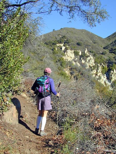
The trail then turns north and leads away from the West Fork toward the top of the falls. Several hundred yards beyond, as you round another corner, Tangerine Falls comes into view and you can see the route all the way up and past the Pinnacle. Once you reach this unique formation, the trail drops down into the shade of the narrow gorge, which is just upstream of the falls.
The side route over to the Pinnacle requires use of your hands as there is a bit of scrambling to get over to it, but once you are there you will love both the perch and the views it affords. This is a very, very nice place to spend an afternoon.
You would expect that it would be easy to reach the top of the falls from here but it isn’t. There is lots of poison oak in the creek and one 10-foot waterfall you would need to down climb to get there. With a rope you might be able to make it.
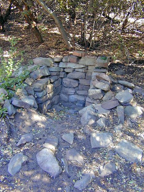
Hiking into the upper canyon is also a treat. It is narrow and filled with willows, sycamore, and oaks, creating a lot of shade, and the trail is almost level. There are lots of stream crossings and you will find an assortment of small trails leading off the main one, but to reach the homestead area you should generally follow the trail that continues along the creek. If you are lucky you will find the old farm equipment and a bit further up the old root cellar, which is an excellent place for lunch.
It appears that the old route up to the crest is also being restored as well. At one point before you reach the root cellar, a trail leads very steeply up a hill on the right side of the creek. Should you explore this you will find yourself following a thin ridgeline directly uphill for a long distance. Eventually you will top out on a larger ridgeline which divides the middle and east forks of Cold Spring from each other.
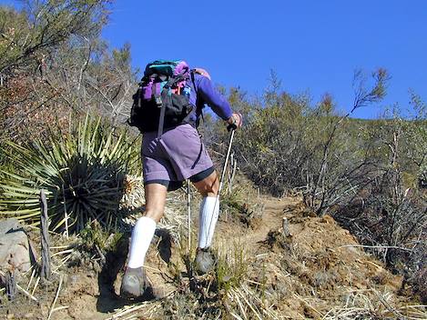
The route up the main ridge is sketchy now but this will change as those who do the illegal cutting of the brush up here continue to widen the trail. There is one final knoll-marking the furthest I have been on this “trail”-a knoll on which I would love to spend the night if it weren’t so hard to get here. The spot is open, with a fringe of chaparral all around and there are 360 degree views. The hill drops off in all directions and you can see Camino Cielo just above you, seemingly just a rock’s throw away. But the 300-foot drop down to a small saddle and the 900-foot climb up to the road means, in mountain terms, you are actually still a long way away from the crest. Hard core hikers will have no trouble continuing on, heading a mile east to the top of the main Cold Springs Trail and looping back down on it.
If you would like to know where this spot is, try looking at the Santa Barbara topo. There is a marker on the map which says “2884” that is right below the “R” in “Forest. Perhaps we will meet there someday.


