
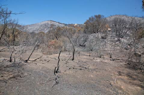
The greater Santa Barbara area experienced its first significant rain of autumn over the weekend. Despite a flash flood warning from the National Weather Service, precipitation was not prolific, dropping less than an inch of water in two days. Since the Gap Fire burned nearly 10,000 acres of vegetation in July-mostly on mountainous National Forest lands-there has been concern about potential debris flows and mudslides from the denuded areas when seasonal rains do eventually come.
Accordingly, the Santa Barbara County Flood Control District has been working with the City of Goleta’s Public Works Department, the U.S. Forest Service, and the U.S. Geological Survey to mitigate damage done to the hilly landscape, and otherwise prepare for the possibility of heavy winter rains.
For a short time, many Goleta residents became attuned to the regular droning of hydromulch planes flying nonstop during daylight hours in an effort to stabilize the siltiest of the scorched lands. County and city work crews have also been busy clearing out creekbeds of debris and installing debris racks in some of the creeks, to catch any flotsam that makes its way down from the mountains.
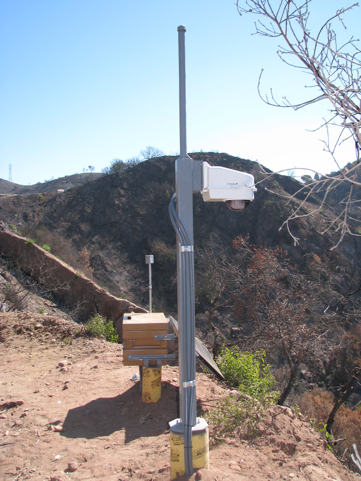
However, one of the more quiescent efforts is also one of the most significant. In partnership with the National Weather Service, USGS provided a rainfall and creek flow monitoring system designed to keep residents and public safety officials in the know if things become critical during a rain event.
The interagency monitoring partnership was formed in response to the Waterman Canyon mudslides, which claimed the lives of 14 people during the last week of 2003. “We put our heads together to see what we could do to prevent this kind of debris flow,” said James Bowers, USGS’s chief of hydrologic monitoring in California. In the Goleta area, the USGS monitoring apparatus-which Bowers said cost about $60,000-includes three rainfall gauges and a creek flow gauge on San Pedro Creek, which was determined to be one of the creeks more likely to cause problems in the event of heavy rainfall. “Fortunately, [the Gap] fire happened early enough to get some instrumentation in there.”
There are two automated gauges located at the upper reaches of San Pedro Creek, and one near where it enters cultivated land, between Fairview Avenue and Los Carneros Road in Goleta. Readings are taken every 15 minutes at each station, transmitting up-to-date data by satellite to the USGS Web site, and by microwave radio to the county’s Flood Control District. A USGS field office in Santa Maria-staffed by seven field technicians-keeps tabs on data from all over San Luis Obispo and Santa Barbara counties, but the South Coast of Santa Barbara County is what Bowers called a “perfect storm” area due to its unique geographic features. With mountains running east to west, and winter storms often hitting the coast frontally from the southwest, a condition called orographic lift occurs which carries moisture to high altitudes and can quickly create a large volume of precipitation. “When [Santa Barbara] gets rain, I’m always amazed at the amount of water that’s recorded at San Marcos Pass,” said Bowers.
Tom Fayram, the deputy director of the County’s Public Works Department, said that because the rainfall was so light last weekend, county and Forest Service officials have not been able to discern much about the effectiveness of the hydromulch that now covers some 1,500 acres of the burn area in the Los Padres National Forest. He added that they will be able to tell more when rainfall reaches two to four inches in a single event, at which point aircraft will be deployed to survey superficial erosion from the air. “You can’t walk the area to inspect it more closely because it would destroy the cover provided by the hydromulch,” he explained, reiterating the reason for the Forest Service’s closure of land that received the treatment.
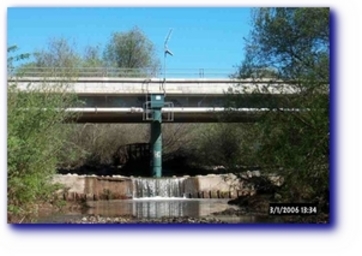
Up-to-date information about rainfall and conditions in San Pedro Creek-including maps, graphs, and charts showing the amount of rainfall for every 15-minute period-is available on the USGS Web site. A webcam monitoring one of the waterfalls on San Pedro Creek, about halfway up the slope according to Fayram, can also be viewed on the Web site.


