
Jesusita Fire Nears Containment But New Phase Begins
Fire Damage to Watersheds Could Cause Major Damage This Winter; Trails Impacted Heavily


While the flames from the Jesusita Fire are cooling down and it appears Santa Barbarans are closer to putting the terrifying images of destruction behind us, another potential disaster looms on the horizon. Much of the vegetation in the upper San Roque, Mission and Rattlesnake Canyons is gone, replaced by mineralized hillsides that are either bare or left with little but the skeletal outlines of formerly dense ten-to-fifteen foot tall chaparral brush.
On Sunday I walked through much of the fire area, hiking up Rattlesnake Canyon to Tin Can Flats, up a connector route to Tunnel Trail and from there made by way back via an off-trail route called the Mission Ridge down into Rattlesnake Canyon.
What is clear from the afternoon hike is that flood control officials will have their hands full this summer and fall preparing for the winter rains. These canyons are located in steep, rugged territory and there is little buffer between the burned areas and the homes below them.
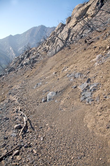
For those who love the trails found in this area – Jesusita, Inspiration Point, Tunnel and Rattlesnake – they have all sustained major damage, much of it from the rock and scree that has slid down from the burn areas above. In some areas the trails are almost buried in loose soil; in others hundreds of fist sized rocks litter the trails and will make them difficult, at best, to hike in the near future.
Trail Closure Now in Effect: In speaking with John Bridgewater, Santa Barbara District Ranger for Los Padres Forest, on Monday it was clear that officials there were already considering the idea of closing most, if not all, of the trails in the burn area for an extended period of time.
This afternoon a closure of Los Padres Forest was implemented for all front country areas stretching from Refugio Road on the west to Cold Springs Trail on the east.
At the local level, SB County Parks is already in the process of closing the upper San Antonio Creek Trail and San Marcos Foothills Preserve and they may consider doing the same for the Arroyo Burro Trail as well.
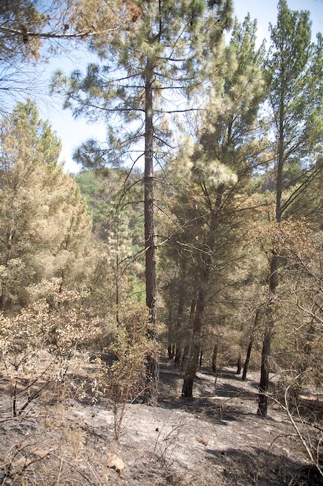
Rattlesnake Canyon Spared: Of the trails in the burn area, Rattlesnake has fared the best. The lower part of the trail was hit hard in the Tea Fire and what was not burned in the fall was in this one. Hikers will appreciate that most of the lower pine forest was spared, as were the riparian forests in the middle canyon section and almost all of Tin Can Flats as well.
Along parts of the upper canyon it is difficult to find evidence of the fire but in many paces the reminders are constant and as you near the upper meadows where the Tunnel Connector takes off there are several sections buried in silt that are difficult to get through. There is also one long section just above the lower pines that is completely burned out as well.
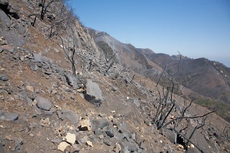
Upward to Tunnel Trail: As I enter Tin Can Flats the fire’s impact is immediate and stunning. Once out of the deep riparian canyons that were protected from the worst of the firestorm, the hillsides and cliffs are a stark contrast to the cool canyon feeling. Heading up the Tunnel Connector I’ve got a full frontal view of every rocky ledge and outcropping: there’s no brush to cover the sandstone walls anywhere.
The climb up to Tunnel Trail is not an easy one. On the best of days the trail is way too steep, gaining almost a thousand feet in just under three-fourths of a mile. Today, the loose soil, scree and rock that is covering the trail makes the hike more like a maze.
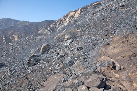
Every so often I glance back, amazed at how much has burned. As I gain altitude I begin to see how much of the far east side of Rattlesnake has burned and I’m able to see across to the upper West Fork of Cold Springs Trail. The fire also burned down into Cold Springs as well.
Though most of the first half mile burned down to mineral soil in Cold Springs as well, the rest has been spared. A small miracle, at least.

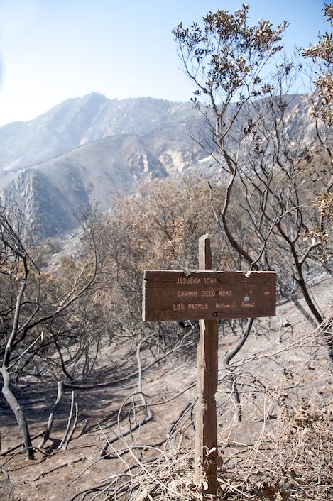
Tunnel Trail: By the time I reach Tunnel Trail my lungs are burning, due in part to the ask that I’ve kicked up but mostly because it’s a tough hike. Near the intersection I hit my first patch of unburned brush, perhaps ten feet deep so I’m slowed down a bit while I work my way through it and I’m distracted by the process. Then I turn around and get my first glimpse into Mission Canyon. I’m astounded. Even more of the upper canyon here has burned and Tunnel Trail is in ruins.
I work my way up to Mission Falls then back down past the connector trail and follow Tunnel downhill. The going is slow with enough dead brush along the way to make it a pain to continue on. At points I head off trail, down into areas with no vegetation and then back up onto the trail.
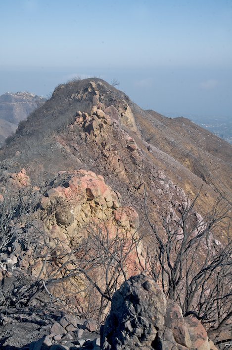
A quarter mile down Mission Ridge takes off to the east. It is a thin wall of rock that hikers have been scrambling up and over for the past forty-five years since the last big fire opened up the hills, the Coyote Fire of 1964.
I work my way up over the ridge and from the top can see that almost none of Tunnel Trail has been spared. My guess: 90% of the trail is burned over and it will need a complete overhaul before it will be usable again.
Over the Ridge: The scramble over the ridge isn’t as difficult as I’d imagined though it is a bit unnerving with steep drop offs on either side and little for handholds, but I’m able to make it without too much difficulty. East of the ridge is a collection of powerlines and a jeepway that drops back down to meet the lower Tunnel Trail.
The views from here are dramatic and as I make my way back down what had been a little known side trail into Rattlesnake Canyon (now completely open hillsides), I realize that the full impacts of the Jesusita Fire have yet to be experienced.


