
Five Day Hikes: From Mammoth Lakes area trailheads out of Lake Mary, Agnew Meadows (near Devils Postpile National Monument), and Rock Creek Lake
Miles: About 9.5 miles a day
Time: Five days; good for hardy children over 9
Maps: Tom Harrison Maps: Mammoth High Country Trail Map
When summer strikes and scorches the Santa Barbara backcountry, then it’s time to head for the much higher Sierra Nevada range bisecting California. For over 25 summers I’ve pulled out of Santa Barbara, taken the 126 through Ventura County’s magnificent orange groves, connected with the 14 through Mojave, and trundled up the venerable 395 past Lone Pine and Independence to Bishop, and then on to 7,500-foot elevation French Camp near Tom’s Place. This 500-mile journey grazes L.A., then moves into Antelope Valley and the Mojave Desert’s torch-like inferno. While many of us appreciate the softer western approaches to the lofty Sierra, I’ve grown to love the more precipitous and distant Eastern Sierra, which features enchanting conifer forests, alpine lakes, and steady hiking in high country above 8,500 feet.

I feature five day hikes near Mammoth Lakes because of the extraordinary day-hiking opportunities available there. My longtime hiking buddy, guru Franko, showed me most of these moderate to strenuous treks long ago.
The perversion of over-development in and around Mammoth Lakes village doesn’t obscure the incredible vision of 11,000-foot Mammoth Mountain and the glowing peaks around, including the incomparable Minarets near Yosemite in the distance. All these hikes presume you’re car camping either at the Forest Service’s French Camp (by Tom’s Place) or more likely renting a Mammoth ski condo for six days, as we did.
Historian and emeritus professor at UCSB Rod Nash discusses the many contradictory definitions of our term wilderness as they have evolved historically in his now-classic tome Wilderness and the American Mind (1967). It begins with the Norse/Germanic term wildeor — a place of wild beasts, uncontrolled by humans. In French it’s lieu desert, and Spanish has tierra salvaje or inmensidad, but the Romance languages don’t quite translate “wilderness” as we often think of it today in English, at root another Germanic tongue.
Seeking wilderness and then walking around basking in this inmensidad stands behind Hiking the Backcountry, in the hope that you, the reader, might attempt a few of these one-day treks! These five day hikes in the Eastern Sierra are a contrast to Santa Barbara’s five backcountry “wildernesses.”
Using the Tom Harrison map, we easily see that three of these five hikes leave from Lake Mary, just a few miles from Mammoth Lakes village (there’s also an efficient bike path for cycling from Mammoth up to the Lake Mary trailheads).
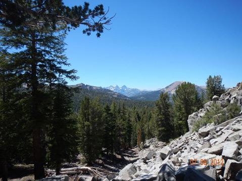
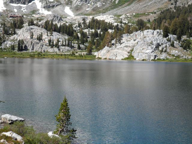
Day 1 — Lake George (L. Mary) day hike toward the Deer Lakes (about 9 miles roundtrip; 7 hours)
With my teaching colleague Chris, I chose this first day hike because we could find the trailhead easily along the far side of Lake Mary near Lake George. Ascending immediately in fragrant coniferous forest trail we passed by the signed turnoff to beautiful Crystal Lake; this lake and the soaring Crystal Crag make a wonderful half-day hike with kids over to the lake, enjoying lunch in the woods at the lakeshore.
However, we kept ascending. After climbing the steep Deer Lakes Trail we attained what the Tom Harrison map termed the “Mammoth Crest.” From here there are wonderful vistas back to the east over the entire Mammoth area and sections of the Long Valley.
Day2 — Lake Mary via Emerald Lake to Barney Lake I (about 8 miles; 5 hours)
After driving again to Lake Mary and taking the obscure turn into “Cold Water Camp” and driving to the end, we found the last large parking lot with the tall USFS signs marking the trail to lovely Emerald Lake. After this short uphill hike, we took a transverse trail over the ridge to join the official Duck Pass Trail near Skelton Lake. This connecting path is marked on the Tom Harrison map, but is not on the USFS trail plaque. It was lovely and there were no hikers using it; once we rejoined the Duck Lake Trail we encountered many clusters of people, often with their dogs. While our eventual goal was to make 10,800-foot Duck Pass, we cut it short at beautiful Barney Lake where we had a simple lunch, then returned. Hikers will be around 9,000 feet for most of this picturesque trek.
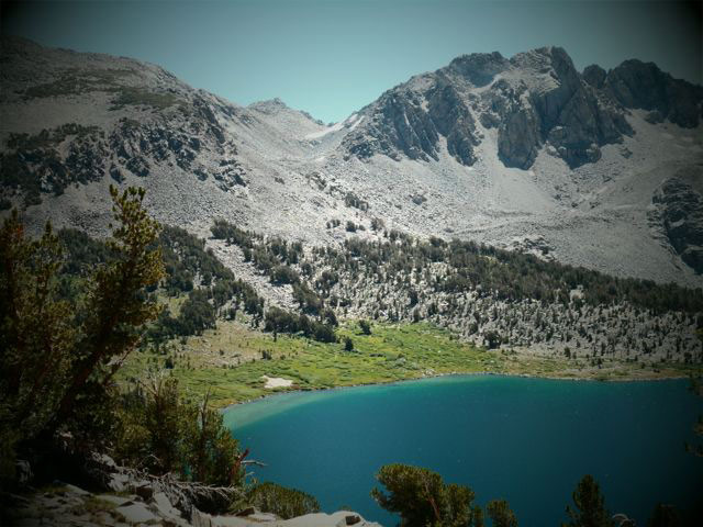
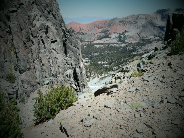
Day 3 — Rock Creek Lake to Morgan Pass (8 miles; 5 hours)
My friend and former colleague at Crane School, renowned naturalist Cathy Rose (noted in Karen Telleen-Lawton’s Canyon Voices book on Rattlesnake Canyon), suggested this hike above Tom’s Place. She exhorted, “Don’t miss the flowers”!
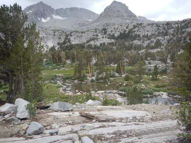
After driving the nine miles straight up to Rock Creek Lake from 395 and the very high parking area called Mosquito Flat (10,300 feet), we began hiking quite early. The sign for Morgan Pass comes up quickly. We took the left arrow, ambling by many beautiful views, enjoying the stony footpath and craggy peaks all around. Along the way we spied a sign for the short trail over to the beautiful Gem Lakes, which we took, encountering beautiful wildflowers, and then returned to the main trail. At these elevations spring wildflowers last well into summer, and we saw plenty of multi-colored Indian paintbrush, lupine, and more.

The final push up a steep granite staircase to Morgan Pass itself led us to contemplation of a climbable nearby peak, “Bear Creek Spire.” While Chris and I rested and ate dried fruit, two other men came up and stopped to look over the Spire. They were there to free climb the northeastern side (a “3”in climbing parlance), which fascinated me but was also very daunting to imagine actually attempting. On various earlier trips I’ve free climbed part way up the Crystal Crag peak with three friends, and no equipment beyond heavy gloves. Neither of these would be called technical climbing.
For some hikers, I recommend making this third day a recuperation day if you’re suffering from days 1 and 2; in any case, my practice is to do restorative yoga in the evenings, with emphasis on the lower back, the hamstrings, as well as slowly massaging olive oil into both knees.
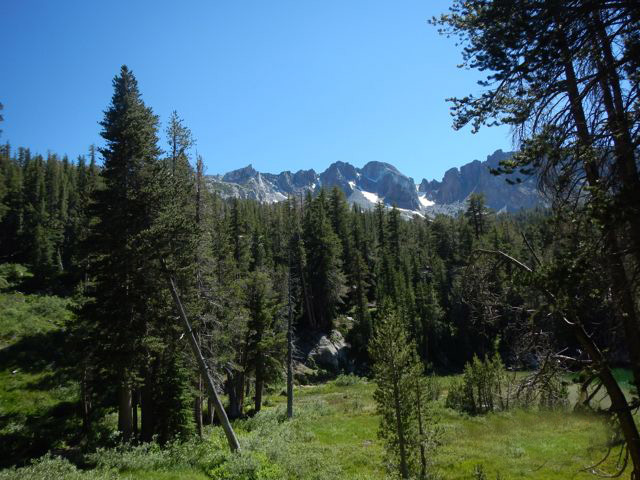
Day 4 —Agnew Meadows to Shadow Lake, then to Ediza Lake (14 miles, 8-9 hours)
This 13- to 14-mile strenuous round trip, taking the required shuttle down into Devils Postpile National Monument to Agnew Meadows, required about eight hours of hiking and was exhausting with the elevation gains and losses en route.
From Agnew Meadows, where you enter the Ansel Adams Wilderness, you avoid the Pacific Coast Trail (PCT) “high trail” and instead take the PCT lower River Trail to Lake Olaine, after which you take the signed trail over the bridge 1.9 miles to glorious Shadow Lake. This is exciting hiking with roaring cataracts of water amid beautiful pines and granite grandeur.
Ascending more after leaving Shadow Lake you ascend 3.2 more miles (and later leave the John Muir Trail) to arrive at 9,300-foot Ediza Lake. Ediza feels really high, and there may be traces of snow around even in July or August.
Day 5 — Lake Mary to Duck Lake via Duck Pass (9.5 miles, around 6 or 7 hours)
This final day hike recapitulates the Day 2 trek, and we specifically wanted to saunter by entrancing Emerald Lake again. On reaching Lake Barney, we pushed on up the ascending trail to Duck Pass and to high Duck Lake itself. This body of water seemed huge compared to most of the other lakes we observed, and for the most part you are out in the harsh daylight above timberline. Sunscreen, a wide-brim hat, and sunglasses are essential gear, as well as water.
We hiked partway around Duck, and if we had kept trudging, in two miles we would have joined the famous John Muir Trail/Pacific Crest Trail, here conjoined.
This total of almost 50 miles day hiking at higher altitude — very high altitude for a “soft” sea-level Santa Barbaran – made me believe I was in better physical shape than when I’d first arrived. It’s over 30 hours hiking 8,500-plus feet above the normal Santa Barbra coastal elevation.
While the alpine flora, the conifers, the springtime wildflowers, the glorious mountains all around were inspiring, and literally created psychological “peak moments,” we weren’t able to observe much wildlife. We did run into swarms of other hikers and several backpacking groups; plenty had brought their children along, which was very encouraging to a schoolteacher.
How Wild Is Wild?
I love the high Sierra mountains’ eastside and westside, and there are some very wild portions left in them, at least “wild” as famed ecologist Aldo Leopold described wilderness in 1921:
“[Wilderness is] a continuous stretch of country preserved in its natural state, open to lawful hunting and fishing, big enough to absorb a two weeks’ pack trip, and kept devoid of roads, artificial trails, cottages, or other works of man.”
Some of these zones are inaccessible to me, I admit, either because I don’t ride horses or haven’t enough strength to hike to them.
Yet the Sierra possesses few uncontrolled wild beasts and in summers endures hordes of tourists and travelers and day hikers. The horse-packers and odoriferous gobs of mule dung litter the trail, and plenty of big dogs roam around. Contradictions abound. The number of backpackers is impressive, but at the same time there are so many! Much of the Sierra, especially Inyo National Forest, has roads, cottages, well-established trails, and other works of man such as manmade lakes. When we would hike in the John Muir or Ansel Adams federal wildernesses, it felt a bit more like an inmensidad.
Strangely, Santa Barbara’s nearly 500,000 acres of federal wildernesses have fewer active trails, fewer roads, wild beasts that are truly “uncontrolled” — black bears, mountain lions, rattlesnakes, coyotes, bees —and hardly any humans. Some of us go to the wild for solitude or near-solitude: pretty difficult in the high Sierra in July or August.
The harsh aridity, the supposed sameness, and the lack of Yosemite-like coniferous splendor have made our local backcountry “forgettable” — and the very definition of true remaining wildeor islands.


