
[Update: Oct. 12, 9:14 a.m.] Although the winds have subsided from the violent gusts that raked the county yesterday, the Alisal Fire has continued to expand during the night and is now estimated at 6,000 acres. Find all our updates on the Alisal Fire here.
[Update: Oct. 11, 8:15 p.m.] The Alisal Fire is estimated at over 3,000 acres, with zero percent containment, according to Los Padres National Forest Public Affairs Officer Andrew Madsen. More than 200 firefighters are working overnight to try to contain the fire, which has been mostly cut off at the top of the hills by dozers, he said.
All air support is currently grounded due to wind, but Madsen said fixed-wing tankers never fly after dark. “We did probably lose a couple hours of time because of the wind,” he said.
More fire crews will be coming to the area from Southern California forest services, including Cleveland and San Bernardino; they are expected to begin arriving in the early morning hours. “We’ll do a flyover in the morning, if we can, and take a look at the acreage,” Madsen said. Gusty winds continue to be a factor. Though winds have died down for now, Madsen said, there is potential for gusts up to 70 miles per hour.
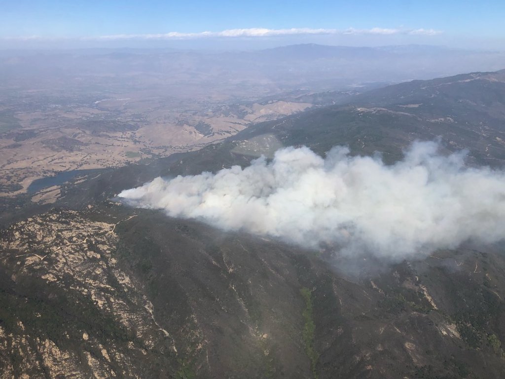
The fire is headed toward the burn scar from the Sherpa Fire, which is expected to slow the spread.
[Update: Oct. 11, 7:50 p.m.] The evacuation order has been expanded to include the area east of El Capitan Beach State Park, west of Dos Pueblos Canyon Road, and south of West Camino Cielo Road, according to the latest boundaries released by the Federal Emergency Management Agency (FEMA).
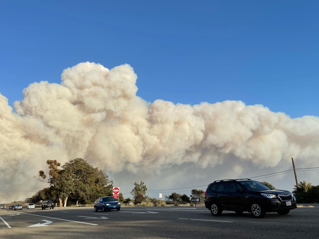
The California Highway Patrol Incident Page is reporting motorists bypassing the highway closure and driving in the wrong direction to leave the area, as well as some abandoning their cars and walking toward the beach. A big rig was reportedly overturned off of the 101; no details on the condition of the driver have been released.
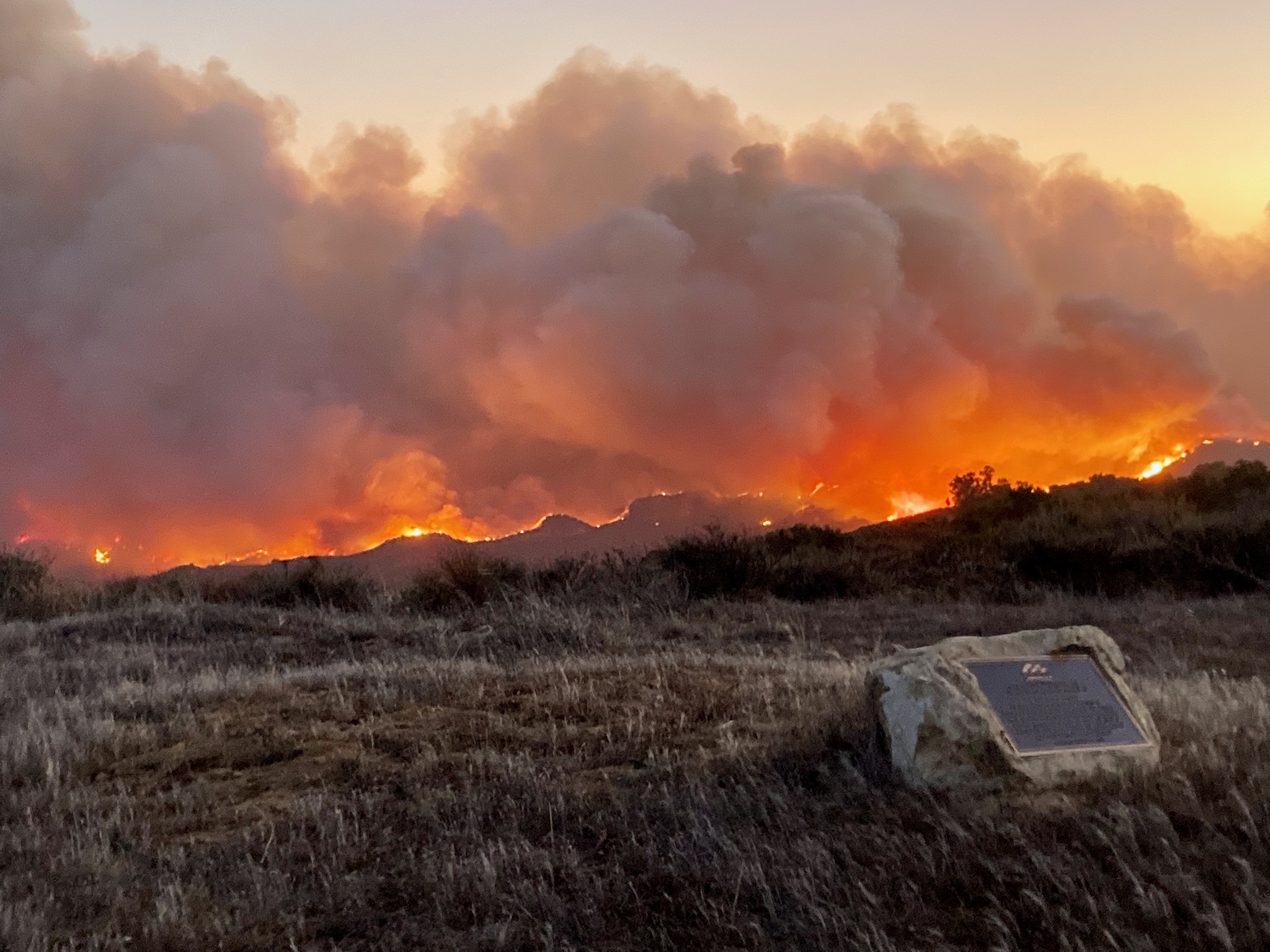
Fire is currently at zero percent containment. Winds are expected to reach up to 70 miles per hour overnight, and aircraft help is currently grounded due to wind concerns. According to OEM, nearly 100 structures could be affected if the fire reaches the top of Tajiguas Canyon; dozers are currently cutting a line at the top of the fire.
[Update: Oct. 11, 6:55 p.m.] All staff have been evacuated from Tajiguas Landfill, according to Public Works spokesperson Lael Wageneck. Available to fire personnel are the site’s fire suppression equipment, hydrants, and water storage tanks that contain more than 300,000 gallons of water.
The fire is now estimated at 1,000 acres with winds reaching 30-35 miles per hour and may reach the ocean, said Captain Nikki Stevens with the Santa Barbara County Fire Department, though Goleta is not expected to be threatened.
[Update: Oct. 11, 5:54 p.m.] The Alisal Fire just hopped Highway 101 northbound lanes, setting parts of the center divider on fire, reported Captain Nikki Stevens of the Santa Barbara County Fire Department. The highway is now closed in both directions, with southbound drivers detoured at Highway 1 south of Buellton and northbound drivers diverted at Winchester in Goleta. Traffic can take State Route 154, also known as the San Marcos Pass, with the exception of trucks carrying hazardous materials.
Approximately 50 structures are threatened by the fast-moving fire, which minutes ago was in the foothills but now is reaching for the sea. It has moved past Tajiguas and the county’s landfill facility there, and should it reach Refugio Canyon, approximately 150 structures are in the fire’s path.
[Update: Oct. 11, 5:30 p.m.] Cold, dry sundowner winds continue to drive what is now called the Alisal Fire to the south and east, as firefighters from Los Padres National Forest and Santa Barbara County Fire fan across several canyon roads on structure defense, said Captain Nikki Stevens, spokesperson for County Fire. The fire was currently moving above Tajiguas, Stevens said, and had reached about 600 acres.
The fire started near the Alisal Reservoir on the Santa Ynez side of the mountains this afternoon, Stevens confirmed. Both Refugio Road and the road to the state beach are now closed. Deputies from the Sheriff’s Office and members of Search and Rescue are going door to door to ensure that residents are notified of the mandatory evacuation order. Roughly 200 people live in Refugio Canyon, said Stevens, and large ranches lie more sparsely to the west.
The fire was burning fast and erratically, Stevens said, in areas very remote from accessible roads. They were anchoring and flanking the fire, getting at areas of opportunity to quell any retreat, she said, but staying away from its path for safety’s sake. “We’re not putting anyone in front of it,” she said. “This hasn’t burned since 1955.”
[Update: Oct. 11, 5 p.m.] To receive assistance with animals under evacuation, call County Animal Services at (805) 681-4332. Earl Warren Showgrounds is receiving livestock. Visit Santa Barbara County Sheriff’s Office Twitter feed for evacuation updates.
[Update: Oct. 11, 4:30 p.m.] An evacuation order was issued for Arroyo Hondo, Tajiguas, Arroyo Quemada, Refugio State Beach, and the canyons above them, at around 3:30 p.m. The fire is moving both to the east and to the north, as it crested the ridge and is headed down the Santa Ynez side.
An evacuation shelter is being set up at Dos Pueblos High School (7266 Alameda Avenue, Goleta) by the Red Cross, said Kelly Hubbard, head of the county’s Office of Emergency Management. Horses and cattle are in the canyons, she said, and Animal Services is working on a shelter for large animals. More information and an interactive map is at ReadySBC.org.
Fire crews are trying to reach the area, which is in rough terrain west of Refugio Road. Aircraft were grounded due to the wind, said County Fire Chief Mark Hartwig, and the fire has the potential to reach 500 acres. These canyons appear to have not burned since the giant Refugio Fire of 1955, which swept across the mountaintops, eventually burning from the Gaviota Pass to the 154. The Sherpa Fire of 2016 was just to the east of Refugio.
[Original Story] A brush fire is burning on the ridge above the Alisal Ranch, but on the Santa Barbara side, according to a report from the Santa Ynez Airport. It started at about 2:30 p.m. amid winds blowing from the northwest at 30-35 mph, and the acreage burned so far is estimated to be about 50-100 acres, said Andrew Madsen, spokesperson for Los Padres National Forest.
A full brush response is headed for the fire, Madsen said, and air tankers have been ordered. According to Edhat, evacuation warnings were issued for Arroyo Quemada, Arroyo Hondo, and Refugio.
The winds kicking up in Refugio are part of a large system affecting much of southwest California that is expected to last through 3 a.m. on Tuesday. So much dust was raised in the Antelope Valley that State Route 138 through Lancaster was closed due to poor visibility. The National Weather Service anticipates winds of 30-50 mph along the coasts and in the valleys, with peak gusts of 50-70 mph in the mountains and the Antelope Valley.
This report will be updated as information becomes available.
Support the Santa Barbara Independent through a long-term or a single contribution.


You must be logged in to post a comment.