


For years Santa Barbara had a geologic wonder that was talked about and visited called “Castle Rock.”
In the “old days,” the bluffs on the beach below Santa Barbara extended to what are today Castillo and Cabrillo boulevards. At this point, there was beach sand and the 50-foot-high bluffs called “Fossil Hill.” A mile farther to the west was the artifact called Castle Rock. At that time, all of the bluffs were exposed to the blast of the surf, just as they are today below the Shoreline Park area. This site was occupied in antiquity by native people who left behind their stone artifacts and burials along the bluffs. The site was referred to as Mispu, “the place of the hand.”
However, before the Rock, this 300-foot projection, or point, out into the sea was witness to other events in local history.
Our story goes back to the founding of Santa Barbara in 1782. In 1781, the Spanish government initiated its last expedition to “Alta California” to fill the gap from San Diego to Monterey with a presidio on the Central Coast. It was called the Moncada Expedition. As in the past two expeditions, there was an army ground component of settlers and a naval support fleet for the expedition.

The naval flotilla in this expedition was composed of two ships, the frigate Princesa and the stores ship Favorita, commanded by Captain Martinez. These left the Spanish 10th Naval Base at San Blas, Mexico, to supply the presidios at San Francisco and Monterey ahead of the land expedition. Sailing south, they were to meet the land expedition somewhere along the central coast. They were to conduct land surveys and help decide just where the new presidio was to be located.
The land expedition, accompanied by Governor Neve, arrived on the Central Coast in April 1782, ahead of the naval units. After surveying the coast from Goleta to Santa Barbara, Governor Neve made an executive decision to place the new presidio at the Santa Barbara location.
To waylay the fleet, a flag was erected on “the point” and fires were lit to let the fleet know just where the land expedition was. The fleet eventually arrived four months later, in August. The Governor ordered the Captain to conduct a survey from Point Conception to Santa Barbara in order to have a record to support their decision for the location of the presidio. The ship’s pilot was assigned this task. This map, called the Pantoja Map after the pilot, is the earliest of the Central Coast. It shows “the point” with the flag. This point was named in honor of the flotilla’s captain, Don Esteban Josef Martinez.
The Point was in the history news again in 1792. The British sent Captain Vancouver to explore the west coast of America and to inspect the Spanish holdings there. An overall comment he had about the defenses, published in his book of his trips, is that they lacked coastal defenses at the harbors. In particular, he saw a need for a redoubt on the Point in Santa Barbara, so the beach below could be defended from pirate landings. The Spanish heard about these recommendations and soon sent the Royal Corp of Engineers Alberto Cordoba, who designed the castillos that were then built at the four presidios. At Santa Barbara, a chevron-shaped bastion was constructed on the Point overlooking the shoreline. It was armed with four bronze cannons. A suitable flag marked the presence of the Spanish forces there.
In 1843, the French explorer DuFlot de Mofras visited California. He prepared maps of his observations at selected locations. In Santa Barbara, he drew the Point and showed the chevron battery built in the 1700s, and referred to it as “Batterie Ruinee.”
When the American army occupied Santa Barbara during the California Conquest in 1847, the troops inspected the Point. There, they found the battery abandoned and armed only with three iron cannons. It was then still possible to walk out to the end of the Point.
In the American Coast Survey of the Central Coast, drawn in 1853, the Point was still shown but the name was changed to “Point Castillo” on the official map.

Sometime after that map, things changed. The Point was shown in a drawing of Santa Barbara as a rock separated from the mainland by several feet. Apparently the tides and pounding surf drove an opening that separated the Point from the mainland. With it went the right wing of the chevron battery. The name “Castillo Rock” was now used to describe the site.
In 1886, county pioneer and banker Thomas B. Dibblee built his huge stone mansion with its overlooking tower on the back of the site of the Castillo Rock. The impression from all around was that of a “castle” on the hill — eventually, the name changed again to ”Castle Rock.”
Over the years, the Rock was a destination place to visit, to climb around on, or sit and stare out to sea when the tide was low. Otherwise, it was always exposed to the crashing surf. In time, a road was cut from the beach along the bluffs to the Rock and cut between the bluff and the rock so one could easily walk or go through with a horse and carriage to the other side and on to Leadbetter Beach. Visitors often searched for fossils and bones that stuck out of the eroding bluffs from the ancient Indian burials there.

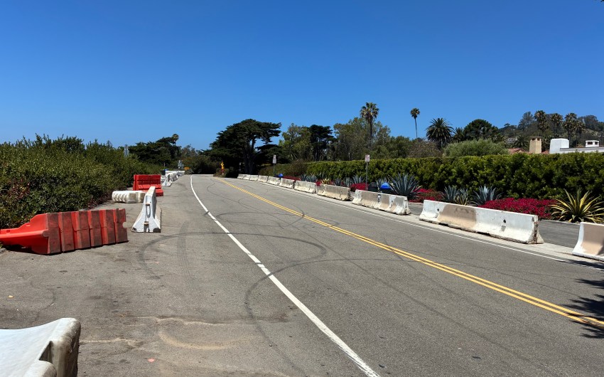
Enter Max Fleischman with his million-dollar yacht in the 1920s. When he visited Santa Barbara, he needed a safe place to anchor it from the attack of the weather and surf in the roadstead of Santa Barbara. To accommodate his needs, a plan was developed to build a breakwater, which began at Castle Rock, went out to sea a half-mile, and made a left turn to the east to enclose a harbor around the yacht. These actions led to the demise of Castle Rock. For safety reasons, the Rock was blown up and used for fill. At the original site of the Rock were placed two concrete pylons marking the entrance to the harbor breakwater. So the famous Point and Rock disappeared from view and memory.
With the breakwater in place, a sand beach formed at what is today Leadbetter Beach. During the 1950s, Cabrillo Boulevard was pushed through to Leadbetter Beach by carving a roadway through the bluffs about 100 feet in from the surf line. With this action, the remaining wing of the Castillo chevron was removed as well as the Indian burials. Eventually, the seaward bluffs were removed and used as fill for parking along the harbor. An aerial photograph from 1957 shows the new roadway and the old location of Castle Rock.
References: Gunpowder and Canvas, by Justin M. Ruhge, 1987; and The Military History of California, by Justin M. Ruhge, 2005.
About the Author: Justin M. Ruhge is a retired California Aerospace Program Manager, physicist, and engineer. Over the past 30 years, he has published 17 books on local, county, and state history specializing in military and maritime history, as well as many magazine and newspaper articles. He lives in Lompoc.
Related Posts


Premier Events

Fri, Jul 31
6:00 PM
Santa Barbara
Asian American Film Series (Closing Night)

Fri, Jul 31
6:00 PM
Santa Barbara
Fiesta Paper Flowers Workshop

Fri, Jul 31
7:00 PM
Santa Barbara
Santa Barbara Rodeo

Fri, Jul 31
7:00 PM
Santa Barbara
Beth Amine’s Wildcat Dance Variety Show

Fri, Jul 31
8:00 PM
Santa Ynez
Rock Icon Rick Springfield at Chumash
Sat, Aug 01
10:00 AM
Santa Barbara
Community Archive Day

Sat, Aug 01
10:00 AM
Carpinteria
Carpinteria Arts & Crafts Faire

Sat, Aug 01
11:00 AM
Santa Barbara
Ortega Park BackPack Distribution

Sat, Aug 01
5:00 PM
Santa Barbara
2026 Old Spanish Days Fiesta

Sat, Aug 01
7:30 PM
Santa Barbara
Samuel Adams & Sibelius
Fri, Jul 31 6:00 PM
Santa Barbara
Asian American Film Series (Closing Night)
Fri, Jul 31 6:00 PM
Santa Barbara
Fiesta Paper Flowers Workshop
Fri, Jul 31 7:00 PM
Santa Barbara
Santa Barbara Rodeo
Fri, Jul 31 7:00 PM
Santa Barbara
Beth Amine’s Wildcat Dance Variety Show
Fri, Jul 31 8:00 PM
Santa Ynez
Rock Icon Rick Springfield at Chumash
Sat, Aug 01 10:00 AM
Santa Barbara
Community Archive Day
Sat, Aug 01 10:00 AM
Carpinteria
Carpinteria Arts & Crafts Faire
Sat, Aug 01 11:00 AM
Santa Barbara
Ortega Park BackPack Distribution
Sat, Aug 01 5:00 PM
Santa Barbara
2026 Old Spanish Days Fiesta
Sat, Aug 01 7:30 PM
Santa Barbara

You must be logged in to post a comment.