Will The Backcountry Trails Be Opened Soon?
Backcountry Experts to Share Information about Trail Conditions on March 10
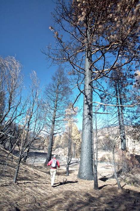
Forest rangers and backcountry trail monitors from Los Padres Forest Association will present a picture of conditions in the backcountry areas scorched by last summer’s wildfire this Monday night at the Faulkner Gallery. The program will begin at 7pm, with a slideshow and presentations by the Santa Barbara and Santa Lucia wilderness rangers as well as Forest Biologist Kevin Cooper, who will share information about the fire’s impact on the wildlife.
Burning from the west end of the San Rafael Wilderness over more than two months to the east end of the Dick Smith Wilderness, almost every backcountry trail was either completely burned over or sustained major damage. As a result, both wildernesses were closed to public use last fall and have still not reopened. With the help of the trail monitors, the Forest Service has been gathering information over the past several months in an effort to determine which, if any, of the trails are safe for public use. Complicating matters, not only has the area received a higher-than-expected amount of rainfall but January’s huge snow storm caused a great deal of damage.
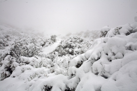
“It was like a one-two-three punch,” Paul Cronshaw, a local school teacher and leader of the Lite Packers who are checking out conditions in the deepest reaches of the wilderness areas explained to me. “After the first rains, many of the drainages started to get choked up with silt and debris. After the second set of storms, many of the trails became almost impassable due to the loose soil sliding down the hill and the gullies that were starting to form. Several of us were working our way down to Santa Cruz Guard Station from the top of Little Pine to see what conditions were like down there. We got by a huge oak that was laying across the trail, scrambled down an eight-foot deep gully not too far beyond that but when we got to another section that had 4-5 gullies one after the other, we knew it was time to head back up the trail. Then, not too long after that we had the snow storms. Oak limbs were down everywhere. Chaparral brush was down on the trail. It was really tough to get anywhere.”
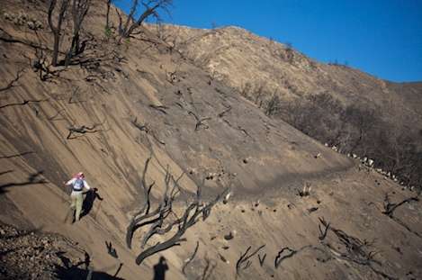
Rik Christensen, another of the Lite Packers put it a bit differently. “It’s a whole new ball game,” he told me. “It was taking us 2-3 times the amount of effort to get to places that had been easy not too long ago. It wasn’t just the brush but the creek crossings, the places where we couldn’t find the trail, the spots where we’d see the trail but because of all of the damage, the effort we’d need to make to get around the bad spots.
Kerry Kellogg, wilderness ranger for the Santa Barbara District, wonders if he’ll be retired before conditions return to pre-Zaca Fire days. “It’s scary out there,” he says. “We’ve got a lot of information coming in that tells us what things are like, and not much of it is good. But some of it came in before the first storms. Other monitoring projects gave us a better picture of what conditions were like after the late falls storms, and some of the data has gotten to us after the second rain storms. Then the snow created a whole different set of conditions. Even the most hard core of our lite hikers are telling us it isn’t safe out there. We’ve also got hazard trees out there that have been severely damaged by the fire that we know will fall in a year or two. Some of them came down during the snow storms and others will probably drop in the next big wind storm. A few of them we can get to by car and take care of but most of them are way out in the wilderness where they’ll come down when they’re ready to. Conditions out there are changing day by day.”

On a personal note, I have been a part of the trail monitoring program throughout the winter and I can echo these concerns. In October, on my first trip through the burn area I was amazed at how intensely the fire had burned, particularly in a 5-10 mile wide swath that took the fire across the Santa Cruz, Buckhorn, Indian, Alamar and Mono watersheds. Driving up towards Little Pine Mountain it was difficult to gauge what had burned but once over the Little Pine crest the scene was breathtaking: huge expanses burned to mineral soil in all directions. Moving on to a small backcountry guard station called Bluff Camp we separated into small groups with each taking a different part of the burn area to explore.
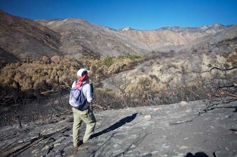
Rik and I headed west out the Grapevine Trail. At first we were sort of amazed at how open things were. “It was like being opened onto a new world,” Rik told me. It looked like we could go anywhere because there just wasn’t any brush to stop us. A half mile into the journey we decided to make our way down Santa Cruz Creek to see how much of the riparian area had burned. “It was pathetic,” Rik added. “Only in the narrowest sections of the canyon were any of the trees still alive.” Sensing that we could head up out of the canyon and over a ridge to a historic overnight spot known as Pelch Camp we headed up onto the top of the ridge. The hiking was easy and the views spectacular. However, as we headed back to Bluff on the Grapevine Trail the first sense of foreboding hit both of us at almost the same time: at first, we couldn’t find the trail. Loose rock had covered almost all of it and just the bare outside edge was visible. We hadn’t even had any rain at that point and gravity alone was covering the trail. What would it be like after a few winter storms hit the area?
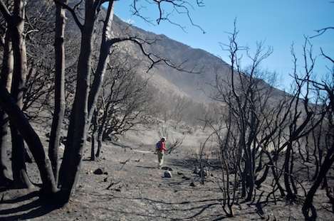
The following day Rik and I headed down another wilderness trail – this along Alamar Creek in the Dick Smith Wilderness. I’d done the hike three years ago with Paul and it was a tough one with brush choking the trail all the way. By the end of the day I was beat. But this time the hike was a piece of cake, the trail easy to find with the chaparral totally removed. But just below Bill Farris Camp we experienced another of those moments of foreboding: on one of the steep sections the trail was totally gone and to continue on we’d need to make our way over a hundred yards of total loose stuff with a 300 foot drop below us. Unnerving to say the least.
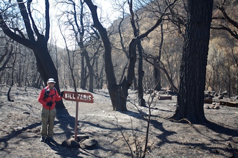
“We’re probably looking at twenty miles or more of trail like this,” Kellogg said after the trip. “We’ve got a lot of this mid-slope type trail and with all of the hillsides burned off above them, the rock and sand is sliding down the hill pretty fast. We may not even be able to see where the old trails go in some places. They’ll just be covered with too much stuff.”
If you’d like to find out more about current trail conditions in the backcountry, join us Monday night. Paul Cronshaw and I will be showing slides taken this winter, Kevin Cooper will be making a presentation on wildlife issues and rangers Kerry Kellogg and Dave Weaver will be there to give us an idea of when things might reopen again.


