

As the trip drew closer, I was getting more impatient to get out on the trail. The idea of seeing the impacts of the Zaca Fire on the Sisquoc River was important to me. As a wild and scenic river and one of the more remote parts of the Santa Barbara backcountry, the Sisquoc is a special place. Historic home of the California condor, location of a number of pioneer settlements and some of the finest wild country, I was worried the damage might be more than I could bear.
More importantly, this was my first true ultralight backpack trip – one in which I’d committed myself to get my base pack weight down below 10 pounds. I was excited to see how things would go. The trip wasn’t a long one, just four days and perhaps 20 miles, but a number of unknowns faced us.
First, we were about to head through sections of the San Rafael Wilderness that hadn’t been checked out yet. We had no idea how difficult it might be to get through, how many obstacles we’d face or how difficult the route finding might be.
Second, I wasn’t sure if my UL pack would be up to the task if we needed to do any serious bush whacking or how I’d handle using equipment that I’d only tested casually before the trip.
OUR ROUTE INTO THE SISQUOC was pretty straight forward: from the crest of the Sierra Madre Mountains we would hike down Judell Canyon to the upper Sisquoc and then follow the river downstream from Heath Camp, past South Fork to Sycamore Camp where we would meet a backcountry trail crew that was working on trail repairs in an area called Forrester’s Leap. Then it would be up the Jackson Trail to Montgomery Potrero where we hoped to find one of the Forest Service support crew who would be willing to drive us back to our car near the top of Judell Trail.
With me is Rik Christensen, godfather of going lite in our local backcountry. He’s also an important part of the Los Padres Forest Association’s trail monitoring program and has explored quite a few other trails since the fire last summer.
Rik is giving my pack a final check before we head down the Judell Trail. With four days of food inside it’s less than 20 pounds total and he’s happy with that but he senses I can distribute the weight better. I’ve got my Thermorest pad folded up inside a stuff sack. “Let’s take it out and fold it in thirds and place it against the inside back of the pack,” he says. “That way you’ve got more padding and can leave the stuff sack behind.”
The Mariposa Plus pack I’m using form Gossamer Gear fits my back well and its light, weighing just a bit over a pound and a quarter but it lacks the structure to keep things comfortable if you don’t pack it well. “Let’s get your sleeping bag, down jacket and rain gear down low to cushion the bottom of the pack,” Rik explains, “then put the food and cook gear on top where it will fit right into the small of your back.” That helps puts the heavier part of my load just above my butt and help keep the weight off my shoulders.
After that the clothes bag goes on top of that along with first aid supplies and a few other odds and ends I want easy access to.
FINALLY WE’RE READY to get on the trail. I hoist the pack and am amazed how easy it is to get up and on. If you’ve been on those trips where you need to lift your pack on a knee to get one strap over a shoulder then grunted as you launched your pack up and around behind you and bent over to keep it in place on your back as you struggled to get the other strap on – you know what I mean.
Ray Jardine, whose book Beyond Backpacking introduced the concept of going lightweight in the early 1990s is an advocate of keeping your pack light enough that you can carry it over your shoulder like a handbag. My pack isn’t light enough for that mode of travel but surprisingly, I barely feel it on my back.
We’re off! Both of us have carbon fiber trekking poles that weigh hardly anything. Rik doesn’t go anywhere without his poles and I’m finding out why. Not only do they give you a bit of a push on the uphills, but using them makes it much easier on the knees going downhill. Plus it turns your pack trip into a full body workout too.
Judell Canyon is named after a turn-of-the-century ranger by the name of Judell Samon. Apparently his service was valued enough that both the canyon and a nearby mountain (Samon Peak) were named after him. The trail meanders down a small side canyon and after a mile or so as additional side canyons join in we find ourselves deep inside the wilderness.
The Sierra Madre side of the backcountry is the drier side, meaning that the vegetation is a bit more sparse, pinyon and juniper country, deciduous oaks and further down scatterings of a tall connifer known as Big Cone spruce. The cones are actually tiny, which seems odd given its name, but forest taxonomy often has such peculiarities. The big cone descriptor has been attached simply because its close cousin the Douglas fir has an even smaller one, making our variety the bigger coned of the two.
RIK LEADS THE WAY down canyon and I follow. Ever the photographer (and never the subject) I get him in the scene wherever possible.
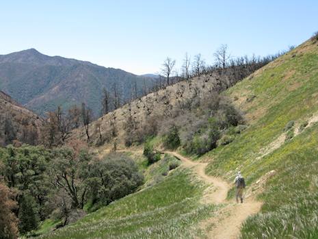
The trail is great, despite the fact that we are surrounded mostly by burned and blackened hillsides. Judell Canyon was hit hard by the Zaca Fire and the signs of this are everywhere. Only down in the deeper parts of the canyon have the oak trees escaped the flames.
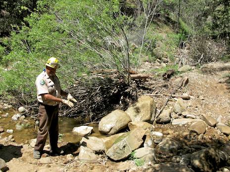
The reason for the trail’s condition is that we have a CCC crew in front of us working the trail. CCC is an acronym for the California Conservation Corps, a program designed to get 18-to-25 year olds the opportunity to learn valuable life skills, while providing trail building and environmental conservation work in the backcountry.
We are loving the work the crew has done and share our appreciation with them when we come to a small creek crossing that has washed out several miles downstream. While several of the crew are working a hand winch to move boulders up into place to reinforce the creek bank, others are busy rebuilding the crossing.
After a few minutes chatting, more thanks for the work they’ve accomplished, a sip of water and a snack, we’re on our way again. Barely five minutes later we come to the end of the CCC efforts and I’m amazed. Behind us, the trail has been easy to follow and in excellent condition; ahead of us the trail disappears in a jumble of washouts. This only serves to heighten our appreciation of how much work it took to rebuild the upper part of the trail.
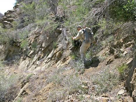
Thus far the pack has served me well. It is comfortable, I’m not feeling the weight much and most of all, it has been easy on my feet. However, as we head into the lower canyon where there is little tread left, numerous down oaks and lots of small gullies to cross, having the lightweight pack and my trekking poles are a life saver.
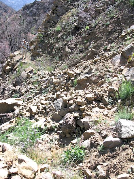
THE GOING IS TOUGH. A good part of the lower canyon is rocky and steep. At places the trail hugs the canyon walls several hundred feet above the creek and a slip could be disastrous. We reach one side canyon that has a five-foot-deep gully carved into it that is difficult to cross, especially given the distance we’d travel if we slid down the gully.
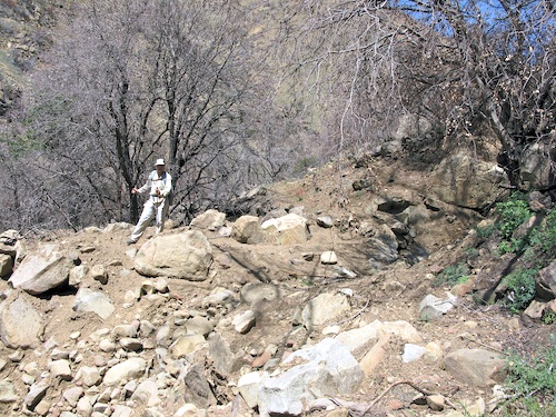
Further down there were more washouts, sections where the trail was difficult to find and one more gully with a sheer dropoff that required us to detour a hundred yards up and around to get by. I reminded myself continuously how difficult the trip would have been with a 35-40 pound pack to lug down the trail. Rarely was there any smooth tread. Most of it had been filled with dirt and rock that had slumped down on the trail, making the footing treacherous and the going very slow. This is not where I’d want to twist an ankle.
You’d almost think by the description that we weren’t having any fun, but the opposite was true. First, I’m a sucker for an adventure and we were in the midst of a Grade-A epic. None of the Forest Service people had been this far down the trail yet and it appeared no one else had either. Nor had anyone been down the Sisquoc from Heath Cap for sure.
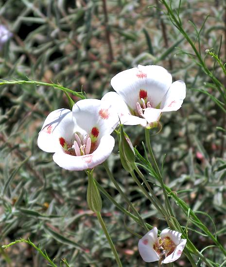
But mostly, the reason Rik and I were in heaven was because of the wildflowers – the fire followers that bloom by the thousands after a major wildfire. There were poppies, lupine, popcorn flowers, chia, monk’s hood, fiddleheads – acres of them – rich with color, covering the trail and the hillsides. While the going was slow, the rewards in having more time to enjoy the beauty made the rest of the hike down to the confluence with the Sisquoc one of the great treats I’ve had the pleasure of experiencing in the backcountry.
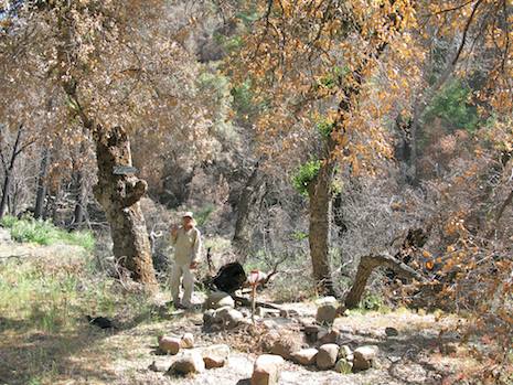
We reached Heath Camp about 2 p.m. Heath is a small camp, often used by horse packers on their way up or down the Sisquoc. Much of the camp has been burned out, but several of the big oaks that shade the camp area were still intact, which was encouraging though many of the nearby trees were black enough that it was difficult to judge whether they’d make it through the next few years or not.
After a short siesta we were on the trail again, our destination for the night an even smaller camp known as Mansfield. We were on the Sisquoc and feeling good.
——————————
Next: Rik and Ray head down the Sisquoc to the South Fork, one of the major outposts in backcountry history.


