

The Basin Complex and Indians fires are scorching large swaths of the Los Padres National Forest in Monterey County and threatening the quaint and historic community of Big Sur. This is the cause of the smoky skies seen over Santa Barbara in the past week, and sure to be the cause of more brown skies in the days and weeks to come. These are just two of the more than 1,000 fires estimated to be burning throughout California early in this dry summer season, and anyone who’s flown over the state in recent days knows that the entire Golden State is coated in a thick, brown atmosphere.
To date, the Indians Fire, which began on June 8 from a smoldering campfire in the wildlands near Fort Hunter Liggett and west of King City, has burned nearly 60,000 acres, two homes, and more than one dozen smaller structures. The fire, which has caused injuries to 16 firefighters, is currently threatening another 500 buildings, 422 of which are homes. Expected containment is July 3, and it is currently 80 percent contained.
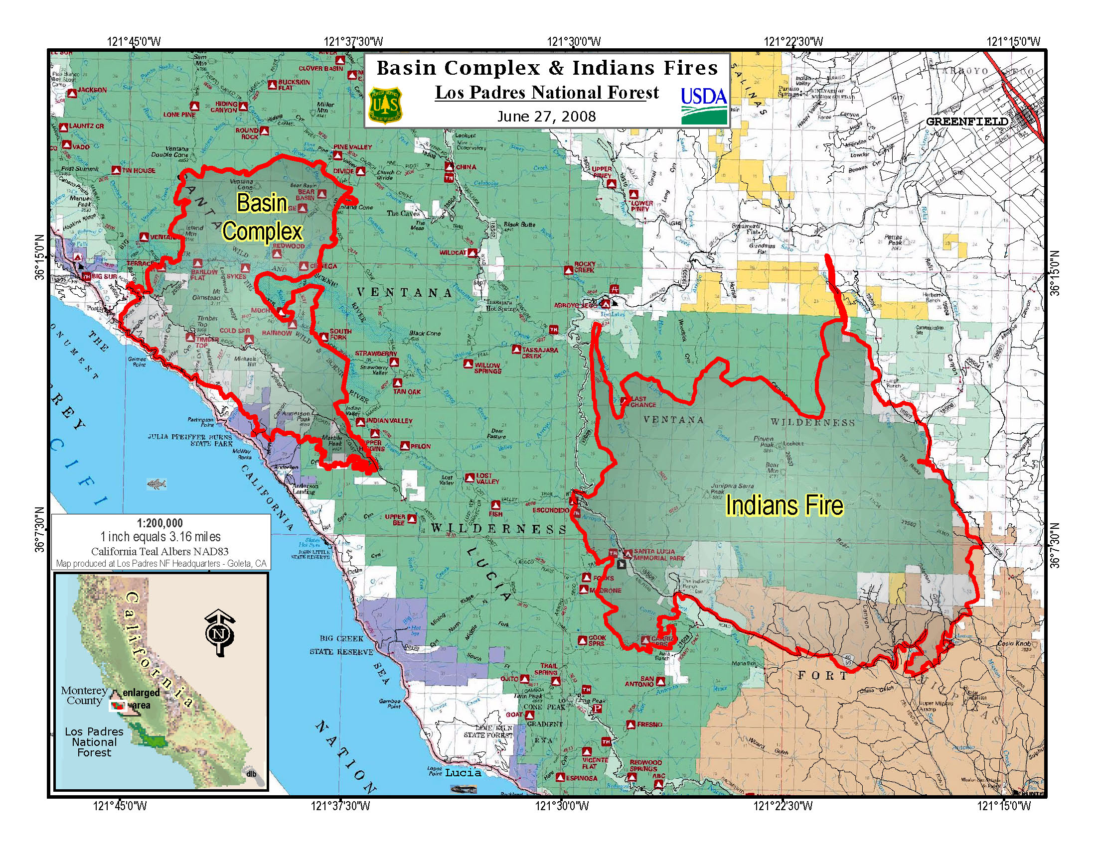
Closer to the coast and more to the north, the Basin Complex Fire – which was sparked by lightning on June 21 and merged with the Gallery Fire last week- has burned nearly 27,000 acres. It is only three percent contained, and has already burned 16 homes, with another 575 residences being threatened. Highway 1 is closed between the famous Nepenthe Restaurant and Big Creek State Reserve and more than 800 firefighters are working to ensure that the fire does not reach the community of Big Sur to the north. Numerous mandatory and advisory evacuations have been issued.
The Independent‘s outdoors editor Ray Ford, whose expert coverage of last year’s Zaca Fire was applauded by many in the community, is currently en-route to the region and will be filing his reports soon.


