La Brea Fire Doubles in Size Overnight
Fire Burns in Remote Part of the Backcountry with Little Threat to Structures
Gusting winds continued through the night on the La Brea fire line, expanding the number of acres burned from 1,300 to more than 2,500 acres. “The fire seemed to want to burn in all directions,” fire information officer Vicki Collins said. There is no word of exactly how far the perimeter has expanded yet, but Collins said that the weather forecast calls for light winds coming out of the west today.
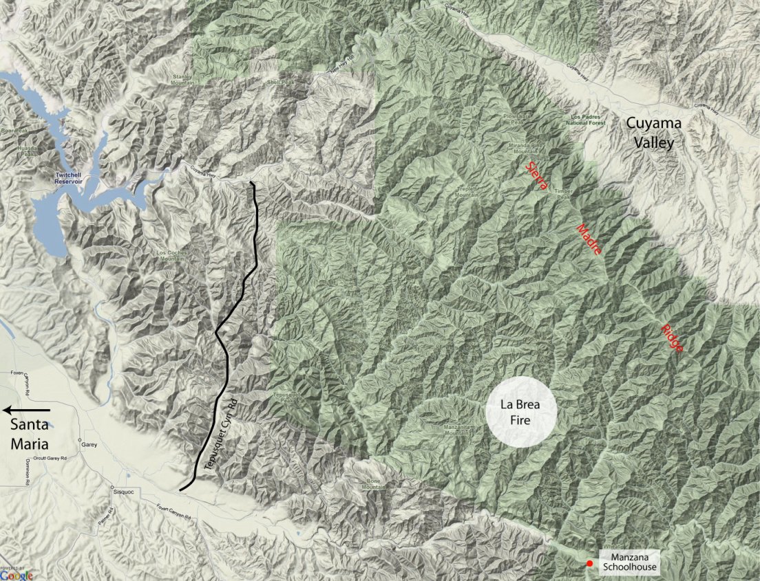
If the forecast holds, this will be good news to those who live in the Tepusquet area, but perhaps not so good news for wilderness enthusiasts. Immediately east of the La Brea Canyon area where the fire is burning is Horse Canyon and from there it is less than five miles upstream along the Sisquoc River to Manzana Schoolhouse.
Los Padres Forest issued an emergency closure order in response to the fire, closing the forest from Highway 166 on the south, all of the Sierra Madre Ridge east to McPherson Peak, and to the south, portions of the San Rafael Wilderness down to the Sisquoc River. For now, the section of the Sisquoc from South Fork Station to the Schoolhouse will be closed to use, though Collins wasn’t sure if the Manzana Creek Trail would be as well.
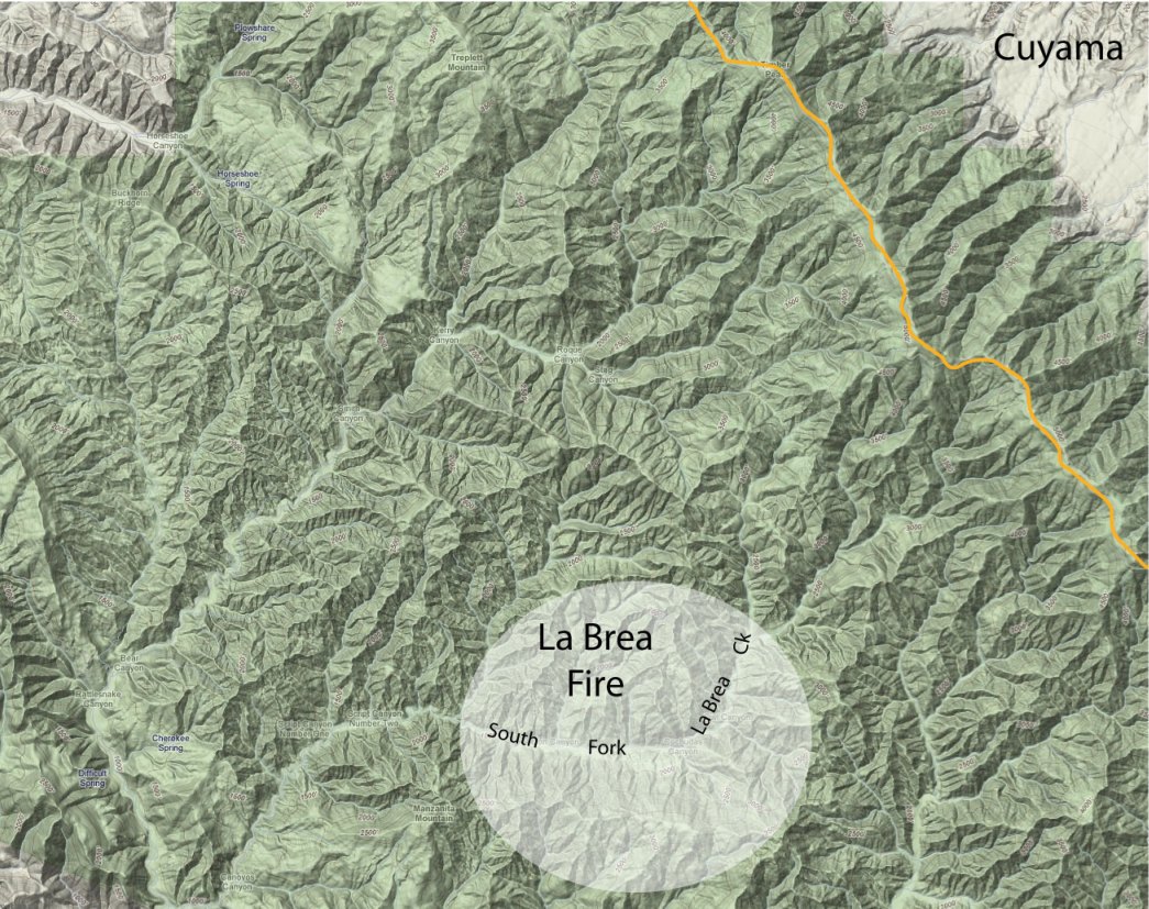
It appears that the La Brea Fire will be another of those fought more from the air than the ground. All of the area east of the fire perimeter is within the San Rafael Wilderness. This not only restricts the use of mechanized equipment but the steep terrain makes it almost impossible to create the type of anchor points and safety zones firefighters need before they enter on foot.
While there are no roads within a mile of the area where Forest Service officials believe the fire started, the origin appears to be somewhat near a backcountry camp known as “Cuchadas,” which is located along the south fork of La Brea Canyon. Historically, the route has connected La Brea Canyon, the Sierra Madre Ridge, and the Schoolhouse area via a network of trails, though in recent years the trails in this area have been so overgrown as to be almost impassable.
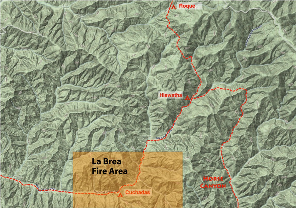
Though there is still no word of the fire’s cause, it should be noted there were no reports of lightning in the area, today was to be the official start of hunting season for portions of the area, and that many of the camps in the area were filled to capacity with those waiting for the season to begin.

