

From August 12 Morning Update, Los Padres National Forest California Interagency Incident Management Team 3/CAL FIRE
Acres: 25,724
Personnel: 1,277
Containment: 10%
Start Date: Aug. 8, 2009
Last night (Tuesday), strong winds of 45-50 mph pushed the fire west toward Treplett Mountain. The winds also enlarged the slop over on the east side of the fire above Cuyama Valley, but the fire remains on the National Forest. The Santa Barbara Sheriff’s Evacuation Order remains in effect in portions of Cuyama Valley. Yesterday and last night, good progress was made with burn out operations to secure the north side of the fire along Sierra Madre Ridge. Additional firefighting resources continue to arrive. La Brea Fire is now under Unified Command including the U.S. Forest Service and CAL FIRE.
Firefighting conditions remain difficult due to the steep and inaccessible terrain, dry dense chapparal, low relative humidity, and erratic winds. Extreme fire behavior has been observed since the fire began. The northeast portion of the fire area has not burned since 1922. The fire has not entered the Sisquoc River area. There is significant fire suppression vehicle traffic and congestion on Highway 166. The public is urged to seek an alternate route and to use extra caution when traveling the highway.
A community fire information meeting will be held tonight at 6:30 p.m. at the Benjamin Foxen Elementary School, 4949 Foxen Canyon Road, in Sisquoc.
Current Situation: The fire is now estimated at 25,724 acres. Today, firefighters will focus on securing fire line around the slop over above Cuyama Valley, opening and reinforcing dozer lines on the west side of the fire, and building fire line along the east side of the fire above Horse Canyon. Three heli-bases now support the fire, one at Santa Ynez Airport, one at Santa Maria Airport, and a supply helibase at the Incident Command Post. A retardant base is located at Spanish Ranch in Cuyama Valley.

Weather: The weather continues to be mostly sunny, hot, and dry with highs of 84-92 degrees along ridgetops and 92-98 degrees in the valleys. Wind gusts today may reach 20-25 mph on the fire.
Evacuations: Effective at 2 p.m., Tuesday, August 11, 2009, an Evacuation Order was issued by the Santa Barbara County Sheriff’s Office for the following areas due to fire activity of La Brea Fire:
– Western Boundary: Sierra Madre Road;
– Southern Boundary: Cottonwood Road;
– Eastern Boundary: Highway 166;
– Northern Boundary: Spoor Canyon.
This area includes Moon and Eckert Canyons. An Evacuation Warning exists for areas bound by Cottonwood Road and Wasioja Road, and between Highway 166 and Sierra Madre Road.
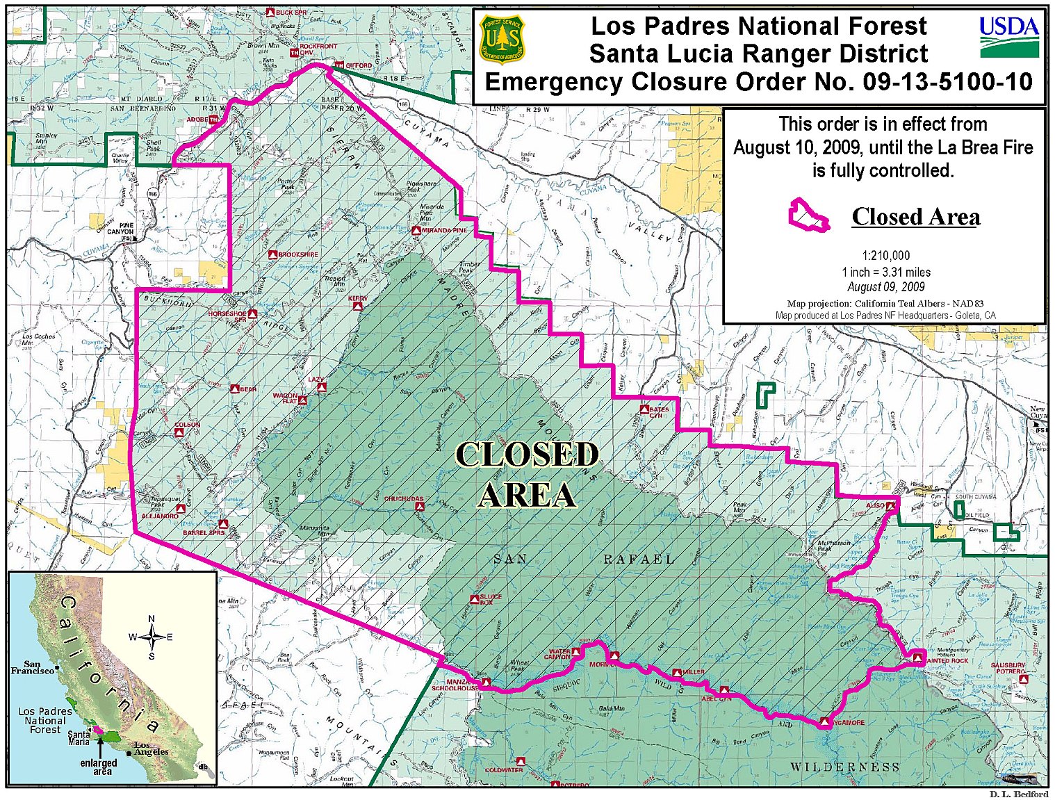
Closures: An emergency closure order is in effect for portions of the Los Padres National Forest in and around the fire. For more information, please contact Fire Information at (805) 961-5770 from 6 a.m.-10 p.m. or http://www.inciweb.org/incident/1803/.
Flight Restrictions: Temporary flight restrictions have been put in place over the fire area.


