La Brea Wednesday Update
Containment Improving but Wilderness Burns
Containment is now complete on all fire lines outside the wilderness. Last night crews continued to hold and mop up 300 feet inside the contained line. Within the wilderness, extreme burning conditions will challenge crews today. The fire may continue to put up plumes of smoke due to islands of brush in the interior of the fire igniting and making uphill runs. These flare-ups are not a threat to the established containment line.
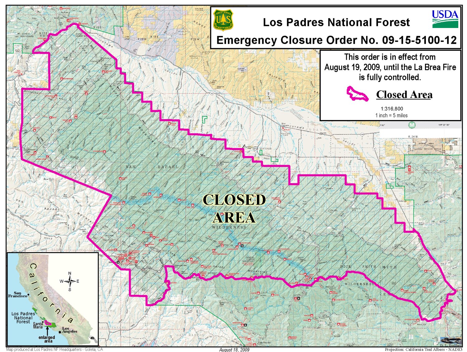
Due to the fire emergency, effective today, the Forest Service is expanding the closure area of forest lands on the southeast side of La Brea Fire.

Last night, firefighters spotted a bear cub on Tepusquet Road. Elsewhere, a mountain lion was seen.
Day Operations Plan: Today’s focus will be containing fire within the wilderness. Eight hotshot crews will work in this steep, rugged terrain supported by air operations. Crews will also focus on fire suppression rehabilitation, including addressing impacts to private land. Suppression rehabilitation efforts will also focus on building water bars, and placing dead vegetation back on indirect firelines to reduce risk of erosion due to rain.
It will be mostly sunny today, with some areas of smoke. Temperatures will be 82-92 in Branches 1 and 3 and 88-98 in Branch 4. Ridgetop winds will be north to northeast at 8-14 mph with local gusts to 20mph, becoming west to northwest after 1 pm. Slope/valley winds will be variable at 4-8 mph becoming upslope/upvalley, 6-12 mph by afternoon.
Fire operations and incident management teams need to keep very aware of current weather conditions and be able to anticipate changes in the weather. In order to do this they use remote automated weather stations or RAWS. Portable RAWS stations are sometimes placed at fires on a temporary basis. La Brea Fire is currently using several of these sites, Fire RAWS 5, 6, and 7.
For additional information on RAWS sites, http://www.fs.fed.us/raws/
U.S. Forest Service Special Agents, the Santa Barbara County Sheriff’s Office, and fire investigators determined the La Brea Fire was caused by a cooking fire at an illegal marijuana drug trafficking operation within the forest. La Brea Fire Tip Line is still open, and anyone with additional information helpful to this ongoing investigation is urged to contact (805) 686-5074.
An emergency closure order is still in effect for portions of the Los Padres National Forest in and around the fire. For more information, please contact Fire Information at (805) 961-5770 from 6 a.m.-10 p.m.
Due to emergency vehicle traffic and congestion on Highway 166, the public is urged to use extra caution when traveling the highway.
Current Situation
Total Personnel: 1,505
Resources: 126 Engines, 56 Crews, 30 Dozers, 59 Water Tenders, 12 Helicopters, 5 Fixed-Wing Aircraft
Size: 89,015 acres
Percent Contained: 75 percent
Fuels Involved: Primarily chaparral with areas of grass and timber.
Fire Behavior: Due to successful suppression actions last night there was very little fire activity. There was some slow fire spread in the southern part of the fire near the top of the Sierra Madre Ridge where active backing and flanking occurred along isolated sections. Otherwise there was occasional activity well inside the current perimeter of the fire.
Significant Events: Crews continued to hold and mop up from Mazana Schoolhouse north toward the Treplett fuel break by Miranda Pine. Direct and indirect line was constructed on the east side by Schoolhouse Canyon down to the Sierra Madre Ridge.
Outlook
Planned Actions: Crews along the south flank of the fire will continue to search out hot spots along the fire line from Mazana Schoolhouse north to the Sierra Madre Ridge. New crews will be inserted via helicopter to help this effort. Over the rest of the fire, crews will patrol for smokes and continue to mop up 300 feet inside the perimeter.
Growth Potential: High
Terrain Difficulty : Extreme
Remarks: Fire is being managed under Unified Command with California Interagency Management Team 3 (commander Pincha-Tully), Cal Fire (commander Heil) and Santa Barbara County Fire Department (commander Schmitt). An evacuation warning is still in effect for the nine threatened residences on Wasioia Road in Cottonwood Canyon area. The two structures destroyed were a non-operational White Oaks Ranger Station and a hunter’s cabin to the east. Fire line constructed in the San Rafael Wilderness will be done using Minimum Impact Suppression Tactics (MIST).


