The recent closure of 138 square miles of fishing grounds impacted by the Refugio oil spill has prompted commercial fishermen based at Santa Barbara Harbor to initiate claims against Plains All American Pipeline, the owner of the faulty infrastructure that dumped more than 100,000 gallons of crude along the Gaviota coastline on May 19.
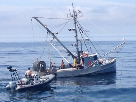
Several commercial fisheries — including lobster, crab, shrimp, halibut, urchin, squid, whelk, and sea cucumber, among others — have grounds in the closed area, according to lobsterman Chris Voss, president of Commercial Fisherman of Santa Barbara (CFSB), a nonprofit advocate for economically and biologically sustainable fisheries. “These guys have pretty significant, legitimate claims,” he said.
As of midday last Thursday, six of 51 total claims were submitted by commercial fishermen, according to a spokesperson with the Refugio Response Joint Information Center. Voss expects that number to climb as fishermen carefully assess the value of their lost time and take. “We would advise fishermen to be slow and deliberate when it comes to filing a claim,” he said. To field and facilitate claims, Plains All American Pipeline has a hotline at refugioresponse.com.
Voss said he was aware of two instances of game wardens warning fishermen for harvesting within the closed area. In both cases, neither boat was cited, according to Alexia Retallack, an information officer with the California Department of Fish and Wildlife, but a shrimper was forced to dump his catch back into the sea, as a public-health precaution. “Nobody has been cited as of this time,” Retallack said. “[Any contact between wardens and fishermen] is educational — we’re just letting fisherman know the boundaries and to pull their gear and leave the area. It’s not punitive.”
Citations would only add insult to injury, and while CFSB’s first concern is that the impacted marine environment return to health, Voss said, fishermen who target that region want to get back to work as soon as possible. “The intertidal area looks to have been hit the hardest,” he said, referring to the area between the low- and high-tide lines. “But the amount of oil in the open ocean appears limited. We’re interested in modifying the duration of the closure and its overall footprint. We’d like access to fishing grounds farther offshore.”
When that might happen is a matter of public safety. Using the omnipresent California mussel as the proverbial canary in a coal mine, biologists with the state’s Office of Spill Response and Protection need at least six weeks to harvest and test the edible bivalve mollusk for contaminants. Such analysis can reveal what’s happening in and around the surf line, but not so much in terms of deeper offshore waters, contends Voss, who’s hoping for a coordinated effort between scientists and fisherman for more comprehensive testing.
In the meantime, CFSB is also attempting to alleviate any concern that local seafood markets are stocked with fish and shellfish contaminated by the spill. They’re not, said Voss. “The closed area is adequate to protect the public from consuming contaminated seafood.”
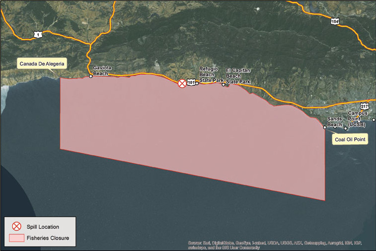
The fisheries closure — which prohibits commercial and recreational harvesting, both offshore and from the beach — initially went into effect on May 19, shutting down an area two miles wide and half a mile seaward. On May 21, it was amended by the California Department of Fish and Wildlife’s Office of Spill Prevention and Response to its current expanse, which runs six miles out to sea between Coal Oil Point to Hollister Ranch’s Cañada de Alegria.
For precise boundaries, visit the Fisheries Closure Map at refugioresponse.com.