

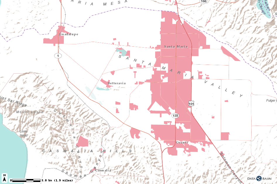
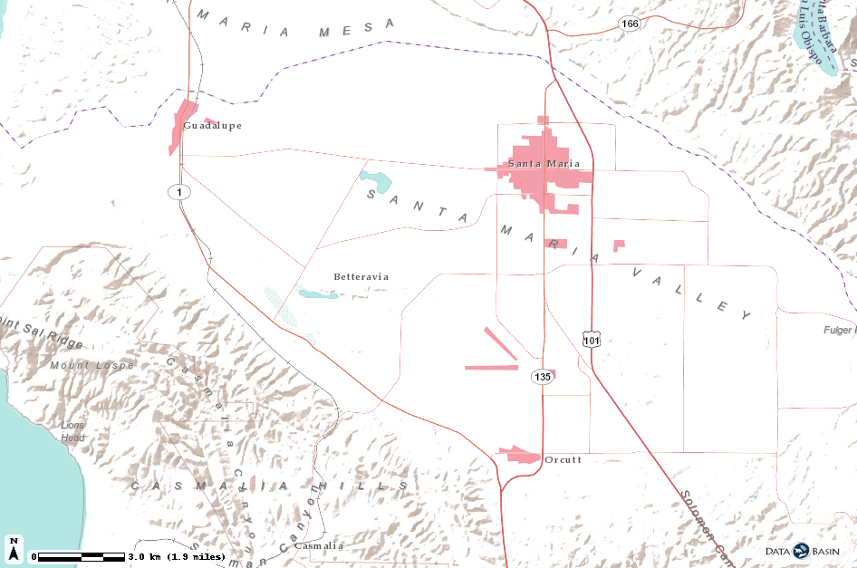
“The pink represents, basically, pavement.” Chet Work, executive director of The Land Trust for Santa Barbara County, is mousing over a map showing Santa Maria’s urban boundary in 1954. Back then, the city appeared as a tiny speck west of Highway 101. When Work flips to the same map in 2016, the speck has grown into a wide corridor reaching from one bend in the highway to another. “That,” Work says, “is a stark understanding of how our land is changing.”
The map highlighting Santa Maria’s growth is one of hundreds that a project called the Santa Barbara County Conservation Blueprint recently published online at sbcblueprint.net. The Santa Barbara Foundation, The Land Trust for Santa Barbara County, and The Cachuma Resource Conservation District partnered together on the initiative, guided by one giant question: As our population increases and the climate changes, how should the county use and protect its land?
Because the question intertwines with so many other issues — water access, soil conditions, and community needs, to name a few — the blueprint is multidimensional. For two years, the creators gathered information and input from different groups of stakeholders. Developers, ranchers, parks departments, and water managers agreed easily on some priorities, like maintaining agricultural areas and community access to outdoor space, but disagreed on others, like deciding what balance of conservation and development makes sense for the future. The blueprint isn’t anti-growth, Work said. It’s meant to inform growth. The atlas will help developers decide between two parcels of land — “which one’s a better park and which one’s a better apartment building,” Work explained.
Full of historic visuals, like a neat series of aerial photographs of Devereux Slough between 1954 and 2017, the website also features maps that highlight more recent data. There’s a hot-spot survey of population density and the layout of Santa Barbara’s power lines and oil wells. Other maps pinpoint where endangered species live and reveal concentrations of pesticide use and asthma cases.
The blueprint has already been put to good use. It helped the Land Trust and the Santa Barbara Foundation prioritize trail development in North County — mapping trails against population density revealed a scarcity of wilderness access around Santa Maria, despite community interest in exploring the outdoors. The maps also helped with grant applications for Federal Emergency Management Agency assistance after the Thomas Fire and debris flow. Said Sharyn Main with the S.B. Foundation: “Our eyes are opening to what it could be used for.”


