A meeting to discuss what to expect in the way of flooding or debris flow post-Cave Fire takes place Thursday evening at Direct Relief. Members of the Forest Service’s Burn Area Emergency Response (BAER) team and county flood and public safety officials will discuss the condition of the burn scar and what they are doing to prepare for and inform the public of winter storms that could impact downstream areas.
The meeting takes place December 19, 5:30 p.m., at 6100 Wallace Bicknell Road in Goleta.
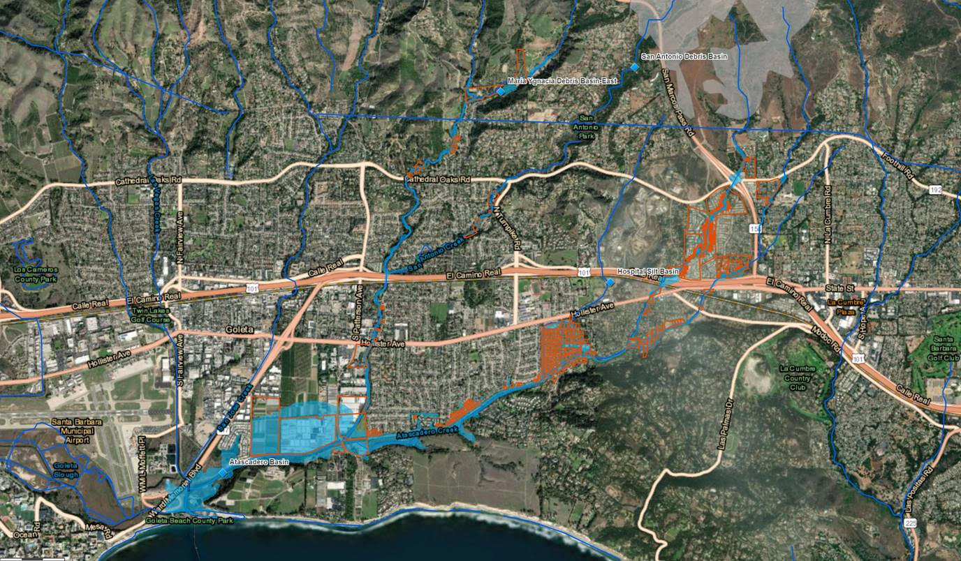
Should a winter storm pose flood or debris flow potential, public officials will warn residents. Possible next steps are evacuation, sheltering in place, or moving to higher ground. An interactive map into which the public can type their address to see where their home is in relation to the burn scar watersheds is at readysbc.org, as well as instructions on signing up to receive early warnings.