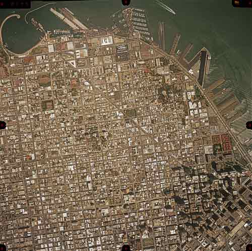
UCSB Snags Stunning Collection of Aerial Photography
Set Offers Bird's Eye View of Major U.S. Metropolitan Areas

The Citipix Collection, a series of more than 500,000 aerial images of 65 major U.S. metropolitan areas, has been donated to UCSB by the Santa Barbara-based Pacific Western Aerial Surveys. The collection, valued at more than $14.3 million, was taken by I.K. Curtis Services, Inc. between 1999 and 2002 and includes both the film negatives and the digitized images. Larry Carver, director of the Map and Imagery Laboratory (MIL) in UCSB’s Davidson Library, has been tracking the collection for several years and is quoted in a UCSB press release as saying, “This is a historic snapshot of the urban history of the United States at the turn of the century that includes major ports of entry, research areas, and coastal services that I have never seen done before at this resolution with aerial photography.”
Not only will this wonderful collection be an appreciated addition to the library, but Brenda Johnson, university librarian, expects that it will experience frequent use by “faculty, corporations, and government agencies.” These photos are extremely accurate because they are shot straight down, and will provide an invaluable resource for people from all disciplines ranging from geology, to history, to public health.
To see a sample of these photos, visit UCSB’s Citipix website.


