
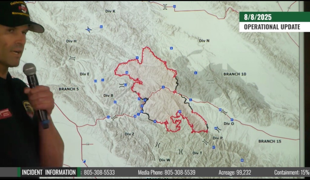
[Updated: Fri., Aug. 8, 2025, 5:07pm]
Containment of the Gifford Fire crept upward to 15 percent Friday morning, with “more black” on the fire map, said Operations Chief Spencer Andreis with Cal Fire, which is firefighter shorthand to indicate where the fire’s been put down and crews are mopping up. That segment grew along State Route 166, which is where the Gifford broke out on August 1. Hand crews are working hard to build handlines in the San Rafael Wilderness to the south to meet the containment lines established along the east side of the fire. To the west, the Gifford has met the Madre Fire burn scar, left from that 80,977-acre blaze in July. But the total acreage of the Gifford — which quickly became California’s largest fire of the year — grew to 99,232 by Friday morning after the flames blew to the northwest around midnight. By Friday afternoon, the fire had grown to 104,590 acres.
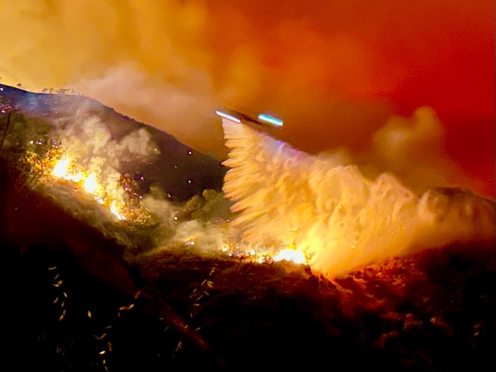
Overnight, smoke and cooler air were trapped close to the ground, incident commanders reported, as an inversion layer held in moisture and winds died down. In upper elevations along Pine Ridge to the northwest, however, the fire took advantage of continued warm dry conditions. A new base camp set up on Thursday in San Luis Obispo County’s Santa Margarita area should speed firefighters’ trip to the Gifford.
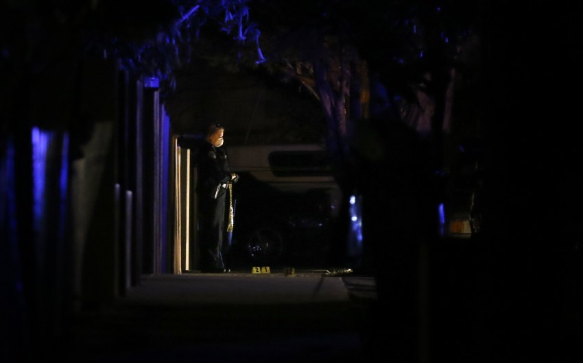
The work in the rugged terrain inland off the 166 has taken a toll, with four firefighters reporting minor injuries, ranging from heat exhaustion to twisted ankles. For such a large fire, the safety record has been good, said Mark Ruggiero, a public information officer on the Gifford. The 166 has tricky and constant wind shifts, which led to four firefighter deaths on August 15, 1979, noted Garrett Huff of Santa Barbara County Fire during a community update yesterday evening in Sisquoc. For the Gifford, the weather should cool over the next two days, but the outlook remains windy, dry, and hot, into the triple digits, forecast into early next week.
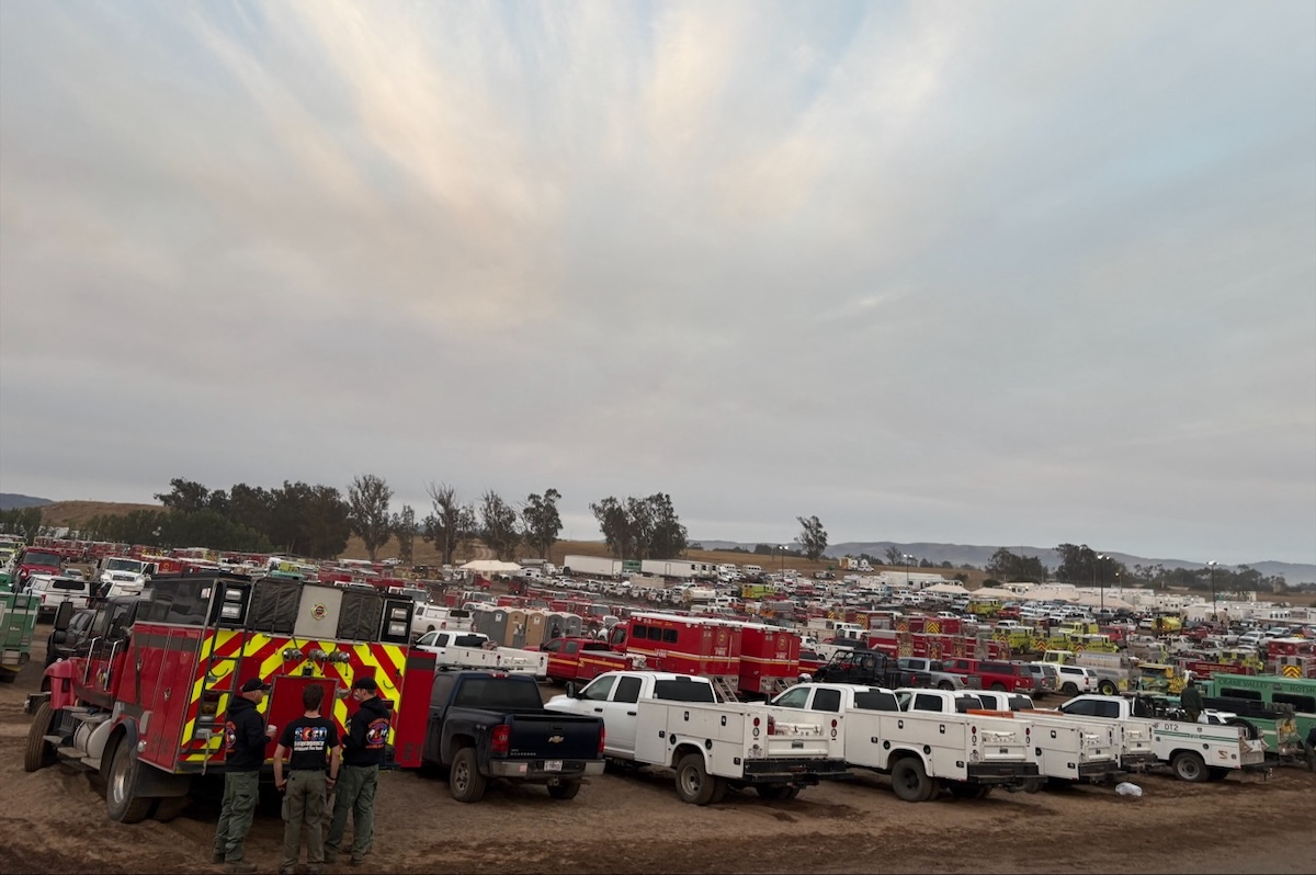
The main base camp in Santa Maria remains a busy hub of incident commanders, map makers, communications and logistics personnel, medical support, and food-and-drink suppliers. More than 3,000 firefighters are on the Gifford and nearly 250 support personnel. As the fire grows, the number of structures threatened has risen to 2,922 in both Santa Barbara and San Luis Obispo counties. For the latest evacuation information or to sign up to receive emergency alerts, visit readysbc.org and prepareslo.org.
Fire officials have held a number of meetings to update residents on the Gifford and take questions — please submit in advance via email to 2025.gifford@firenet.gov. Friday evening’s takes place in Arroyo Grande at 7 p.m. at Branch Elementary School (970 School Road). The meeting will be broadcast on Los Padres National Forest’s YouTube channel and Facebook page.
At the Gifford Fire meeting held in Sisquoc Thursday evening, fire behavior analyst Garrett Hazelton noted that areas in the north of Gifford Fire hadn’t burned in recorded history and that the adjoining landscape last burned in 1912. The old growth plus plentiful grasses from this winter’s rains were contributing to the stubborn persistence of the fire to the north. On the south, however, old burn scars from 10-12 years ago were suppressing fire growth, as they were seeing only small patches of heat on infrared scans of the area.
About $43 million has been spent on the Gifford Fire so far, said Incident Commander Dustin Mueller of the U.S. Forest Service, which remains the largest in California. Though a new fire had broken out in Ventura County, the Canyon Fire near Lake Piru, sending two crews and one strike team from Gifford, the new Santa Margarita camp of about 1,000 firefighters was being supplemented by another 500-1,000 additional firefighters who were headed to the Gifford over the next few days from across the Western United States. Their goal: full suppression of the fire.


You must be logged in to post a comment.