

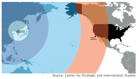
While reading your article “Nukes of Hazard: Vandenberg, Star Wars, and North Korea,” I noticed a map that showed the range of missiles as concentric circles projected onto a flat Earth, which is highly problematic.
In 2003, The Economist posted a very similar map and subsequently issued a formal correction. I would like to bring these maps to your attention so that a similar correction can be issued and such cartographic errors can be avoided in the future.
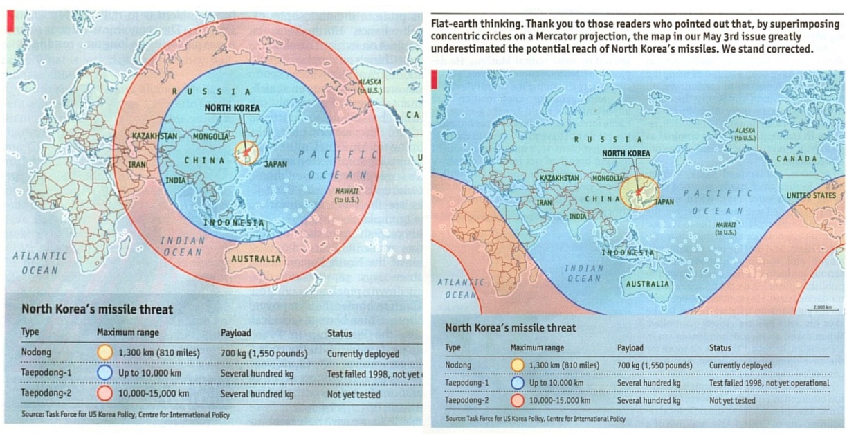
The improved map from the Center for Strategic and International Studies (CSIS) below does not impose concentric circles on a Mercator map projection, but rather, warps the concentric circles to account for the distortion caused by the map projection.
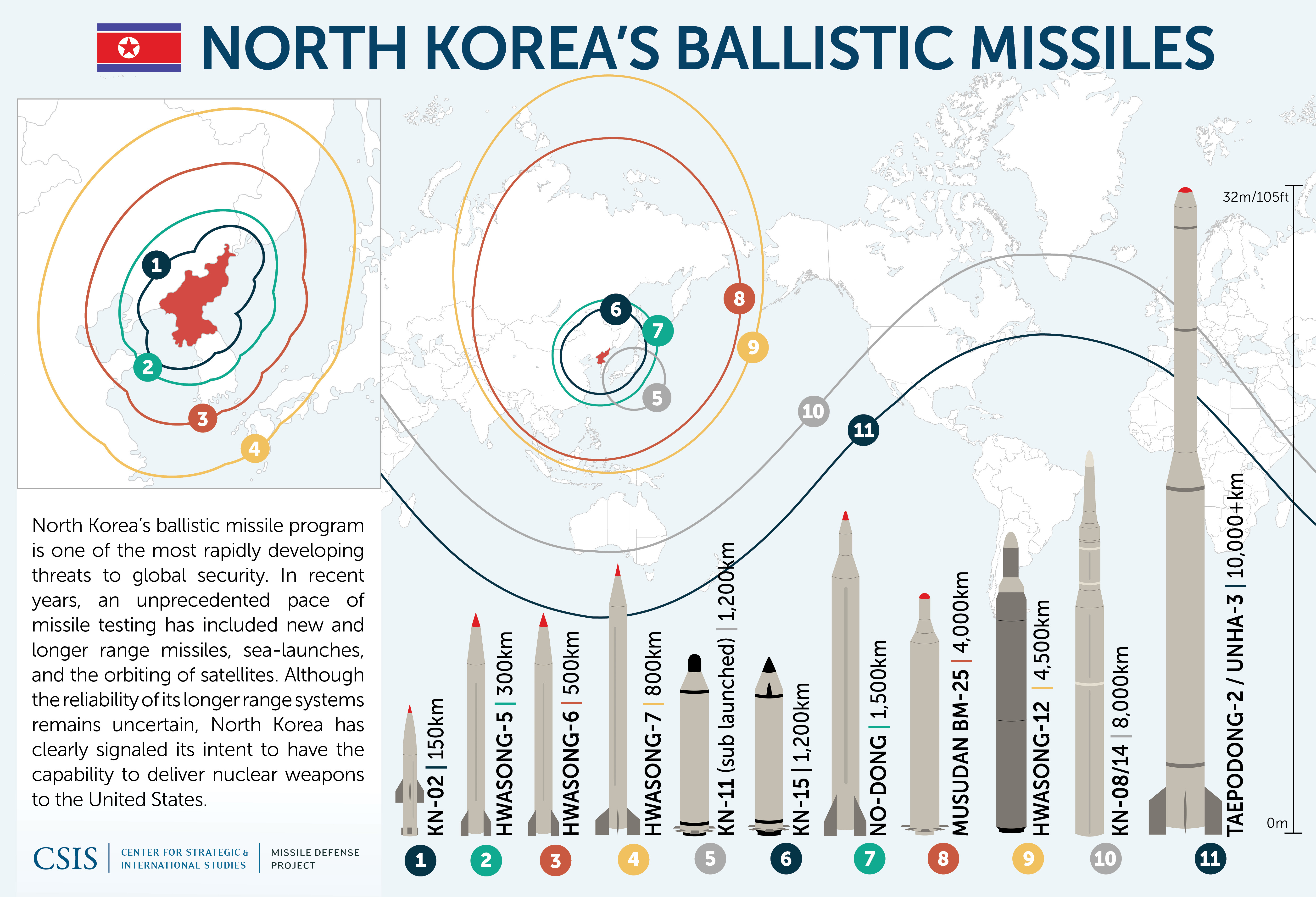
I would also like to mention that according to CSIS, the last two missiles in the above graphic (10, 11) have not yet been tested. The “Nukes of Hazard” article features the Hwasong-12 missile (9), which was tested this May. Other graphics, such as those shown recently in the New York Times, have included caveats explaining this and by indicating projected distances with dashed rather than solid lines. The Independent‘s graphic did not. The difference in distance between the projected range and the actual known range based on completed missile tests varies wildly.
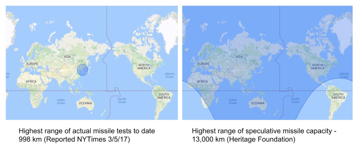
Partisan organizations, like the Heritage Foundation, are responsible in part for promoting this fear mongering. I would hope that The Santa Barbara Independent would be sensitive to this bias and cartographically distinguish tested missile distances, or at least provide readers with this additional information in the map’s legend.
Maps are so powerful because they are simple pictures that can tell rich stories. For this reason however, map producers need to remain vigilant about the stories that we tell with them, lest we “lie with maps.”
Sara Lafia is a graduate student in the UCSB Department of Geography, Center for Spatial Studies.
