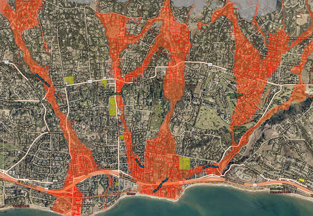
[Update] An evacuation order has been issued as of noon for the Thomas/Whittier/Sherpa fire burn areas to go into effect at 8 p.m. Residents in adjacent Debris Flow Risk Areas are warned by the Santa Barbara County Sheriff’s Office to consider evacuating as well or prepare to be isolated should a debris flow occur. The evacuation map can be found at readysbc.org. Residents should plug in their address to learn in what zone they reside.
[Original Story]
A whole lot of rain is poised to drop throughout Santa Barbara County through Tuesday, up to seven inches in places, according to the latest information from the National Weather Service. In response, county emergency managers sent out text warnings to “Get Ready Now” yesterday afternoon for everyone living in the evacuation “red zones” below recent burn scars — Thomas, Whittier, and Sherpa, in particular — and are considering next steps this afternoon. If the procession of storms lives up to the computer modeling, areas at risk of debris flow will be ordered to evacuate sometime today. A map to show areas at risk can be found at readysbc.org as well as information on how to sign up for alerts.
Weather forecasters have had their eyes on the approaching storm all week, with the various models that agreed on the thunder-and-lightning-fed downpour that dropped in early Thursday morning now predicting hourly rain of up to 1.25 inches on south-facing hillsides from the Santa Ynez mountains to the San Gabriels on Saturday. This is larger than the debris-flow trigger of 0.82 inches for areas below the Thomas Fire, and county officials warn residents to identify a high place they can scramble to within minutes and ready their belongings for an evacuation when asked.
The “main event,” as forecasters are calling it, is shooting in along a powerful jet stream aimed at the Central Coast. It’s expected to combine with an atmospheric river coming from the subtropics to the south. Before departing Saturday night, it could produce thunderstorms and up to 65 mph wind gusts in the foothills. Flooded roads and downed trees are likely. Once the weather clears by Wednesday, snow may be visible down to about 4,500 feet.
Correction: Maximum wind gusts predicted at the time this was posted were 65mph, not 75mph.