Historic Franklin Trail Re-opens Today
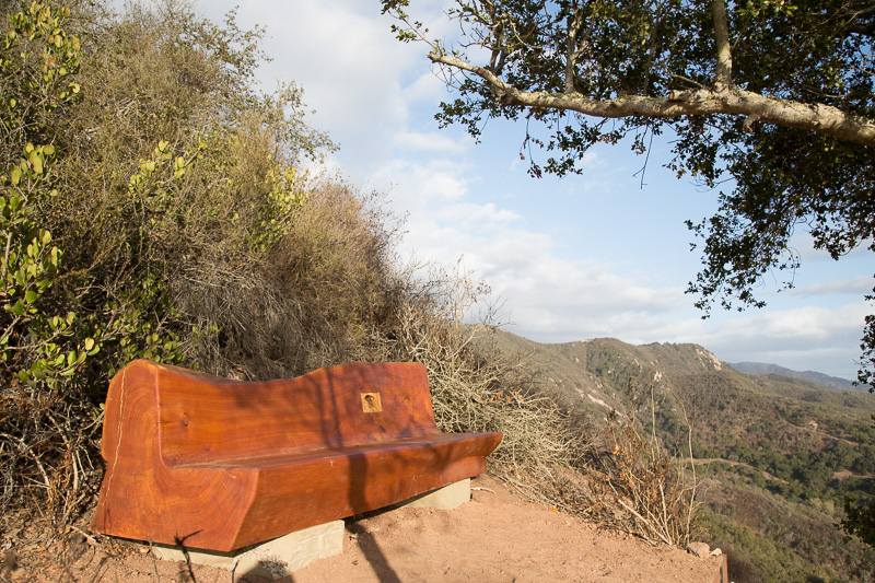
Come Enjoy the Views From Atop the Ridge

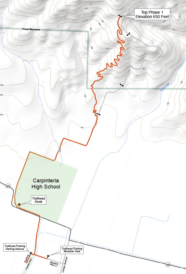
HIKE FACTS
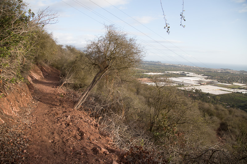
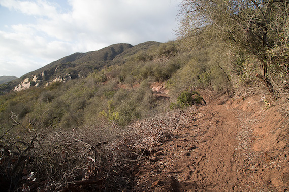
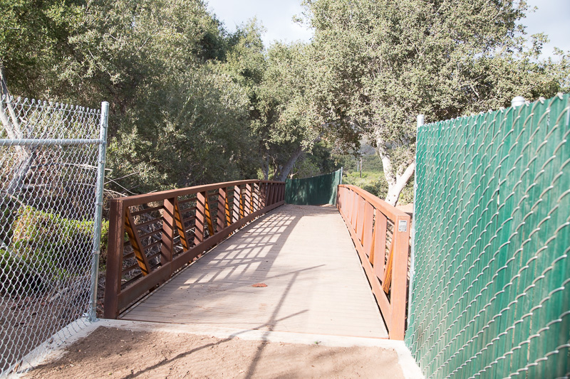
Starting Point: At Meadow View Lane off Linden Avenue or near the upper end of Franklin Park on Sterling Avenue. Length: .1 miles to high school along paved path; .75 miles along school, nursery and orchards to the start of the main trail; 2.0 miles to top of knoll; 2.25 to locked gate. Gain: relatively level to start of main trail; 650’ gain to the intersection with the jeep road; 750’ to locked gate where Phase 1 section ends. Difficulty: Easy through lower section; moderate to high point. Path: Native soil tread. Season: All year; may be muddy after any measurable amount of rain. Use: Multiuse but temporarily closed to equestrians and mountain bikes until sufficient rain to compact soil.
Please Note: NO TRAIL PARKING ALLOWED AT THE HIGH SCHOOL. OK for dogs but they are required to be on leash through the Phase 1 section on the County easement.
———————————————————–
The Franklin Trail is one of our area’s oldest trails, having been constructed in 1913 by the Forest Service and support from the Carpinteria community. For many years the trail was one of the most popular ways to access the backcountry, climbing over the crest of the Santa Ynez Mountains and dropping down Alder Creek to an area known as Billirad Flats, not too far from the present site of Jameson Reservoir.
In that year the Santa Barbara Guidebook, authored by Leila Weekes Wilson noted: “The Carpinteria-Juncal Trail [the Forest Service designated name for the trail], a new trail, from Franklin Cañon, Carpinteria, over the mountains to the upper Santa Ynez River, is now complete. This is a trail that will appeal strongly to every resident of Santa Barbara County. From the summit one may turn and look toward the Pacific Ocean and the islands, and the Eden of Santa Barbara County, the lovely valley of Carpinteria, at your feet. While looking east [actually north] are rugged ranges that drop down to the beautiful Santa Ynez River, where trout fishing is good, and camping facilities ideal.”
Cate School Adventures. One of those who plunked down a chunk of change to see the Franklin Trail completed in 1913 was Curtis Cate. According to Roxie Grant Lapidus, whose description of these early days on the Franklin Trail in her essay titled: The Historic Franklin Trail and Early Adventures in the Back Country, “Cate quickly discovered the trail’s potential for teaching his kids some tough lessons,” she wrote “Mr. Cate was an advocate of cold showers and rugged outdoor experiences, and every student was required to have a horse. Small groups of boys rode the local trails every weekend, either toward the Casitas, or up the Franklin Trail and over into the Santa Ynez River area.”
Lapidus also describes the nostalgia for one student who as he is about to graduate, describes what the experience has meant to him: “One cannot possibly forget certain moments associated with camping: that first smell of frying steak, the first meal prepared in the twilight after the long ride over the Coast Range, and, next morning, the keen exhilaration of a plunge into the Santa Ynez. What can be finer, on the return trip, after the exhausting climb up the north slope of this last western range, than reaching the summit and looking out over that wide vista of coastal plain, the blue Pacific, and beyond….”
The Franklin Trail provided access for decades for many an outdoor adventurer, hunter, fisherman and backcountry explorer for many decades until things began to change after World War II, especially as avocado ranching became more and more prominent. About the same time Carpinterians were first venturing over the Santa Ynez Mountains to explore the mysteries of the backcountry, Santa Barbara Judge R.B. Ord introduced the Mexican avocado to the area. By the 1950s a number of varieties were becoming commercially successful, among them the Fuerte and the Hass.
Avocado Ranches Boom. In Carpinteria, ranches such as those owned by the Franklin families and others began to change hands and this shift in ownership accelerated in the early 1970s when the Carpinteria Valley became a mecca for commercial flower growing. Over time a wide swath of valley land stretching along the base of the mountains from Santa Monica Canyon east to the County were developed either for avocados or nursery related businesses. By the mid 70s public access to the mountains ground to a halt. In 1975 when I wrote my first Day Hikes book, a brief description of the Franklin Trail was included and the trail still passable via an Edison jeepway that led from Linden to the start of the trail. By 1980 when I added a second edition, it had been closed and though the upper trail was still there, there was no longer a way to get to it.
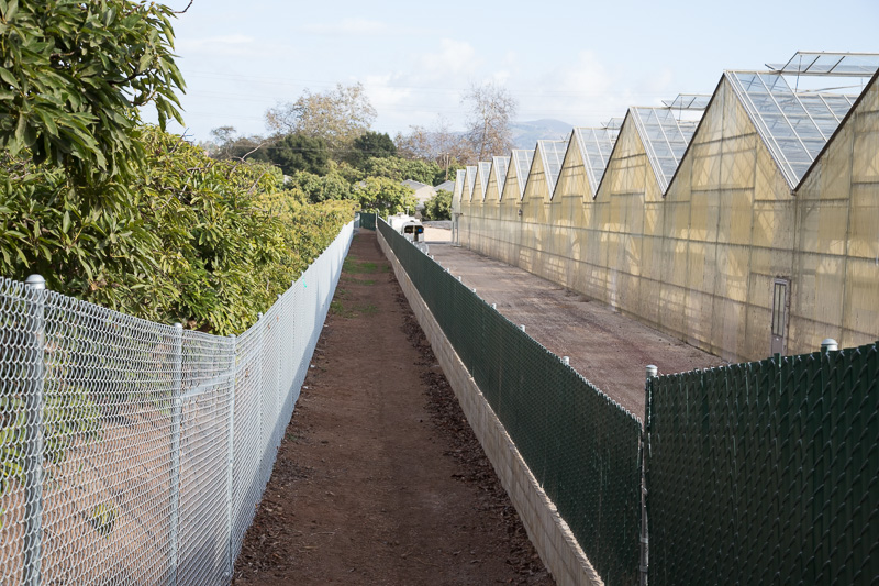
The issue for the local ranchers was what is known as avocado (Phytophthora) root rot, considered to be the most serious and important disease of avocado worldwide a disease that is potentially fatal should a tree become infected. Worrying that horses or foot traffic could introduce the disease into their orchards the solution was simple; keep the public out.
Owners Restrict Use. By the 1980s, fate of the Franklin Trail was held in the hands of three property owners: Johannes Flowers, the Horton Ranch and a large 3,000+ acre holding above known as Rancho Monte Alegre, owned by RMA Partners VI. The question was whether easements through the three properties might ever be established. Of these, the Monte Alegre property was the first that the County and its Riding and Hiking Trails Advisory Committee (CRAHTAC) began to look at since it stretched from the top of the first knoll behind the high school to Forest Service owned land further inland. Eventually after a number of battles, both in court and in the political arena, an easement was confirmed through the property but only under the condition that it be fenced on both sides for its entire length. Clearly that was no a practical option and for the 1980s and 90s, there was little progress in re-opening the trail.
Land Trusts Get Involved. Then in the early 2000s, a glimmer of hope appeared when negotiations began for the development of conservation easements on two of the properties. In 2004, RMA Partners approached the Trust for Public Land (TPL) in 2004 to discuss a conservation easement that would help protect the natural and agricultural resources and provide the long sought trail easement that could re-open the Franklin Trail.

According to the TPL website “the conservation easement granted to The Land Trust for Santa Barbara County, permanently extinguished development rights on the property except for the agreed upon 25 home sites and permitted agricultural uses.” In addition the RML Partners agreed to begin a separate discussion on the donation of two major public trail easements, one along the Franklin Trail corridor and the other an east-west route that could tie into other existing trails.
Then in late 2005 Bill and Glenna Horton, owners of the middle property, entered into an agreement with the Land Trust for Santa Barbara County to preserve 104 acres of the Horton avocado ranch. “We wanted to preserve it as a ranch and open space for the benefit of the community,” noted Bill. “I would hope other property owners do the same. I hate to see the hillsides covered by these monstrous homes and/or greenhouses.”
“It’s a way for some owners to get the value out of their home without selling it,” said Land Trust Executive Director Michael Feeney at the time. “If the ranch is ever sold, he noted, conditions of the conservation easement do not change.
It appeared that public access to the Franklin Trail might soon be on the horizon. However, it turned out not to be the case. Along with a number of technical stumbling blocks it turned out that raising the funding for the construction of the trail once the easement issues had been settled was not so easy. County Parks turned to a grant source known as the CA Recreational Trails Program but was turned down repeated in the mid-2000 period. When the economy sunk in 2008, the grant funds began to dry up and when the economic issues began to impact the RML lands, discussions relating to the easement on that property began to lag as well.
Friends of the Franklin Trail Emerge. Enter long time trail supporters Jane Murray and Bud Girard, both members of the Montecito Trails Foundation and long time Carpinteria residents, who stepped up and took the lead. With Bud working with the County and Land Trust on the technical issues and Jane helping to spearhead the fund raising side, a group known as the Friends of the Franklin Trail was born in 2010. By 2012 the group had raised sufficient funding that trail construction was now a real possibility.
In the meantime, working with the Horton Ranch and beginning discussions with Johannes Persoon on the easement through his nursery, by early 2013 it was clear the trail would be built. Construction began in late May and though it took much longer than anyone would have wanted, starting today it is official. The Franklin Trail is open and ready for use.
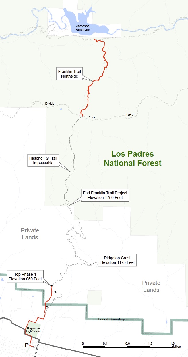
Work Remain For Full Re-Opening. Though the re-opening today signals a major accomplishment in the efforts to re-open the historic Franklin Trail to the crest, much work remains. Walking the trail today will take you only about 2 miles of the 7 miles needed to reach the top of the Santa Ynez Mountains. The RMA property will still be closed to public use, though not out of any adverse intentions. Development of lots on the eastern portion of the property has stalled over the past few years due to economic issues and an agreement to remove the fencing requirement along the trail easement won’t occur until the proposed developments occur. The good news is that the 4.5 or so miles of the trail through RMA property needs little improvement for the public to use it.
Forest Land Beyond. North of the RMA property a significant challenge remains in opening the trail through Forest Service lands. Though open and usable three decades ago, the trail is now overgrown enough to be almost impossible to follow and completely impassable for the parts that have been explored. The route is also extremely steep, climbing slightly over 2,000′ to the crest. Until surveyed, it is impossible to know what challenges may lie ahead on this part of the trail.
Already Jane and Bud and the Friends of the Franklin Trail are hard at work on what they are calling Phase 2 of the project. An ambitious lot, they hope to have the rest of the trail open by 2015 at the latest. If you’d like to support the effort you may do so by visiting the Friend’s website and making a donation.